 |
|
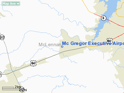
Mc Gregor Executive Airport |
Location & QuickFacts
| FAA Information Effective: | 2008-09-25 |
| Airport Identifier: | PWG |
| Airport Status: | Operational |
| Longitude/Latitude: | 097-18-59.5000W/31-29-05.7000N
-97.316528/31.484917 (Estimated) |
| Elevation: | 592 ft / 180.44 m (Surveyed) |
| Land: | 900 acres |
| From nearest city: | 4 nautical miles W of Waco, TX |
| Location: | Mc Lennan County, TX |
| Magnetic Variation: | 06E (2000) |
Owner & Manager
| Ownership: | Publicly owned |
| Owner: | City Of Mcgregor |
| Address: | P O Box 192
Mc Gregor, TX 76657 |
| Phone number: | 254-840-2806 |
| Manager: | Rob Blanchard |
| Address: | Po Box 192
Mc Gregor, TX 76657 |
| Phone number: | 254-848-5477
OR 254-848-2345. |
Airport Operations and Facilities
| Airport Use: | Open to public |
| Wind indicator: | Yes |
| Segmented Circle: | Yes |
| Control Tower: | No |
| Lighting Schedule: | DUSK-DAWN
MIRL RY 17/35 PRESET LOW INTST; TO INCR INTST ACTVT - CTAF. |
| Beacon Color: | Clear-Green (lighted land airport) |
| Landing fee charge: | No |
| Sectional chart: | San Antonio |
| Region: | ASW - Southwest |
| Boundary ARTCC: | ZFW - Fort Worth |
| Tie-in FSS: | FTW - Fort Worth |
| FSS on Airport: | No |
| FSS Phone: | 817-541-3474 |
| FSS Toll Free: | 1-800-WX-BRIEF |
| NOTAMs Facility: | PWG (NOTAM-d service avaliable) |
| Federal Agreements: | NGRY |
Airport Communications
| CTAF: | 122.800 |
| Unicom: | 122.800 |
Airport Services
| Fuel available: | 100LLA1+
FOR FUEL AFT HRS CALL 254-848-2345. MILITARY FUEL CONTRACT. |
| Airframe Repair: | MAJOR |
| Power Plant Repair: | MAJOR |
| Bottled Oxygen: | HIGH/LOW |
| Bulk Oxygen: | HIGH/LOW |
Runway Information
Runway 04/22
| Dimension: | 3484 x 55 ft / 1061.9 x 16.8 m |
| Surface: | ASPH, Good Condition |
| Weight Limit: | Single wheel: 12000 lbs. |
| |
Runway 04 |
Runway 22 |
| Longitude: | 097-19-03.9900W | 097-18-36.0770W |
| Latitude: | 31-28-45.8140N | 31-29-10.6480N |
| Elevation: | 568.00 ft | 568.00 ft |
| Alignment: | 44 | 127 |
| Traffic Pattern: | Left | Left |
| Markings: | Basic, Good Condition | Basic, Good Condition |
|
Runway 17/35
| Dimension: | 5501 x 75 ft / 1676.7 x 22.9 m |
| Surface: | ASPH, Good Condition |
| Weight Limit: | Single wheel: 30000 lbs. |
| Edge Lights: | Medium |
| |
Runway 17 |
Runway 35 |
| Longitude: | 097-19-06.0290W | 097-19-04.9200W |
| Latitude: | 31-29-37.6540N | 31-28-43.9200N |
| Elevation: | 590.00 ft | 566.00 ft |
| Alignment: | 127 | 127 |
| Traffic Pattern: | Left | Left |
| Markings: | Non-precision instrument, Good Condition | Non-precision instrument, Good Condition |
| Crossing Height: | 37.00 ft | 45.00 ft |
| VASI: | 4-light PAPI on left side | 4-light PAPI on left side |
| Visual Glide Angle: | 3.00° | 3.00° |
| Runway End Identifier: | Yes | |
| Obstruction: | 27 ft trees, 1072.0 ft from runway, 32:1 slope to clear | 25 ft trees, 1008.0 ft from runway, 250 ft right of centerline, 32:1 slope to clear |
|
Radio Navigation Aids
| ID |
Type |
Name |
Ch |
Freq |
Var |
Dist |
| ROB | NDB | Robinson | | 400.00 | 07E | 12.7 nm |
| HLR | NDB | Hood | | 347.00 | 07E | 29.5 nm |
| IL | NDB | Iresh | | 278.00 | 07E | 34.2 nm |
| GR | NDB | Starn | | 323.00 | 07E | 34.6 nm |
| LXY | NDB | Mexia | | 329.00 | 07E | 42.2 nm |
| MNZ | NDB | Hamilton | | 251.00 | 07E | 43.3 nm |
| TPL | VOR/DME | Temple | 041X | 110.40 | 09E | 17.5 nm |
| GRK | VOR/DME | Gray | 055X | 111.80 | 07E | 37.3 nm |
| GNL | VOR/DME | Groesbeck | 025X | 108.80 | 05E | 39.7 nm |
| ACT | VORTAC | Waco | 100X | 115.30 | 09E | 10.9 nm |
| LZZ | VORTAC | Lampasas | 072X | 112.50 | 08E | 46.0 nm |
| JEN | VORTAC | Glen Rose | 097X | 115.00 | 06E | 49.7 nm |
Remarks
- GCO AVBL ON FREQ 121.725 THRU ACT CD & FLT SVCS.
Images and information placed above are from
http://www.airport-data.com/airport/PWG/
We thank them for the data!
| General Info
|
| Country |
United States
|
| State |
TEXAS
|
| FAA ID |
PWG
|
| Latitude |
31-29-05.700N
|
| Longitude |
097-18-59.500W
|
| Elevation |
592 feet
|
| Near City |
WACO
|
We don't guarantee the information is fresh and accurate. The data may
be wrong or outdated.
For more up-to-date information please refer to other sources.
|
|


