 |
|
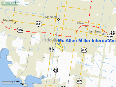
Mc Allen Miller Intl Airport |
| McAllen-Miller International Airport |
| IATA: MFE – ICAO: KMFE |
| Summary |
| Airport type |
Public |
| Operator |
City of McAllen |
| Serves |
Rio Grande Valley, Texas |
| Location |
McAllen, Texas |
| Elevation AMSL |
107 ft / 33 m |
| Coordinates |
26°10′33″N 98°14′19″W / 26.17583°N 98.23861°W / 26.17583; -98.23861 |
| Runways |
| Direction |
Length |
Surface |
| ft |
m |
| 13/31 |
7,120 |
2,170 |
Asphalt |
| 18/36 |
2,638 |
804 |
Asphalt |
| Airport Director: Phil Brown |
McAllen-Miller International Airport (IATA: MFE, ICAO: KMFE) is an airport in McAllen, Texas, United States, located 2 miles (3.2 km) south of the central business district. The airport has 2 runways and one terminal with 5 gates.
According to the updated 20-year Master Plan for MFE, runway 13/31 will be extended to 10,000 ft. In addition, a parallel runway will be added. An expanded cargo apron will be on the south side of the airport. In early 2006, Gate 5 opened on the main concourse due to the arrival of Delta Connection. In 2008, a terminal capacity study will be conducted to assess the future needs of the airport and possible terminal expansion to include eight (8) gates, larger ticketing/office area, TSA security area queue. Paid parking at the airport was implemented on November 15, 2007 with the implementation of the Economy, Long-term and Short-term Lots. Airlines and destinations
| Airlines |
Destinations |
| Allegiant Air |
Las Vegas, Orlando-Sanford |
| American Airlines |
Dallas/Fort Worth |
| Continental Airlines |
Houston-Intercontinental |
| Continental Express operated by ExpressJet Airlines |
Houston-Intercontinental |
| Delta Connection operated by Atlantic Southeast Airlines |
Memphis |
Traffic
MFE is currently the busiest commercial passenger airport in the Rio Grande Valley metropolitan areas. The airport is also served by all three global alliances, Star Alliance, SkyTeam, and oneworld. In 2007, it served a total of 426,418 passengers, increasing to 735,108, in 2009, surpassing Valley International Airport in Harlingen by several thousand travelers. Following growth in commercial passenger service, MFE lost its only international flight in September 2007 - a daily Continental Express flight to Mexico City. After less than one year in service, it was announced that MFE would lose its only non-stop flight to Los Angeles, operated by Delta Connection partner ExpressJet Airlines, at the end of 2007. In December 2007, it was announced that Delta Connection would pull out of the McAllen market altogether on January 6, 2008, discontinuing its remaining two flights a day from MFE to Atlanta, operated by Delta Connection partner Atlantic Southeast Airlines. In March 2009, Delta, through its wholly-owned subsidiary Northwest Airlines, returned to MFE with operations to Memphis, operated by Northwest Airlink partner Pinnacle Airlines. Northwest Airlines had previously operated flights from MFE to Memphis starting in 2004. On September 7, 2010, Delta Connection partner Atlantic Southeast Airlines resumed service to MFE essentially taking over the non-stop MFE-MEM route from Pinnacle Airlines. On May 24, 2009, Allegiant Air commenced bi-weekly, non-stop service to LAX Los Angeles, in addition to non-stop service to SFB Orlando two (2) times a week, and non-stop service to LAS Las Vegas five times a week. On August 15th, 2009, Allegiant announced that it would cease to operate service from MFE to LAX after less than a year in service due to poor passenger load factor.
Area Airports
Nearby commercial airports with passenger service include:
- Valley International Airport (HRL) - Harlingen (40 miles)
- Brownsville/South Padre Island International Airport (BRO) - Brownsville (63 miles)
The above content comes from Wikipedia and is published under free licenses – click here to read more.
Location & QuickFacts
| FAA Information Effective: | 2008-09-25 |
| Airport Identifier: | MFE |
| Airport Status: | Operational |
| Longitude/Latitude: | 098-14-19.0000W/26-10-33.0000N
-98.238611/26.175833 (Estimated) |
| Elevation: | 107 ft / 32.61 m (Surveyed) |
| Land: | 370 acres |
| From nearest city: | 2 nautical miles S of Mc Allen, TX |
| Location: | Hidalgo County, TX |
| Magnetic Variation: | 07E (1980) |
Owner & Manager
| Ownership: | Publicly owned |
| Owner: | City Of Mc Allen |
| Address: | P O Box 220
Mc Allen, TX 78502 |
| Phone number: | 956-972-7000 |
| Manager: | Philip Brown |
| Address: | 2500 S Bicentennial Blvd
Mc Allen, TX 78503-3140 |
| Phone number: | 956-682-9101 |
Airport Operations and Facilities
| Airport Use: | Open to public |
| Wind indicator: | Yes |
| Segmented Circle: | Yes |
| Control Tower: | Yes |
| Lighting Schedule: | DUSK-DAWN
WHEN ATCT CLSD MIRL RY 18/36 & HIRL RY 13/31 PRESET MED INTST; ACTVT MALSR RY 13 - CTAF. |
| Beacon Color: | Clear-Green (lighted land airport) |
| Landing fee charge: | No |
| Sectional chart: | Brownsville |
| Region: | ASW - Southwest |
| Boundary ARTCC: | ZHU - Houston |
| Tie-in FSS: | SJT - San Angelo |
| FSS on Airport: | No |
| FSS Toll Free: | 1-800-WX-BRIEF |
| NOTAMs Facility: | MFE (NOTAM-d service avaliable) |
| Certification type/date: | I C S 05/1973
RY 18/36 NOT AVBL FOR AIR CARRIER OPNS. |
| Federal Agreements: | NGY |
Airport Communications
| CTAF: | 118.500 |
| Unicom: | 122.950 |
Airport Services
| Fuel available: | 100LLA |
| Airframe Repair: | MAJOR |
| Power Plant Repair: | MAJOR |
| Bottled Oxygen: | HIGH |
Runway Information
Runway 13/31
| Dimension: | 7120 x 150 ft / 2170.2 x 45.7 m |
| Surface: | ASPH, Fair Condition |
| Surface Treatment: | Saw-cut or plastic Grooved |
| Weight Limit: | Single wheel: 90000 lbs.
Dual wheel: 190000 lbs.
Dual tandem wheel: 280000 lbs. |
| Edge Lights: | High |
| |
Runway 13 |
Runway 31 |
| Longitude: | 098-14-46.7803W | 098-13-57.1506W |
| Latitude: | 26-10-58.5395N | 26-10-04.0671N |
| Elevation: | 107.00 ft | 102.00 ft |
| Alignment: | 127 | 127 |
| ILS Type: | ILS/DME
| |
| Traffic Pattern: | Left | Left |
| Markings: | Precision instrument, Fair Condition | Precision instrument, Fair Condition |
| Crossing Height: | 0.00 ft | 52.00 ft |
| Displaced threshold: | 137.00 ft | 0.00 ft |
| VASI: | | 4-box on left side |
| Visual Glide Angle: | 0.00° | 3.00° |
| Approach lights: | MALSR | |
| Runway End Identifier: | | Yes |
| Obstruction: | 14 ft road, 650.0 ft from runway, 550 ft right of centerline, 32:1 slope to clear
APCH RATIO 37:1 FM DSPLCD THR. | , 50:1 slope to clear |
| Decleard distances: | Take off run available 7120.00 ft
Take off distance available 7120.00 ft
Actual stop distance available 7120.00 ft
Landing distance available 6983.00 ft
| Take off run available 7120.00 ft
Take off distance available 7120.00 ft
Actual stop distance available 7120.00 ft
Landing distance available 7120.00 ft
|
|
Runway 18/36
| Dimension: | 2638 x 60 ft / 804.1 x 18.3 m |
| Surface: | ASPH, Good Condition |
| Weight Limit: | Single wheel: 12500 lbs. |
| Edge Lights: | Medium |
| |
Runway 18 |
Runway 36 |
| Longitude: | 098-14-08.6940W | 098-14-13.0787W |
| Latitude: | 26-10-50.5618N | 26-10-24.7345N |
| Elevation: | 104.00 ft | 96.00 ft |
| Alignment: | 127 | 9 |
| Traffic Pattern: | Left | Left |
| Markings: | Basic, Good Condition | Basic, Good Condition |
| Crossing Height: | 35.00 ft | 0.00 ft |
| VASI: | 2-light PAPI on left side
PAPI OTS INDEFLY. | |
| Visual Glide Angle: | 4.00° | 0.00° |
| Obstruction: | 18 ft pole, 575.0 ft from runway, 20:1 slope to clear | , 50:1 slope to clear |
| Decleard distances: | Take off run available 2638.00 ft
Take off distance available 2638.00 ft
Actual stop distance available 2638.00 ft
Landing distance available 2638.00 ft
| Take off run available 2638.00 ft
Take off distance available 2638.00 ft
Actual stop distance available 2638.00 ft
Landing distance available 2638.00 ft
|
|
Radio Navigation Aids
| ID |
Type |
Name |
Ch |
Freq |
Var |
Dist |
| SNE | NDB | Santa Elena | | 260.00 | 07E | 37.4 nm |
| REX | VOR | Reynosa | | 112.40 | 08E | 9.8 nm |
| MFE | VOR/DME | Mc Allen | 119X | 117.20 | 09E | 0.2 nm |
| HRL | VOR/DME | Harlingen | 029X | 109.20 | 05E | 31.8 nm |
| MAM | VOR/DME | Matamoros | 090X | 114.30 | 07E | 45.7 nm |
| BRO | VORTAC | Brownsville | 110X | 116.30 | 09E | 49.0 nm |
Remarks
- JET OR LARGE PROPELLER ACFT TRNG PROHIBITED (INCLUDING PRACTICE APCHS; TGL & PRACTICE INSTRUMENT APCH PROCS) DUE TO NOISE ABATEMENT PROCEDURES EFFECT 2300-0600.
- WHEN DEPARTING ARPT FLY RY HDG UNTIL REACHING 1000 FT AGL BEFORE MAKING PROCEDURE TURN.
- FOR ARFF WHEN ATCT CLSD CTC, MC ALLEN ARPT OPNS 956-682-9101.
- NO 180 DEGS LOCKED WHEEL TURNS ON RY 13/31.
- BIRDS ON & INVOF ARPT (SEASONAL).
Images and information placed above are from
http://www.airport-data.com/airport/MFE/
We thank them for the data!
| General Info
|
| Country |
United States
|
| State |
TEXAS
|
| FAA ID |
MFE
|
| Latitude |
26-10-33.000N
|
| Longitude |
098-14-19.000W
|
| Elevation |
107 feet
|
| Near City |
MC ALLEN
|
We don't guarantee the information is fresh and accurate. The data may
be wrong or outdated.
For more up-to-date information please refer to other sources.
|
|


