 |
|
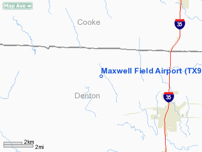
Location & QuickFacts
| FAA Information Effective: | 2008-09-25 |
| Airport Identifier: | TX96 |
| Airport Status: | Operational |
| Longitude/Latitude: | 097-15-25.0610W/33-23-57.4100N
-97.256961/33.399281 (Estimated) |
| Elevation: | 825 ft / 251.46 m (Estimated) |
| Land: | 40 acres |
| From nearest city: | 5 nautical miles NW of Sanger, TX |
| Location: | Denton County, TX |
| Magnetic Variation: | 07E (1985) |
Owner & Manager
| Ownership: | Privately owned |
| Owner: | Donald W. Maxwell |
| Address: | Rt 1 Box 307
Sanger, TX 76266 |
| Phone number: | 817-458-4252 |
| Address: |
|
Airport Operations and Facilities
| Airport Use: | Private
PERSONAL USE. |
| Segmented Circle: | No |
| Control Tower: | No |
| Sectional chart: | Dallas-ft Worth |
| Region: | ASW - Southwest |
| Boundary ARTCC: | ZFW - Fort Worth |
| Tie-in FSS: | FTW - Fort Worth |
| FSS Phone: | 817-541-3474 |
| FSS Toll Free: | 1-800-WX-BRIEF |
Runway Information
Runway 17/35
| Dimension: | 1900 x 200 ft / 579.1 x 61.0 m |
| Surface: | TURF, |
| |
Runway 17 |
Runway 35 |
| Traffic Pattern: | Left | Left |
|
Radio Navigation Aids
| ID |
Type |
Name |
Ch |
Freq |
Var |
Dist |
| GLE | NDB | Gainesville | | 330.00 | 06E | 19.4 nm |
| GMZ | NDB | Grindstone Mountain | | 356.00 | 07E | 28.7 nm |
| DNI | NDB | Denison | | 341.00 | 06E | 38.9 nm |
| AUV | NDB | Arbuckle | | 284.00 | 07E | 45.6 nm |
| RBD | NDB | Redbird | | 287.00 | 06E | 47.6 nm |
| NFW | TACAN | Nas Jrb Fort Worth | 024X | | 07E | 38.8 nm |
| TTT | VOR/DME | Maverick | 078X | 113.10 | 06E | 33.7 nm |
| CVE | VOR/DME | Cowboy | 109X | 116.20 | 06E | 35.4 nm |
| UKW | VORTAC | Bowie | 071X | 112.40 | 06E | 29.5 nm |
| FUZ | VORTAC | Ranger | 104X | 115.70 | 06E | 30.9 nm |
| ADM | VORTAC | Ardmore | 114X | 116.70 | 06E | 49.0 nm |
| FTW | VOT | Fort Worth Meacham | | 108.20 | | 35.3 nm |
| DAL | VOT | Dallas Love Field | | 113.30 | | 39.0 nm |
Remarks
- PRVDD FIELD RESTRICTED TO PERSONAL USE AND TFC PATTERNS CONDUCTED WEST OF MAXWELL FLD TO AVOID CONFLICT WITH TFC AT BAR VK ARPT.
Images and information placed above are from
http://www.airport-data.com/airport/TX96/
We thank them for the data!
| General Info
|
| Country |
United States
|
| State |
TEXAS
|
| FAA ID |
TX96
|
| Latitude |
33-23-57.410N
|
| Longitude |
097-15-25.061W
|
| Elevation |
825 feet
|
| Near City |
SANGER
|
We don't guarantee the information is fresh and accurate. The data may
be wrong or outdated.
For more up-to-date information please refer to other sources.
|
|


