 |
|
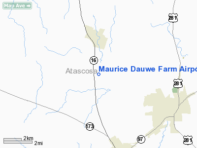
Maurice Dauwe Farm Airport |
Location & QuickFacts
| FAA Information Effective: | 2008-09-25 |
| Airport Identifier: | XS47 |
| Airport Status: | Operational |
| Longitude/Latitude: | 098-34-16.0660W/29-00-00.8910N
-98.571129/29.000248 (Estimated) |
| Elevation: | 447 ft / 136.25 m (Estimated) |
| Land: | 0 acres |
| From nearest city: | 3 nautical miles S of Poteet, TX |
| Location: | Atascosa County, TX |
| Magnetic Variation: | 07E (1985) |
Owner & Manager
| Ownership: | Privately owned |
| Owner: | Maurice P Dauwe |
| Address: | Rte 1,box 163
Poteet, TX 78065 |
| Phone number: | 512-742-3408 |
| Address: |
|
Airport Operations and Facilities
| Airport Use: | Private |
| Wind indicator: | Yes |
| Segmented Circle: | No |
| Control Tower: | No |
| Landing fee charge: | No |
| Sectional chart: | San Antonio |
| Region: | ASW - Southwest |
| Boundary ARTCC: | ZHU - Houston |
| Tie-in FSS: | SJT - San Angelo |
| FSS on Airport: | No |
| FSS Toll Free: | 1-800-WX-BRIEF |
Airport Services
| Airframe Repair: | NONE |
| Power Plant Repair: | NONE |
Runway Information
Runway 14/32
| Dimension: | 2000 x 60 ft / 609.6 x 18.3 m |
| Surface: | TURF, |
| |
Runway 14 |
Runway 32 |
| Traffic Pattern: | Left | Left |
|
Runway 18/36
| Dimension: | 1800 x 100 ft / 548.6 x 30.5 m |
| Surface: | TURF, |
| |
Runway 18 |
Runway 36 |
| Traffic Pattern: | Left | Left |
|
Radio Navigation Aids
| ID |
Type |
Name |
Ch |
Freq |
Var |
Dist |
| PEZ | NDB | Pleasanton | | 275.00 | 07E | 3.9 nm |
| HHH | NDB | Devine | | 359.00 | 07E | 21.0 nm |
| CVB | NDB | Castroville | | 338.00 | 08E | 25.4 nm |
| HMA | NDB | Hondo | | 329.00 | 08E | 38.7 nm |
| KSY | TACAN | Kelly | 057X | | 07E | 23.5 nm |
| DHK | TACAN | Randolph | 036X | | 09E | 36.0 nm |
| SSF | VOR | Stinson | | 108.40 | 09E | 16.9 nm |
| HDO | VOR/DME | Hondo | 31X | 109.40 | 08E | 38.1 nm |
| RND | VORTAC | Randolph | 70X | 112.30 | 09E | 34.6 nm |
| THX | VORTAC | Three Rivers | 051X | 111.40 | 08E | 37.1 nm |
| SAT | VORTAC | San Antonio | 115X | 116.80 | 08E | 39.1 nm |
| COT | VORTAC | Cotulla | 105X | 115.80 | 09E | 43.3 nm |
| SAT | VOT | San Antonio Intl | | 110.40 | | 32.5 nm |
Images and information placed above are from
http://www.airport-data.com/airport/XS47/
We thank them for the data!
| General Info
|
| Country |
United States
|
| State |
TEXAS
|
| FAA ID |
XS47
|
| Latitude |
29-00-00.891N
|
| Longitude |
098-34-16.066W
|
| Elevation |
447 feet
|
| Near City |
POTEET
|
We don't guarantee the information is fresh and accurate. The data may
be wrong or outdated.
For more up-to-date information please refer to other sources.
|
|


