 |
|
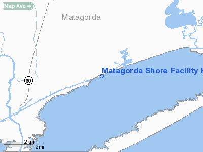
Matagorda Shore Facility Heliport |
Location & QuickFacts
| FAA Information Effective: | 2008-09-25 |
| Airport Identifier: | 02TA |
| Airport Status: | Operational |
| Longitude/Latitude: | 095-52-25.8610W/28-43-16.9500N
-95.873850/28.721375 (Estimated) |
| Elevation: | 5 ft / 1.52 m (Estimated) |
| Land: | 0 acres |
| From nearest city: | 5 nautical miles NE of Matagorda, TX |
| Location: | Matagorda County, TX |
| Magnetic Variation: | 06E (1985) |
Owner & Manager
| Ownership: | Privately owned |
| Owner: | American Exploration Co |
| Address: | 1331 Lamar St., Suite 900
Houston, TX 77010-3088 |
| Phone number: | 713-756-6000 |
| Manager: | Les Thompson |
| Address: | P.o. Box 280
Wadsworth, TX 77483 |
| Phone number: | 713-224-5673 |
Airport Operations and Facilities
| Airport Use: | Private |
| Wind indicator: | Yes |
| Segmented Circle: | No |
| Control Tower: | No |
| Landing fee charge: | No |
| Sectional chart: | Houston |
| Region: | ASW - Southwest |
| Boundary ARTCC: | ZHU - Houston |
| Tie-in FSS: | CXO - Montgomery County |
| FSS on Airport: | No |
| FSS Toll Free: | 1-800-WX-BRIEF
FOR FP FILING CALL CXO FSS 1-800-833-5602. |
Runway Information
Helipad H1
| Dimension: | 32 x 32 ft / 9.8 x 9.8 m |
| Surface: | CONC, |
| |
Runway H1 |
Runway |
| Traffic Pattern: | Left | Left |
|
Radio Navigation Aids
| ID |
Type |
Name |
Ch |
Freq |
Var |
Dist |
| BYY | NDB | Bay City | | 344.00 | 06E | 15.1 nm |
| ARM | NDB | Wharton | | 245.00 | 06E | 35.2 nm |
| PKV | NDB | Port Lavaca | | 515.00 | 05E | 42.8 nm |
| PSX | VORTAC | Palacios | 120X | 117.30 | 08E | 22.9 nm |
Images and information placed above are from
http://www.airport-data.com/airport/02TA/
We thank them for the data!
| General Info
|
| Country |
United States
|
| State |
TEXAS
|
| FAA ID |
02TA
|
| Latitude |
28-43-16.950N
|
| Longitude |
095-52-25.861W
|
| Elevation |
5 feet
|
| Near City |
MATAGORDA
|
We don't guarantee the information is fresh and accurate. The data may
be wrong or outdated.
For more up-to-date information please refer to other sources.
|
|


