 |
|
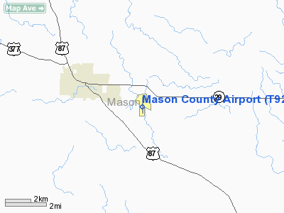
Location & QuickFacts
| FAA Information Effective: | 2008-09-25 |
| Airport Identifier: | T92 |
| Airport Status: | Operational |
| Longitude/Latitude: | 099-11-03.5000W/30-43-56.0000N
-99.184306/30.732222 (Estimated) |
| Elevation: | 1502 ft / 457.81 m (Surveyed) |
| Land: | 232 acres |
| From nearest city: | 3 nautical miles SE of Mason, TX |
| Location: | Mason County, TX |
| Magnetic Variation: | 08E (1985) |
Owner & Manager
| Ownership: | Publicly owned |
| Owner: | Mason County |
| Address: | Courthouse
Mason, TX 76856 |
| Phone number: | 325-347-5556 |
| Manager: | Jerry Bearden, Co Judge |
| Address: | County Courthouse
Mason, TX 76856 |
| Phone number: | 325-347-5556 |
Airport Operations and Facilities
| Airport Use: | Open to public |
| Wind indicator: | Yes |
| Segmented Circle: | Yes |
| Control Tower: | No |
| Lighting Schedule: | DUSK-DAWN |
| Beacon Color: | Clear-Green (lighted land airport) |
| Landing fee charge: | No |
| Sectional chart: | San Antonio |
| Region: | ASW - Southwest |
| Boundary ARTCC: | ZHU - Houston |
| Tie-in FSS: | SJT - San Angelo |
| FSS on Airport: | No |
| FSS Toll Free: | 1-800-WX-BRIEF |
| NOTAMs Facility: | SJT (NOTAM-d service avaliable) |
| Federal Agreements: | Y1 |
Airport Communications
Airport Services
| Fuel available: | 100LL
FOR FUEL CALL 915-347-5439 OR 347-5252. |
| Airframe Repair: | MINOR |
| Power Plant Repair: | MINOR |
| Bottled Oxygen: | NONE |
| Bulk Oxygen: | NONE |
Runway Information
Runway 13/31
| Dimension: | 3000 x 60 ft / 914.4 x 18.3 m |
| Surface: | TURF, Fair Condition |
| |
Runway 13 |
Runway 31 |
| Longitude: | 099-11-13.1950W | 099-10-49.1940W |
| Latitude: | 30-44-07.6400N | 30-43-44.6410N |
| Elevation: | 1514.00 ft | 1490.00 ft |
| Traffic Pattern: | Left | Left |
| Obstruction: | 6 ft tree, 190.0 ft from runway, 31:1 slope to clear | 12 ft brush, 210.0 ft from runway, 18:1 slope to clear |
|
Runway 17/35
| Dimension: | 3716 x 50 ft / 1132.6 x 15.2 m |
| Surface: | ASPH, Good Condition |
| Edge Lights: | Low |
| |
Runway 17 |
Runway 35 |
| Longitude: | 099-11-03.0761W | 099-11-03.8465W |
| Latitude: | 30-44-14.3358N | 30-43-37.5693N |
| Elevation: | 1502.00 ft | 1498.00 ft |
| Alignment: | 127 | 1 |
| Traffic Pattern: | Left | Left |
| Markings: | Non-precision instrument, Good Condition | Non-precision instrument, Good Condition |
| Obstruction: | 10 ft tree, 275.0 ft from runway, 165 ft left of centerline, 8:1 slope to clear | 13 ft tree, 200.0 ft from runway, 165 ft right of centerline |
|
Radio Navigation Aids
| ID |
Type |
Name |
Ch |
Freq |
Var |
Dist |
| BBD | NDB | Brady | | 380.00 | 07E | 27.7 nm |
| MFS | NDB | Horseshoe Bay Resort | | 403.00 | 07E | 44.6 nm |
| BMQ | NDB | Burnet | | 341.00 | 07E | 49.0 nm |
| ER | NDB | Shein | | 263.00 | 08E | 50.0 nm |
| LLO | VORTAC | Llano | 019X | 108.20 | 08E | 20.9 nm |
| JCT | VORTAC | Junction | 107X | 116.00 | 08E | 33.7 nm |
| STV | VORTAC | Stonewall | 085X | 113.80 | 08E | 40.2 nm |
| CSI | VORTAC | Center Point | 122X | 117.50 | 08E | 48.7 nm |
Remarks
- HEAVY TRANSIENT UTILIZATION OF ARPT DURING NOV-JAN.
- FOR SERVICE CALL 915-347-5439.
Images and information placed above are from
http://www.airport-data.com/airport/T92/
We thank them for the data!
| General Info
|
| Country |
United States
|
| State |
TEXAS
|
| FAA ID |
T92
|
| Latitude |
30-43-56.040N
|
| Longitude |
099-11-03.500W
|
| Elevation |
1502 feet
|
| Near City |
MASON
|
We don't guarantee the information is fresh and accurate. The data may
be wrong or outdated.
For more up-to-date information please refer to other sources.
|
|


