 |
|
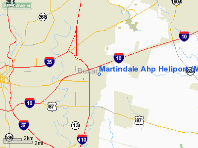
Location & QuickFacts
| FAA Information Effective: | 2008-09-25 |
| Airport Identifier: | MDA |
| Airport Status: | Operational |
| Longitude/Latitude: | 098-22-40.0510W/29-25-52.8390N
-98.377792/29.431344 (Estimated) |
| Elevation: | 674 ft / 205.44 m (Estimated) |
| Land: | 0 acres |
| From nearest city: | 5 nautical miles E of San Antonio, TX |
| Location: | Bexar County, TX |
| Magnetic Variation: | 07E (1985) |
Owner & Manager
| Ownership: | Army owned |
| Owner: | Us Army Atca-aso |
| Address: | Cameron Station
Alexandria, VA 22314 |
| Address: |
|
Airport Operations and Facilities
| Airport Use: | Private |
| Segmented Circle: | No |
| Control Tower: | No |
| Sectional chart: | San Antonio |
| Region: | ASW - Southwest |
| Boundary ARTCC: | ZHU - Houston |
| Tie-in FSS: | SJT - San Angelo |
| FSS on Airport: | No |
| FSS Toll Free: | 1-800-WX-BRIEF |
Airport Communications
Runway Information
Runway 17/35
| Dimension: | 3000 x 700 ft / 914.4 x 213.4 m |
| Surface: | ASPH, |
| |
Runway 17 |
Runway 35 |
| Traffic Pattern: | Left | Left |
|
Radio Navigation Aids
| ID |
Type |
Name |
Ch |
Freq |
Var |
Dist |
| CVB | NDB | Castroville | | 338.00 | 08E | 25.2 nm |
| PEZ | NDB | Pleasanton | | 275.00 | 07E | 29.6 nm |
| HHH | NDB | Devine | | 359.00 | 07E | 34.3 nm |
| HMA | NDB | Hondo | | 329.00 | 08E | 41.7 nm |
| ER | NDB | Shein | | 263.00 | 08E | 44.0 nm |
| DHK | TACAN | Randolph | 036X | | 09E | 8.6 nm |
| KSY | TACAN | Kelly | 057X | | 07E | 10.9 nm |
| SSF | VOR | Stinson | | 108.40 | 09E | 11.0 nm |
| HDO | VOR/DME | Hondo | 31X | 109.40 | 08E | 42.2 nm |
| RND | VORTAC | Randolph | 70X | 112.30 | 09E | 7.2 nm |
| SAT | VORTAC | San Antonio | 115X | 116.80 | 08E | 13.5 nm |
| STV | VORTAC | Stonewall | 085X | 113.80 | 08E | 49.6 nm |
| SAT | VOT | San Antonio Intl | | 110.40 | | 7.8 nm |
Remarks
- PPR DSN 954-1721 C512-782-1721. CLSD TO FIXED WING.
- ALL ACFT USE EXTREME CTN; 8 FT FENCE INSTALLED AROUND ACFT PARKED AREA ON CLSD RY 13/31 & ALONG W EDGE OF RY 17/35.
- PAD ON NW CORNER RWY 31 IS TRAN REFUEL SITE.
- DO NOT OVERFLY TOWN OF KIRBY 1 NM N OF AIRFIELD. EAST TFC ONLY.
- ARMY NATIONAL GUARD OPNS 134.1/247.4 & 36.90.
Images and information placed above are from
http://www.airport-data.com/airport/MDA/
We thank them for the data!
| General Info
|
| Country |
United States
|
| State |
TEXAS
|
| FAA ID |
MDA
|
| Latitude |
29-25-52.839N
|
| Longitude |
098-22-40.051W
|
| Elevation |
674 feet
|
| Near City |
SAN ANTONIO
|
We don't guarantee the information is fresh and accurate. The data may
be wrong or outdated.
For more up-to-date information please refer to other sources.
|
|


