 |
|
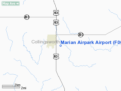
Location & QuickFacts
| FAA Information Effective: | 2008-09-25 |
| Airport Identifier: | F06 |
| Airport Status: | Operational |
| Longitude/Latitude: | 100-11-45.4130W/34-50-44.1990N
-100.195948/34.845611 (Estimated) |
| Elevation: | 2008 ft / 612.04 m (Surveyed) |
| Land: | 116 acres |
| From nearest city: | 1 nautical miles SE of Wellington, TX |
| Location: | Collingsworth County, TX |
| Magnetic Variation: | 08E (1985) |
Owner & Manager
| Ownership: | Publicly owned |
| Owner: | City Of Wellington |
| Address: | Po Box 949
Wellington, TX 79095 |
| Phone number: | 806-447-2544 |
| Manager: | Jon Sessions
CITY MANAGER. |
| Address: | Po Box 949
Wellington, TX 79095 |
| Phone number: | 806-447-2544 |
Airport Operations and Facilities
| Airport Use: | Open to public |
| Wind indicator: | Yes |
| Segmented Circle: | Yes |
| Control Tower: | No |
| Lighting Schedule: | DUSK-DAWN |
| Beacon Color: | Clear-Green (lighted land airport)
ROTG BCN OTS INDEFLY. |
| Landing fee charge: | No |
| Sectional chart: | Dallas-ft Worth |
| Region: | ASW - Southwest |
| Boundary ARTCC: | ZFW - Fort Worth |
| Tie-in FSS: | FTW - Fort Worth |
| FSS on Airport: | No |
| FSS Phone: | 817-541-3474 |
| FSS Toll Free: | 1-800-WX-BRIEF |
| NOTAMs Facility: | FTW (NOTAM-d service avaliable) |
| Federal Agreements: | N1 |
Airport Communications
Airport Services
| Fuel available: | 100LL |
| Bottled Oxygen: | NONE |
| Bulk Oxygen: | NONE |
Runway Information
Runway 04/22
| Dimension: | 1010 x 135 ft / 307.8 x 41.1 m |
| Surface: | TURF, Fair Condition |
| |
Runway 04 |
Runway 22 |
| Traffic Pattern: | Left | Left |
|
Runway 12/30
| Dimension: | 4035 x 60 ft / 1229.9 x 18.3 m |
| Surface: | ASPH, Good Condition |
| Weight Limit: | Single wheel: 2500 lbs. |
| Edge Lights: | Medium |
| |
Runway 12 |
Runway 30 |
| Traffic Pattern: | Left | Left |
| Markings: | Basic, Good Condition | Basic, Good Condition |
| Displaced threshold: | 525.00 ft | 0.00 ft |
| Obstruction: | 18 ft road, 200.0 ft from runway, 100 ft left of centerline
APCH RATIO 32:1 FM DSPLCD THR; +18 FT ROAD 184 FT LEFT CNTRLN 590 FT FM DSPLCD THR.
+4 FT FENCE 150 FT FM THLD 125 FT L. | 10 ft road, 450.0 ft from runway, 150 ft right of centerline, 25:1 slope to clear |
|
Runway 17/35
| Dimension: | 1700 x 175 ft / 518.2 x 53.3 m |
| Surface: | TURF, Fair Condition |
| |
Runway 17 |
Runway 35 |
| Traffic Pattern: | Left | Left |
| Obstruction: | 18 ft road, 760.0 ft from runway, 42:1 slope to clear | , 50:1 slope to clear |
|
Radio Navigation Aids
| ID |
Type |
Name |
Ch |
Freq |
Var |
Dist |
| CDS | VORTAC | Childress | 123X | 117.60 | 10E | 29.0 nm |
| SYO | VORTAC | Sayre | 099X | 115.20 | 10E | 40.8 nm |
| LTS | VORTAC | Altus | 035X | 109.80 | 08E | 47.0 nm |
Remarks
- EXTENSIVE AG OPNS DURING SPRING/SUMMER.
Images and information placed above are from
http://www.airport-data.com/airport/F06/
We thank them for the data!
| General Info
|
| Country |
United States
|
| State |
TEXAS
|
| FAA ID |
F06
|
| Latitude |
34-50-44.199N
|
| Longitude |
100-11-45.413W
|
| Elevation |
2008 feet
|
| Near City |
WELLINGTON
|
We don't guarantee the information is fresh and accurate. The data may
be wrong or outdated.
For more up-to-date information please refer to other sources.
|
|


