 |
|
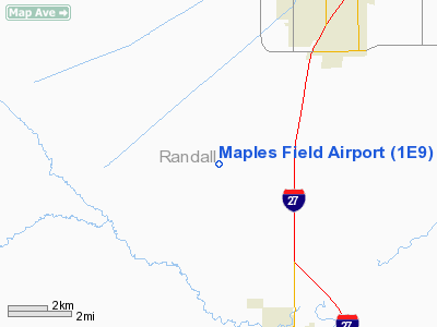
Location & QuickFacts
| FAA Information Effective: | 2008-09-25 |
| Airport Identifier: | 1E9 |
| Airport Status: | Operational |
| Longitude/Latitude: | 101-57-40.6910W/35-03-55.1990N
-101.961303/35.065333 (Estimated) |
| Elevation: | 3677 ft / 1120.75 m (Estimated) |
| Land: | 138 acres |
| From nearest city: | 6 nautical miles NW of Canyon, TX |
| Location: | Randall County, TX |
| Magnetic Variation: | 09E (1985) |
Owner & Manager
| Ownership: | Privately owned |
| Owner: | Sam Maples |
| Address: | 6315 Chenot
Amarillo, TX 79109 |
| Phone number: | 806-358-2737 |
| Manager: | Sam Maples |
| Address: | 6315 Chenot
Amarillo, TX 79109 |
| Phone number: | 806-358-2737 |
Airport Operations and Facilities
| Airport Use: | Open to public |
| Wind indicator: | No |
| Segmented Circle: | No |
| Control Tower: | No |
| Lighting Schedule: | DUSK-2300 |
| Beacon Color: | Clear-Green (lighted land airport)
ROTG BCN OTS INDEFLY. |
| Landing fee charge: | No |
| Sectional chart: | Dallas-ft Worth |
| Region: | ASW - Southwest |
| Boundary ARTCC: | ZAB - Albuquerque |
| Tie-in FSS: | FTW - Fort Worth |
| FSS on Airport: | No |
| FSS Phone: | 817-541-3474 |
| FSS Toll Free: | 1-800-WX-BRIEF |
| NOTAMs Facility: | FTW (NOTAM-d service avaliable) |
Airport Communications
Airport Services
| Bottled Oxygen: | NONE |
| Bulk Oxygen: | NONE |
Runway Information
Runway 17/35
| Dimension: | 3865 x 24 ft / 1178.1 x 7.3 m |
| Surface: | GRVL, Fair Condition
LOOSE AGREGATE ON RY. |
| Weight Limit: | Single wheel: 4000 lbs. |
| Edge Lights: | Non-standard lighting system
NSTD LIRL. SOUTH 2957 FT LGTD; RY 17 LGTD THR RELOCATED 908 FT. LIRL OTS INDEFLY. |
| |
Runway 17 |
Runway 35 |
| Traffic Pattern: | Left | Left |
| Obstruction: | , 50:1 slope to clear | 15 ft road, 65.0 ft from runway, 4:1 slope to clear |
|
Radio Navigation Aids
| ID |
Type |
Name |
Ch |
Freq |
Var |
Dist |
| AM | NDB | Pande | | 251.00 | 09E | 9.1 nm |
| HRX | NDB | Hereford | | 341.00 | 09E | 21.8 nm |
| DUX | NDB | Durrett | | 414.00 | 09E | 48.0 nm |
| PNH | VORTAC | Panhandle | 113X | 116.60 | 08E | 16.4 nm |
Remarks
- FENCE EAST & WEST SIDE OF RY 17/35 OBSTRUCTS PRIM SFC.
- LIRL RY 17/35 OTS INDEFLY.
Images and information placed above are from
http://www.airport-data.com/airport/1E9/
We thank them for the data!
| General Info
|
| Country |
United States
|
| State |
TEXAS
|
| FAA ID |
1E9
|
| Latitude |
35-03-55.199N
|
| Longitude |
101-57-40.691W
|
| Elevation |
3677 feet
|
| Near City |
CANYON
|
We don't guarantee the information is fresh and accurate. The data may
be wrong or outdated.
For more up-to-date information please refer to other sources.
|
|


