|
|
 |
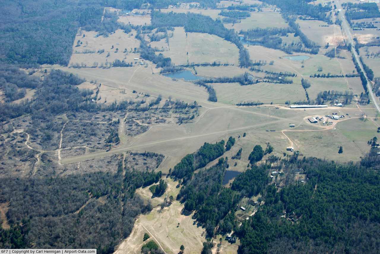
(Click on the photo to enlarge) |
Location & QuickFacts
| FAA Information Effective: | 2008-09-25 |
| Airport Identifier: | 6F7 |
| Airport Status: | Operational |
| Longitude/Latitude: | 094-21-15.6940W/32-49-35.4960N
-94.354359/32.826527 (Estimated) |
| Elevation: | 320 ft / 97.54 m (Estimated) |
| Land: | 160 acres |
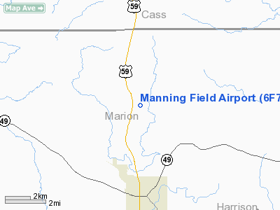
| From nearest city: | 4 nautical miles N of Jefferson, TX |
| Location: | Marion County, TX |
| Magnetic Variation: | 05E (1985) |
Owner & Manager
| Ownership: | Privately owned |
| Owner: | Roger Manning |
| Address: | 4702 N. Us 59
Jefferson, TX 75657 |
| Phone number: | 903-665-3532 |
| Manager: | Roger Manning |
| Address: | 4702 N. Us 59
Jefferson, TX 75657 |
| Phone number: | 903-665-3532 |
Airport Operations and Facilities
| Airport Use: | Open to public |
| Wind indicator: | Yes |
| Segmented Circle: | No |
| Control Tower: | No |
| Landing fee charge: | No |
| Sectional chart: | Memphis |
| Region: | ASW - Southwest |
| Boundary ARTCC: | ZFW - Fort Worth |
| Tie-in FSS: | FTW - Fort Worth |
| FSS on Airport: | No |
| FSS Phone: | 817-541-3474 |
| FSS Toll Free: | 1-800-WX-BRIEF |
| NOTAMs Facility: | FTW (NOTAM-d service avaliable) |
Airport Communications
Airport Services
| Bottled Oxygen: | NONE |
| Bulk Oxygen: | NONE |
Runway Information
Runway 02/20
| Dimension: | 1845 x 100 ft / 562.4 x 30.5 m |
| Surface: | TURF, Good Condition |
| |
Runway 02 |
Runway 20 |
| Traffic Pattern: | Left | Left |
| Obstruction: | 46 ft tree, 78.0 ft from runway, 110 ft left of centerline, 1:1 slope to clear | 60 ft trees, 0.0 ft from runway, 90 ft right of centerline |
|
Runway 07/25
| Dimension: | 3600 x 100 ft / 1097.3 x 30.5 m |
| Surface: | TURF, Good Condition |
| |
Runway 07 |
Runway 25 |
| Traffic Pattern: | Left | Left |
| Obstruction: | 35 ft pline, 210.0 ft from runway, 6:1 slope to clear | 60 ft trees, 0.0 ft from runway, 60L/ ft right of centerline |
|
Runway 12/30
| Dimension: | 5000 x 80 ft / 1524.0 x 24.4 m |
| Surface: | TURF, Good Condition |
| |
Runway 12 |
Runway 30 |
| Traffic Pattern: | Left | Left |
| Obstruction: | 10 ft road | 4 ft fence, 0.0 ft from runway |
|
Radio Navigation Aids
| ID |
Type |
Name |
Ch |
Freq |
Var |
Dist |
| VIV | NDB | Vivian | | 284.00 | 06E | 17.5 nm |
| ATA | NDB | Atlanta | | 347.00 | 04E | 18.6 nm |
| LST | NDB | Lone Star | | 305.00 | 05E | 20.6 nm |
| RPF | NDB | Carthage | | 332.00 | 04E | 39.0 nm |
| ABG | NDB | Ambassador | | 404.00 | 07E | 41.0 nm |
| HNO | NDB | Henderson | | 371.00 | 06E | 46.2 nm |
| SPH | NDB | Springhill | | 375.00 | 05E | 48.0 nm |
| BAD | TACAN | Barksdale | 105X | | 05E | 39.8 nm |
| DTN | VOR | Downtown | | 108.60 | 07E | 35.5 nm |
| EIC | VORTAC | Belcher | 121X | 117.40 | 07E | 27.7 nm |
| GGG | VORTAC | Gregg County | 070X | 112.30 | 07E | 31.8 nm |
| TXK | VORTAC | Texarkana | 110X | 116.30 | 07E | 43.7 nm |
| EMG | VORTAC | Elm Grove | 049X | 111.20 | 07E | 46.2 nm |
| SHV | VOT | Shreveport Regional | | 108.20 | | 29.1 nm |
Remarks
- ULTRALIGHT ACTIVITY ON & INVOF ARPT.
- NO LINE OF SIGHT BTN RY ENDS 20, 25 & 30.
- VFR OPNS PRVDD LANDG THRS ARE DSPLCD TO PRVD 20:1 CLNC OVER ANY OBSTNS.
Images and information placed above are from
http://www.airport-data.com/airport/6F7/
We thank them for the data!
| General Info
|
| Country |
United States
|
| State |
TEXAS
|
| FAA ID |
6F7
|
| Latitude |
32-49-35.496N
|
| Longitude |
094-21-15.694W
|
| Elevation |
320 feet
|
| Near City |
JEFFERSON
|
We don't guarantee the information is fresh and accurate. The data may
be wrong or outdated.
For more up-to-date information please refer to other sources.
|
|