 |
|
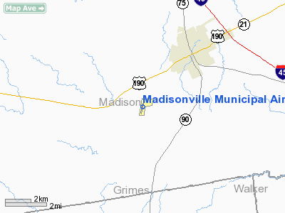
Madisonville Muni Airport |
Location & QuickFacts
| FAA Information Effective: | 2008-09-25 |
| Airport Identifier: | 51R |
| Airport Status: | Operational |
| Longitude/Latitude: | 095-57-07.2000W/30-54-46.2000N
-95.952000/30.912833 (Estimated) |
| Elevation: | 287 ft / 87.48 m (Surveyed) |
| Land: | 40 acres |
| From nearest city: | 3 nautical miles SW of Madisonville, TX |
| Location: | Madison County, TX |
| Magnetic Variation: | 07E (1980) |
Owner & Manager
| Ownership: | Publicly owned |
| Owner: | City Of Madisonville |
| Address: | 210 W. Cottonwood
Madisonville, TX 77864 |
| Phone number: | 936-348-2748 |
| Manager: | Paul Feazelle |
| Address: | 210 W. Cottonwood
Madisonville, TX 77864 |
| Phone number: | 936-348-2748 |
Airport Operations and Facilities
| Airport Use: | Open to public |
| Wind indicator: | Yes |
| Segmented Circle: | Yes |
| Control Tower: | No |
| Lighting Schedule: | DUSK-DAWN |
| Beacon Color: | Clear-Green (lighted land airport) |
| Landing fee charge: | No |
| Sectional chart: | Houston |
| Region: | ASW - Southwest |
| Boundary ARTCC: | ZHU - Houston |
| Tie-in FSS: | CXO - Montgomery County |
| FSS on Airport: | No |
| FSS Toll Free: | 1-800-WX-BRIEF
FOR FP FILING CALL CXO FSS 1-800-833-5602 |
| NOTAMs Facility: | CXO (NOTAM-d service avaliable) |
Airport Communications
Airport Services
| Airframe Repair: | NONE |
| Power Plant Repair: | NONE |
| Bottled Oxygen: | NONE |
| Bulk Oxygen: | NONE |
Runway Information
Runway 18/36
| Dimension: | 3202 x 50 ft / 976.0 x 15.2 m |
| Surface: | ASPH, Good Condition |
| Weight Limit: | Single wheel: 4000 lbs. |
| Edge Lights: | Medium |
| |
Runway 18 |
Runway 36 |
| Longitude: | 095-57-03.9620W | 095-57-10.3950W |
| Latitude: | 30-55-01.8100N | 30-54-30.6110N |
| Elevation: | 287.00 ft | 260.00 ft |
| Alignment: | 127 | 10 |
| Traffic Pattern: | Left | Left |
| Markings: | Non-precision instrument, Good Condition | Non-precision instrument, Good Condition |
| Obstruction: | 50 ft tree, 200.0 ft from runway, 200 ft left of centerline
+45 FT TREES 180 FT R & 190 FT L OF CNTRLN AT THLD. | 42 ft tree, 200.0 ft from runway, 190 ft left of centerline
+40 FT TREES 180 FT L & 200 FT R OF CNTRLN AT THLD. |
|
Radio Navigation Aids
| ID |
Type |
Name |
Ch |
Freq |
Var |
Dist |
| UTS | NDB | Huntsville | | 308.00 | 06E | 21.3 nm |
| BNH | NDB | Brenham | | 362.00 | 06E | 46.9 nm |
| LOA | VORTAC | Leona | 045X | 110.80 | 08E | 12.7 nm |
| CLL | VORTAC | College Station | 080X | 113.30 | 08E | 30.5 nm |
| TNV | VORTAC | Navasota | 106X | 115.90 | 08E | 37.9 nm |
Remarks
- GOLF COURSE CLUB HOUSE 1/2 MI NE ATNDD DALGT-FONE.
- AIRPORT GATE LOCKED FROM 2200-0600 CALL 936-348-2748.
Images and information placed above are from
http://www.airport-data.com/airport/51R/
We thank them for the data!
| General Info
|
| Country |
United States
|
| State |
TEXAS
|
| FAA ID |
51R
|
| Latitude |
30-54-46.200N
|
| Longitude |
095-57-07.200W
|
| Elevation |
287 feet
|
| Near City |
MADISONVILLE
|
We don't guarantee the information is fresh and accurate. The data may
be wrong or outdated.
For more up-to-date information please refer to other sources.
|
|


