 |
|
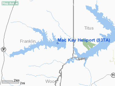
Location & QuickFacts
| FAA Information Effective: | 2008-09-25 |
| Airport Identifier: | 93TA |
| Airport Status: | Operational |
| Longitude/Latitude: | 095-09-27.7860W/33-03-36.4330N
-95.157718/33.060120 (Estimated) |
| Elevation: | 351 ft / 106.98 m (Estimated) |
| Land: | 0 acres |
| From nearest city: | 8 nautical miles SE of Mount Vernon, TX |
| Location: | Franklin County, TX |
| Magnetic Variation: | 06E (1985) |
Owner & Manager
| Ownership: | Privately owned |
| Owner: | J.w. Mackay |
| Address: | Route 1 Box 107
Scroggins, TX 75480 |
| Phone number: | 214-860-2888 |
| Manager: | J.w. Mackay |
| Address: | Route 1 Box 107
Scroggins, TX 75480 |
| Phone number: | 214-860-2888 |
Airport Operations and Facilities
| Airport Use: | Private |
| Wind indicator: | Yes |
| Segmented Circle: | No |
| Control Tower: | No |
| Lighting Schedule: | PHONE REQ
FOR HELIPAD LGTS PHONE 214-860-2888. |
| Landing fee charge: | No |
| Sectional chart: | Dallas-ft Worth |
| Region: | ASW - Southwest |
| Boundary ARTCC: | ZFW - Fort Worth |
| Tie-in FSS: | FTW - Fort Worth |
| FSS on Airport: | No |
| FSS Phone: | 817-541-3474 |
| FSS Toll Free: | 1-800-WX-BRIEF |
Runway Information
Helipad H1
| Dimension: | 80 x 80 ft / 24.4 x 24.4 m |
| Surface: | CONC, |
| Edge Lights: | Medium |
| |
Runway H1 |
Runway |
| Traffic Pattern: | Left | Left |
|
Radio Navigation Aids
| ID |
Type |
Name |
Ch |
Freq |
Var |
Dist |
| LST | NDB | Lone Star | | 305.00 | 05E | 22.4 nm |
| ABG | NDB | Ambassador | | 404.00 | 07E | 28.6 nm |
| TY | NDB | Tyler | | 320.00 | 06E | 41.8 nm |
| SYW | NDB | Cash | | 428.00 | 05E | 46.1 nm |
| ATA | NDB | Atlanta | | 347.00 | 04E | 48.8 nm |
| MJF | TACAN | Arvilla | 033X | | 05E | 45.5 nm |
| UIM | VOR/DME | Quitman | 087X | 114.00 | 08E | 15.1 nm |
| SLR | VOR/DME | Sulphur Springs | 027X | 109.00 | 08E | 21.1 nm |
| PRX | VOR/DME | Paris | 083X | 113.60 | 07E | 32.5 nm |
| TYR | VOR/DME | Tyler | 089X | 114.20 | 06E | 44.1 nm |
| GGG | VORTAC | Gregg County | 070X | 112.30 | 07E | 43.7 nm |
Images and information placed above are from
http://www.airport-data.com/airport/93TA/
We thank them for the data!
| General Info
|
| Country |
United States
|
| State |
TEXAS
|
| FAA ID |
93TA
|
| Latitude |
33-03-36.433N
|
| Longitude |
095-09-27.786W
|
| Elevation |
351 feet
|
| Near City |
MOUNT VERNON
|
We don't guarantee the information is fresh and accurate. The data may
be wrong or outdated.
For more up-to-date information please refer to other sources.
|
|


