 |
|
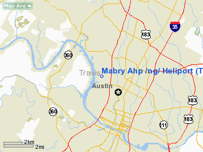
Location & QuickFacts
| FAA Information Effective: | 2008-09-25 |
| Airport Identifier: | TX26 |
| Airport Status: | Operational |
| Longitude/Latitude: | 097-46-01.0230W/30-19-00.7420N
-97.766951/30.316873 (Estimated) |
| Elevation: | 670 ft / 204.22 m (Estimated) |
| Land: | 0 acres |
| From nearest city: | 1 nautical miles SW of Austin, TX |
| Location: | Travis County, TX |
| Magnetic Variation: | 07E (1985) |
Owner & Manager
| Ownership: | Army owned |
| Owner: | Us Army Atca-aso |
| Address: | Cameron Station
Alexandria, VA 22314 |
| Address: |
|
Airport Operations and Facilities
| Airport Use: | Private |
| Segmented Circle: | No |
| Control Tower: | No |
| Sectional chart: | San Antonio |
| Region: | ASW - Southwest |
| Boundary ARTCC: | ZHU - Houston |
| Tie-in FSS: | SJT - San Angelo |
| FSS on Airport: | No |
| FSS Toll Free: | 1-800-WX-BRIEF |
Runway Information
Helipad H1
| Dimension: | 50 x 50 ft / 15.2 x 15.2 m |
| Surface: | GRAVEL, |
| |
Runway H1 |
Runway |
| Traffic Pattern: | Left | Left |
|
Radio Navigation Aids
| ID |
Type |
Name |
Ch |
Freq |
Var |
Dist |
| GUO | NDB | Georgetown | | 332.00 | 06E | 22.5 nm |
| MFS | NDB | Horseshoe Bay Resort | | 403.00 | 07E | 33.0 nm |
| BMQ | NDB | Burnet | | 341.00 | 07E | 35.2 nm |
| GYB | NDB | Lee County | | 385.00 | 07E | 41.9 nm |
| IL | NDB | Iresh | | 278.00 | 07E | 42.6 nm |
| HLR | NDB | Hood | | 347.00 | 07E | 48.9 nm |
| GRK | VOR/DME | Gray | 055X | 111.80 | 07E | 43.1 nm |
| CWK | VORTAC | Centex | 075X | 112.80 | 06E | 12.8 nm |
| STV | VORTAC | Stonewall | 085X | 113.80 | 08E | 49.2 nm |
Remarks
- OFFICIAL BUSINESS ONLY - CAUTION: 100' TWRS & PLINES EAST & SE OF CAMP MABRY. 25' WIRES ON THE 03 APCH/21 DEP PATH OF 49AD HELIPAD. BOTH HELIPADS IN CLOSE PROXIMITY TO BLDG & HEAVILY TRAVELED ROADS.
- LCTD WITHIN ROBERT MUELLER MUNI ARPT TFC AREA. EAST TFC ONLY AT 1000' MSL CLSD TO F/W ACFT. PPR - V954-5167; C512-465-5167.
Images and information placed above are from
http://www.airport-data.com/airport/TX26/
We thank them for the data!
| General Info
|
| Country |
United States
|
| State |
TEXAS
|
| FAA ID |
TX26
|
| Latitude |
30-19-00.742N
|
| Longitude |
097-46-01.023W
|
| Elevation |
670 feet
|
| Near City |
AUSTIN
|
We don't guarantee the information is fresh and accurate. The data may
be wrong or outdated.
For more up-to-date information please refer to other sources.
|
|


