 |
|
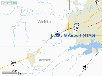
Location & QuickFacts
| FAA Information Effective: | 2008-09-25 |
| Airport Identifier: | 4TA5 |
| Airport Status: | Operational |
| Longitude/Latitude: | 098-38-46.2100W/33-51-09.3520N
-98.646169/33.852598 (Estimated) |
| Elevation: | 1068 ft / 325.53 m (Estimated) |
| Land: | 0 acres |
| From nearest city: | 3 nautical miles NE of Holliday, TX |
| Location: | Wichita County, TX |
| Magnetic Variation: | 07E (1985) |
Owner & Manager
| Ownership: | Privately owned |
| Owner: | Larry A. Grimm |
| Address: | 8579 Seymour Hwy
Wichita Falls, TX 76308-6944 |
| Phone number: | 817-692-0440 |
| Manager: | Larry A. Grimm |
| Address: | 8579 Seymour Hwy
Wichita Falls, TX 76308-6944 |
| Phone number: | 817-692-0440 |
Airport Operations and Facilities
| Airport Use: | Private |
| Wind indicator: | Yes |
| Segmented Circle: | Yes |
| Control Tower: | No |
| Landing fee charge: | No |
| Sectional chart: | Dallas-ft Worth |
| Region: | ASW - Southwest |
| Boundary ARTCC: | ZFW - Fort Worth |
| Tie-in FSS: | FTW - Fort Worth |
| FSS on Airport: | No |
| FSS Phone: | 817-541-3474 |
| FSS Toll Free: | 1-800-WX-BRIEF |
Runway Information
Runway 17/35
| Dimension: | 1800 x 50 ft / 548.6 x 15.2 m |
| Surface: | TURF, |
| |
Runway 17 |
Runway 35 |
| Traffic Pattern: | Left | Left |
| Obstruction: | 35 ft plines, 300.0 ft from runway | 4 ft fence, 10.0 ft from runway |
|
Radio Navigation Aids
| ID |
Type |
Name |
Ch |
Freq |
Var |
Dist |
| SKB | NDB | Scotland | | 344.00 | 08E | 8.8 nm |
| ONY | NDB | Olney | | 272.00 | 07E | 31.3 nm |
| VRT | NDB | Wilbarger | | 230.00 | 08E | 38.7 nm |
| GHX | NDB | Graham | | 371.00 | 07E | 42.0 nm |
| GMZ | NDB | Grindstone Mountain | | 356.00 | 07E | 46.1 nm |
| PFL | NDB | Post | | 308.00 | 08E | 47.0 nm |
| SHP | TACAN | Sheppard | 045X | | 10E | 11.1 nm |
| LAW | VOR/DME | Lawton | 031X | 109.40 | 09E | 40.4 nm |
| DUC | VOR/DME | Duncan | 047X | 111.00 | 09E | 48.4 nm |
| SPS | VORTAC | Wichita Falls | 074X | 112.70 | 10E | 8.5 nm |
| UKW | VORTAC | Bowie | 071X | 112.40 | 06E | 45.4 nm |
Images and information placed above are from
http://www.airport-data.com/airport/4TA5/
We thank them for the data!
| General Info
|
| Country |
United States
|
| State |
TEXAS
|
| FAA ID |
4TA5
|
| Latitude |
33-51-09.352N
|
| Longitude |
098-38-46.210W
|
| Elevation |
1068 feet
|
| Near City |
HOLLIDAY
|
We don't guarantee the information is fresh and accurate. The data may
be wrong or outdated.
For more up-to-date information please refer to other sources.
|
|


