 |
|
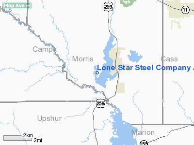
Lone Star Steel Company Airport |
Location & QuickFacts
| FAA Information Effective: | 2008-09-25 |
| Airport Identifier: | 4TE0 |
| Airport Status: | Operational |
| Longitude/Latitude: | 094-44-00.7450W/32-56-00.4670N
-94.733540/32.933463 (Estimated) |
| Elevation: | 285 ft / 86.87 m (Estimated) |
| Land: | 50 acres |
| From nearest city: | 2 nautical miles SW of Lone Star, TX |
| Location: | Morris County, TX |
| Magnetic Variation: | 05E (1990) |
Owner & Manager
| Ownership: | Privately owned |
| Owner: | Lone Star Steel Co |
| Address: | Box 803546
Dallas, TX 75380-3546 |
| Phone number: | 972-386-3981 |
| Manager: | David Jordan |
| Address: |
Tx |
| Phone number: | 903-656-6589 |
Airport Operations and Facilities
| Airport Use: | Private |
| Wind indicator: | Yes |
| Segmented Circle: | No |
| Control Tower: | No |
| Lighting Schedule: | DUSK-DAWN
ACTVT MIRL RY 13/31 - 122.750. |
| Beacon Color: | Clear-Green-Yellow (heliport) |
| Landing fee charge: | No |
| Sectional chart: | Memphis |
| Region: | ASW - Southwest |
| Boundary ARTCC: | ZFW - Fort Worth |
| Tie-in FSS: | FTW - Fort Worth |
| FSS on Airport: | No |
| FSS Phone: | 817-541-3474 |
| FSS Toll Free: | 1-800-WX-BRIEF |
Airport Communications
Airport Services
| Airframe Repair: | NONE |
| Power Plant Repair: | NONE |
Runway Information
Runway 13/31
| Dimension: | 5350 x 42 ft / 1630.7 x 12.8 m |
| Surface: | CONC, |
| Edge Lights: | Medium |
| |
Runway 13 |
Runway 31 |
| Elevation: | 285.00 ft | 275.00 ft |
| Traffic Pattern: | Left | Left |
|
Radio Navigation Aids
| ID |
Type |
Name |
Ch |
Freq |
Var |
Dist |
| LST | NDB | Lone Star | | 305.00 | 05E | 0.6 nm |
| ABG | NDB | Ambassador | | 404.00 | 07E | 28.4 nm |
| ATA | NDB | Atlanta | | 347.00 | 04E | 29.2 nm |
| VIV | NDB | Vivian | | 284.00 | 06E | 36.8 nm |
| HNO | NDB | Henderson | | 371.00 | 06E | 45.3 nm |
| TY | NDB | Tyler | | 320.00 | 06E | 48.5 nm |
| UIM | VOR/DME | Quitman | 087X | 114.00 | 08E | 32.1 nm |
| SLR | VOR/DME | Sulphur Springs | 027X | 109.00 | 08E | 43.8 nm |
| TYR | VOR/DME | Tyler | 089X | 114.20 | 06E | 48.5 nm |
| GGG | VORTAC | Gregg County | 070X | 112.30 | 07E | 31.0 nm |
| EIC | VORTAC | Belcher | 121X | 117.40 | 07E | 47.6 nm |
| TXK | VORTAC | Texarkana | 110X | 116.30 | 07E | 48.2 nm |
| SHV | VOT | Shreveport Regional | | 108.20 | | 49.2 nm |
Images and information placed above are from
http://www.airport-data.com/airport/4TE0/
We thank them for the data!
| General Info
|
| Country |
United States
|
| State |
TEXAS
|
| FAA ID |
4TE0
|
| Latitude |
32-56-00.467N
|
| Longitude |
094-44-00.745W
|
| Elevation |
285 feet
|
| Near City |
LONE STAR
|
We don't guarantee the information is fresh and accurate. The data may
be wrong or outdated.
For more up-to-date information please refer to other sources.
|
|


