|
|
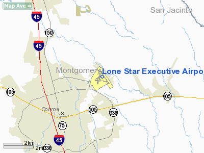
Lone Star Executive Airport |
| Lone Star Executive Airport |
| IATA: CXO – ICAO: KCXO – FAA LID: CXO |
| Summary |
| Airport type |
Public |
| Owner |
Montgomery County |
| Serves |
Houston, Texas |
| Location |
Conroe, Texas |
| Elevation AMSL |
245 ft / 75 m |
| Coordinates |
30°21′09″N 095°24′52″W / 30.3525°N 95.41444°W / 30.3525; -95.41444 |
| Website |
co.montgomery.tx.us/air/ |
| Runways |
| Direction |
Length |
Surface |
| ft |
m |
| 14/32 |
6,000 |
1,829 |
Asphalt |
| 1/19 |
5,000 |
1,524 |
Concrete |
| Statistics (2006) |
| Aircraft operations |
80,060 |
| Based aircraft |
254 |
| Sources: airport web site and FAA |
Lone Star Executive Airport (IATA: CXO, ICAO: KCXO, FAA LID: CXO) is a county-owned public-use airport located in Conroe, Montgomery County, Texas, United States, 37 miles (60 km) north of the central business district of Houston. It is was formerly known as Montgomery County Airport. History
Lone Star Executive Airport was constructed during World War II to serve as a military facility, but was converted in 1945 to be a predominately civilian airfield.
Facilities and aircraft
Lone Star Executive Airport covers an area of 1,277 acres (517 ha) which contains two runways: 14/32 with a 6,000 x 150 ft (1,829 x 46 m) concrete pavement and 1/19 with a 5,000 x 100 ft (1,524 x 30 m) concrete surface.
For the 12-month period ending April 30, 2010, the airport had 78,432 aircraft operations, an average of 215 per day: 94% general aviation, 5% military and <1% air taxi. At that time there were 254 aircraft based at this airport: 74% single-engine, 15% multi-engine, 3% jet, 3% helicopter and 5% military.
Accidents and incidents
- On 20 June 1996, Douglas DC-3A N23WT of Loren Davis Ministries International was destroyed in a crash at Cut and Shoot, Texas. The aircraft was on a training flight based at Conroe Airport when an engine failure occurred. The co-pilot did not hear the call to feather the propellor on the affected engine. The aircraft flew into a tree, hit power lines and was destroyed in the subsequent fire. A witness stated that the aircraft was lifted off with insufficient airspeed. The crew also attempted to fly the aircraft at an incorrect airspeed following the engine failure.
The above content comes from Wikipedia and is published under free licenses – click here to read more.
 |
(Click on the photo to enlarge) |
Location & QuickFacts
| FAA Information Effective: | 2008-09-25 |
| Airport Identifier: | CXO |
| Airport Status: | Operational |
| Longitude/Latitude: | 095-24-52.3406W/30-21-08.5135N
-95.414539/30.352365 (Estimated) |
| Elevation: | 245 ft / 74.68 m (Surveyed) |
| Land: | 1277 acres |
| From nearest city: | 37 nautical miles N of Houston, TX |
| Location: | Montgomery County, TX |
| Magnetic Variation: | 05E (2000) |
Owner & Manager
| Ownership: | Publicly owned |
| Owner: | Montgomery County |
| Address: | Po Box 539
Conroe, TX 77301 |
| Phone number: | 936-539-7811 |
| Manager: | Scott Smith |
| Address: | 10260 Carl Pickering Memorial
Conroe, TX 77303 |
| Phone number: | 936-788-8311 |
Airport Operations and Facilities
| Airport Use: | Open to public |
| Wind indicator: | Yes |
| Segmented Circle: | Yes |
| Control Tower: | No |
| Lighting Schedule: | DUSK-DAWN
MIRL RY 14/32 PRESET LOW INTST; INCR INTST & ACTVT MALSR RY 14 - CTAF. |
| Beacon Color: | Clear-Green (lighted land airport) |
| Landing fee charge: | No |
| Sectional chart: | Houston |
| Region: | ASW - Southwest |
| Boundary ARTCC: | ZHU - Houston |
| Tie-in FSS: | CXO - Montgomery County |
| FSS on Airport: | No |
| FSS Toll Free: | 1-800-WX-BRIEF
FOR FP FILING CALL CXO FSS 1-800-833-5602 |
| NOTAMs Facility: | CXO (NOTAM-d service avaliable) |
| Federal Agreements: | NGPY3 |
Airport Communications
| CTAF: | 122.950 |
| Unicom: | 122.950
UNICOM MONITORED FM 0700-2100. |
Airport Services
| Fuel available: | 100LLA |
| Airframe Repair: | MAJOR |
| Power Plant Repair: | MAJOR |
| Bottled Oxygen: | NONE |
| Bulk Oxygen: | NONE |
Runway Information
Runway 01/19
| Dimension: | 5000 x 100 ft / 1524.0 x 30.5 m |
| Surface: | CONC, Good Condition |
| Weight Limit: | Single wheel: 140000 lbs. |
| Edge Lights: | Medium |
| |
Runway 01 |
Runway 19 |
| Longitude: | 095-25-10.1644W | 095-24-53.3149W |
| Latitude: | 30-20-44.2720N | 30-21-31.5572N |
| Elevation: | 230.00 ft | 229.00 ft |
| Alignment: | 17 | 127 |
| Traffic Pattern: | Left | Left |
| Markings: | Non-precision instrument, Good Condition | Non-precision instrument, Good Condition |
| Crossing Height: | 33.00 ft | 40.00 ft |
| VASI: | 2-light PAPI on left side | 2-light PAPI on left side |
| Visual Glide Angle: | 3.00° | 3.00° |
| Obstruction: | 19 ft tree, 550.0 ft from runway, 285 ft right of centerline, 17:1 slope to clear | 65 ft trees, 1910.0 ft from runway, 80 ft left of centerline, 26:1 slope to clear |
|
Runway 14/32
| Dimension: | 6000 x 150 ft / 1828.8 x 45.7 m |
| Surface: | CONC, Good Condition |
| Weight Limit: | Single wheel: 140000 lbs. |
| Edge Lights: | Medium |
| |
Runway 14 |
Runway 32 |
| Longitude: | 095-25-03.9070W | 095-24-25.1090W |
| Latitude: | 30-21-33.4780N | 30-20-44.5470N |
| Elevation: | 230.00 ft | 241.00 ft |
| Alignment: | 127 | 127 |
| ILS Type: | ILS/DME
| |
| Traffic Pattern: | Left | Left |
| Markings: | Precision instrument, Good Condition | Non-precision instrument, Good Condition |
| Crossing Height: | 31.00 ft | 27.00 ft |
| Displaced threshold: | 591.00 ft | 0.00 ft |
| VASI: | 2-light PAPI on left side | 4-box on left side |
| Visual Glide Angle: | 3.00° | 3.00° |
| Approach lights: | MALSR
MALSR OTS INDEFLY. | |
| Runway End Identifier: | | Yes |
| Obstruction: | 12 ft hill, 250.0 ft from runway, 440 ft right of centerline, 4:1 slope to clear
APCH RATIO 50:1 AT DSPLCD THLD. | 52 ft tree, 1670.0 ft from runway, 684 ft right of centerline, 28:1 slope to clear |
|
Radio Navigation Aids
| ID |
Type |
Name |
Ch |
Freq |
Var |
Dist |
| DWH | NDB | David Hooks | | 521.00 | 05E | 15.7 nm |
| BVP | NDB | Nixin | | 326.00 | 05E | 23.9 nm |
| UTS | NDB | Huntsville | | 308.00 | 06E | 25.1 nm |
| EYQ | NDB | Weiser | | 286.00 | 06E | 27.8 nm |
| LYD | NDB | Lakeside | | 249.00 | 05E | 35.0 nm |
| JPA | NDB | Sanjac | | 347.00 | 05E | 44.9 nm |
| SGR | NDB | Hull | | 388.00 | 05E | 45.1 nm |
| EFD | TACAN | Ellington | 031X | | 05E | 46.8 nm |
| HUB | VOR/DME | Hobby | 118X | 117.10 | 05E | 42.5 nm |
| IAH | VORTAC | Humble | 113X | 116.60 | 05E | 24.0 nm |
| TNV | VORTAC | Navasota | 106X | 115.90 | 08E | 33.6 nm |
| DAS | VORTAC | Daisetta | 116X | 116.90 | 05E | 41.1 nm |
| HOU | VOT | Houston Wm P Hobby | | 108.40 | | 43.1 nm |
Remarks
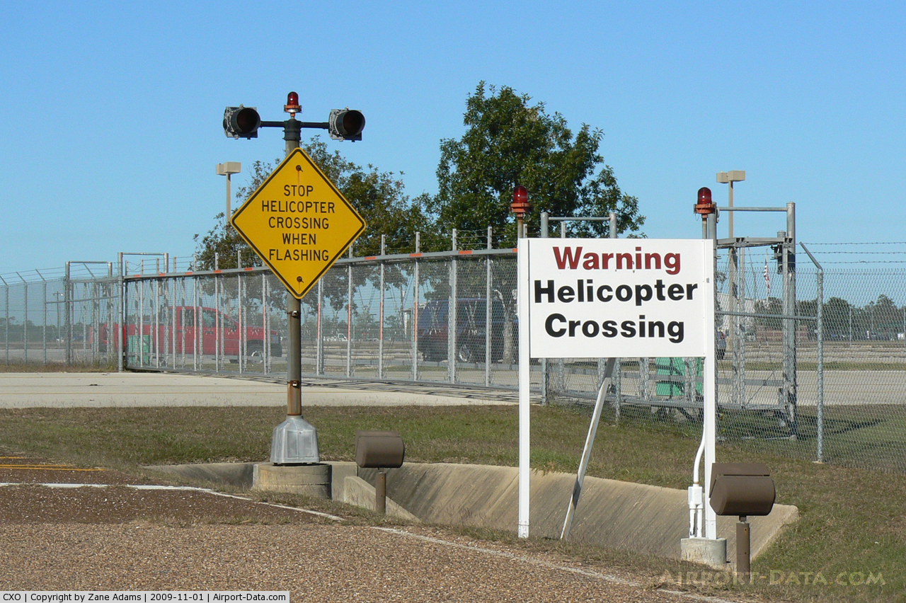
- EXTENSIVE MILITARY HELICOPTER ACTIVITY ON ARPT.
Images and information placed above are from
http://www.airport-data.com/airport/CXO/
We thank them for the data!
|
|