 |
|
Location & QuickFacts
| FAA Information Effective: | 2008-09-25 |
| Airport Identifier: | TX25 |
| Airport Status: | Operational |
| Longitude/Latitude: | 095-57-03.8720W/31-59-21.5800N
-95.951076/31.989328 (Estimated) |
| Elevation: | 391 ft / 119.18 m (Surveyed) |
| Land: | 0 acres |
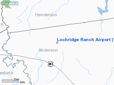
| From nearest city: | 14 nautical miles SW of Athens, TX |
| Location: | Anderson County, TX |
| Magnetic Variation: | 06E (1985) |
Owner & Manager
| Ownership: | Privately owned |
| Owner: | Edwin L. Cox |
| Address: | 7515 Lemmon Avenue, Hgr G
Dallas, TX 75209 |
| Phone number: | 214-358-3726 |
| Manager: | Frank Sanker, Chief Pilot |
| Address: | 7515 Lemmon Avenue, Hgr G
Dallas, TX 75209 |
| Phone number: | 214-247-0815 |
Airport Operations and Facilities
| Airport Use: | Private |
| Wind indicator: | Yes |
| Segmented Circle: | No |
| Control Tower: | No |
| Lighting Schedule: | PHONE REQ
FOR MIRL RY 17/35 & VASI RYS 17 & 35 CALL 214-418-5673. |
| Landing fee charge: | No |
| Sectional chart: | Houston |
| Region: | ASW - Southwest |
| Boundary ARTCC: | ZFW - Fort Worth |
| Tie-in FSS: | FTW - Fort Worth |
| FSS on Airport: | No |
| FSS Phone: | 817-541-3474 |
| FSS Toll Free: | 1-800-WX-BRIEF |
Runway Information
Runway 17/35
| Dimension: | 5000 x 60 ft / 1524.0 x 18.3 m |
| Surface: | ASPH, |
| Edge Lights: | Medium |
| |
Runway 17 |
Runway 35 |
| Traffic Pattern: | Left | Left |
| VASI: | 2-box on left side | 2-box on left side |
|
Radio Navigation Aids
| ID |
Type |
Name |
Ch |
Freq |
Var |
Dist |
| LIQ | NDB | Lochridge Ranch | | 335.00 | 09E | 1.3 nm |
| CSZ | NDB | Crossroads | | 215.00 | 08E | 4.5 nm |
| AHX | NDB | Athens | | 269.00 | 06E | 11.9 nm |
| PYF | NDB | Pyramid | | 418.00 | 06E | 14.7 nm |
| PSN | NDB | Palestine | | 375.00 | 04E | 17.9 nm |
| CRS | NDB | Corsicana | | 396.00 | 06E | 22.8 nm |
| CGQ | NDB | Powell | | 344.00 | 06E | 24.7 nm |
| TY | NDB | Tyler | | 320.00 | 06E | 35.4 nm |
| LXY | NDB | Mexia | | 329.00 | 07E | 35.5 nm |
| JSO | NDB | Cherokee County | | 263.00 | 05E | 38.2 nm |
| AVZ | NDB | Travis | | 260.00 | 06E | 48.7 nm |
| FZT | VOR/DME | Frankston | 051X | 111.40 | 06E | 22.0 nm |
| TYR | VOR/DME | Tyler | 089X | 114.20 | 06E | 35.5 nm |
| GNL | VOR/DME | Groesbeck | 025X | 108.80 | 05E | 39.2 nm |
| CQY | VORTAC | Cedar Creek | 095X | 114.80 | 06E | 18.0 nm |
Images and information placed above are from
http://www.airport-data.com/airport/TX25/
We thank them for the data!
| General Info
|
| Country |
United States
|
| State |
TEXAS
|
| FAA ID |
TX25
|
| Latitude |
31-59-21.580N
|
| Longitude |
095-57-03.872W
|
| Elevation |
391 feet
|
| Near City |
ATHENS
|
We don't guarantee the information is fresh and accurate. The data may
be wrong or outdated.
For more up-to-date information please refer to other sources.
|
|


