 |
|
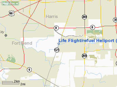
Life Flight/refuel Heliport |
Location & QuickFacts
| FAA Information Effective: | 2008-09-25 |
| Airport Identifier: | TE11 |
| Airport Status: | Operational |
| Longitude/Latitude: | 095-26-15.7870W/29-34-10.8430N
-95.437719/29.569679 (Estimated) |
| Elevation: | 65 ft / 19.81 m (Estimated) |
| Land: | 0 acres |
| From nearest city: | 12 nautical miles S of Houston, TX |
| Location: | Fort Bend County, TX |
| Magnetic Variation: | 06E (1985) |
Owner & Manager
| Ownership: | Privately owned |
| Owner: | Memorial Herman Hosp.-life Flight |
| Address: | 6411 Fannin St
Houston, TX 77030 |
| Phone number: | 713-704-2788 |
| Manager: | Eric Von Wenckstern
DIRECTOR OF OPERATIONS |
| Address: | 6411 Fannin St
Houston, TX 77030 |
| Phone number: | 713-797-2788 |
Airport Operations and Facilities
| Airport Use: | Private
REFUELING STATION ONLY FOR HOSPITAL - OPERATED AIRCRAFT. |
| Wind indicator: | Yes |
| Segmented Circle: | No |
| Control Tower: | No |
| Sectional chart: | Houston |
| Region: | ASW - Southwest |
| Boundary ARTCC: | ZHU - Houston |
| Tie-in FSS: | CXO - Montgomery County |
| FSS Toll Free: | 1-800-WX-BRIEF
FOR FP FILING CALL CXO FSS 1-800-833-5602. |
Runway Information
Helipad H1
| Dimension: | 75 x 75 ft / 22.9 x 22.9 m |
| Surface: | CONC, |
| |
Runway H1 |
Runway |
| Traffic Pattern: | Left | Left |
|
Radio Navigation Aids
| ID |
Type |
Name |
Ch |
Freq |
Var |
Dist |
| SYG | NDB | Sandy Point | | 402.00 | 05E | 4.4 nm |
| SGR | NDB | Hull | | 388.00 | 05E | 12.0 nm |
| LYD | NDB | Lakeside | | 249.00 | 05E | 19.4 nm |
| JPA | NDB | Sanjac | | 347.00 | 05E | 20.1 nm |
| EYQ | NDB | Weiser | | 286.00 | 06E | 24.3 nm |
| BVP | NDB | Nixin | | 326.00 | 05E | 28.0 nm |
| DWH | NDB | David Hooks | | 521.00 | 05E | 34.1 nm |
| GLS | NDB | Galveston | | 206.00 | 08E | 38.4 nm |
| ARM | NDB | Wharton | | 245.00 | 06E | 41.9 nm |
| BYY | NDB | Bay City | | 344.00 | 06E | 42.2 nm |
| CBC | NDB | Anahuac | | 413.00 | 05E | 42.3 nm |
| EFD | TACAN | Ellington | 031X | | 05E | 14.7 nm |
| HUB | VOR/DME | Hobby | 118X | 117.10 | 05E | 9.9 nm |
| MHF | VOR/DME | Trinity | 083X | 113.60 | 07E | 36.1 nm |
| ELA | VOR/DME | Eagle Lake | 111X | 116.40 | 08E | 46.3 nm |
| IAH | VORTAC | Humble | 113X | 116.60 | 05E | 23.8 nm |
| VUH | VORTAC | Scholes | 077X | 113.00 | 06E | 34.9 nm |
| HOU | VOT | Houston Wm P Hobby | | 108.40 | | 9.5 nm |
Images and information placed above are from
http://www.airport-data.com/airport/TE11/
We thank them for the data!
| General Info
|
| Country |
United States
|
| State |
TEXAS
|
| FAA ID |
TE11
|
| Latitude |
29-34-10.843N
|
| Longitude |
095-26-15.787W
|
| Elevation |
65 feet
|
| Near City |
HOUSTON
|
We don't guarantee the information is fresh and accurate. The data may
be wrong or outdated.
For more up-to-date information please refer to other sources.
|
|


