 |
|
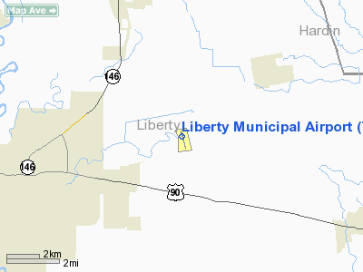
| Liberty Municipal Airport |
| IATA: none – ICAO: none – FAA LID: T78 |
| Summary |
| Airport type |
Public |
| Owner |
City of Liberty |
| Serves |
Liberty, Texas |
| Elevation AMSL |
70 ft / 21 m |
| Coordinates |
30°04′40″N 094°41′55″W / 30.07778°N 94.69861°W / 30.07778; -94.69861 |
| Website |
www.libertyairport.org |
| Runways |
| Direction |
Length |
Surface |
| ft |
m |
| 16/34 |
3,801 |
1,159 |
Asphalt |
| Statistics (2007) |
| Aircraft operations |
5,725 |
| Based aircraft |
14 |
| Source: Federal Aviation Administration |
Liberty Municipal Airport (FAA LID: T78) is a public use airport in Liberty County, Texas, United States. It is owned by the City of Liberty and is located six nautical miles (11 km) northeast of its central business district.
Facilities and aircraft
Liberty Municipal Airport covers an area of 127 acres (51 ha) at an elevation of 70 feet (21 m) above mean sea level. It has one runway designated 16/34 with an asphalt surface measuring 3,801 by 75 feet (1,159 x 23 m).
For the 12-month period ending September 20, 2007, the airport had 5,725 aircraft operations, an average of 15 per day: 99.6% general aviation and 0.4% military. At that time there were 14 aircraft based at this airport: 86% single-engine and 14% ultralight.
The above content comes from Wikipedia and is published under free licenses – click here to read more.
Location & QuickFacts
| FAA Information Effective: | 2008-09-25 |
| Airport Identifier: | T78 |
| Airport Status: | Operational |
| Longitude/Latitude: | 094-41-54.8000W/30-04-40.1000N
-94.698556/30.077806 (Estimated) |
| Elevation: | 70 ft / 21.34 m (Surveyed) |
| Land: | 127 acres |
| From nearest city: | 6 nautical miles NE of Liberty, TX |
| Location: | Liberty County, TX |
| Magnetic Variation: | 05E (1995) |
Owner & Manager
| Ownership: | Publicly owned |
| Owner: | City Of Liberty |
| Address: | 1829 Sam Houston
Liberty, TX 77575 |
| Phone number: | 936-336-4600 |
| Manager: | Leslie Wallace |
| Address: | 214 Cardinal Dr.
Liberty, TX 77575 |
| Phone number: | 936-391-0074 |
Airport Operations and Facilities
| Airport Use: | Open to public |
| Wind indicator: | Yes |
| Segmented Circle: | Yes |
| Control Tower: | No |
| Lighting Schedule: | DUSK-DAWN
ACTVT MIRL RY 16/34 - CTAF. |
| Beacon Color: | Clear-Green (lighted land airport) |
| Landing fee charge: | No |
| Sectional chart: | Houston |
| Region: | ASW - Southwest |
| Boundary ARTCC: | ZHU - Houston |
| Tie-in FSS: | CXO - Montgomery County |
| FSS on Airport: | No |
| FSS Toll Free: | 1-800-WX-BRIEF
FOR FP FILING CALL CXO FSS 1-800-992-7433. |
| NOTAMs Facility: | CXO (NOTAM-d service avaliable) |
| Federal Agreements: | NGY |
Airport Communications
Airport Services
| Fuel available: | 100LL
24 HR SELF-SERVICE FUEL. |
| Bottled Oxygen: | NONE |
| Bulk Oxygen: | NONE |
Runway Information
Runway 16/34
| Dimension: | 3801 x 75 ft / 1158.5 x 22.9 m |
| Surface: | ASPH, Good Condition |
| Weight Limit: | Single wheel: 10000 lbs. |
| Edge Lights: | Medium
MIRL OTS INDEFLY. |
| |
Runway 16 |
Runway 34 |
| Longitude: | 094-42-00.0726W | 094-41-49.4432W |
| Latitude: | 30-04-58.2910N | 30-04-21.8195N |
| Elevation: | 69.00 ft | 69.00 ft |
| Alignment: | 127 | 127 |
| Traffic Pattern: | Left | Left |
| Markings: | Non-precision instrument, Fair Condition | Non-precision instrument, Fair Condition |
| VASI: | 2-light PAPI on left side | |
| Obstruction: | 25 ft trees, 200.0 ft from runway, 230 ft right of centerline
+25 FT TREES 230 FT RT OF RY CENTERLINE FM THLD TO 200 FT. | 34 ft trees, 1040.0 ft from runway, 250 ft right of centerline, 25:1 slope to clear |
|
Radio Navigation Aids
| ID |
Type |
Name |
Ch |
Freq |
Var |
Dist |
| CBC | NDB | Anahuac | | 413.00 | 05E | 18.4 nm |
| GDE | NDB | Goodhue | | 368.00 | 07E | 25.8 nm |
| BVP | NDB | Nixin | | 326.00 | 05E | 27.4 nm |
| HRD | NDB | Hardin County | | 524.00 | 04E | 27.6 nm |
| JPA | NDB | Sanjac | | 347.00 | 05E | 31.3 nm |
| GLS | NDB | Galveston | | 206.00 | 08E | 44.8 nm |
| DWH | NDB | David Hooks | | 521.00 | 05E | 45.2 nm |
| ORG | NDB | Orange | | 211.00 | 05E | 47.0 nm |
| EYQ | NDB | Weiser | | 286.00 | 06E | 49.8 nm |
| EFD | TACAN | Ellington | 031X | | 05E | 37.2 nm |
| MHF | VOR/DME | Trinity | 083X | 113.60 | 07E | 32.0 nm |
| BPT | VOR/DME | Beaumont | 092X | 114.50 | 07E | 36.4 nm |
| HUB | VOR/DME | Hobby | 118X | 117.10 | 05E | 39.4 nm |
| SBI | VOR/DME | Sabine Pass | 101X | 115.40 | 07E | 41.7 nm |
| DAS | VORTAC | Daisetta | 116X | 116.90 | 05E | 7.3 nm |
| IAH | VORTAC | Humble | 113X | 116.60 | 05E | 34.5 nm |
| VUH | VORTAC | Scholes | 077X | 113.00 | 06E | 49.4 nm |
| HOU | VOT | Houston Wm P Hobby | | 108.40 | | 39.9 nm |
Remarks
- ARPT CLSD AT NIGHT.
- TWY LGTS OTS INDEFLY.
Images and information placed above are from
http://www.airport-data.com/airport/T78/
We thank them for the data!
| General Info
|
| Country |
United States
|
| State |
TEXAS
|
| FAA ID |
T78
|
| Latitude |
30-04-40.100N
|
| Longitude |
094-41-54.800W
|
| Elevation |
70 feet
|
| Near City |
LIBERTY
|
We don't guarantee the information is fresh and accurate. The data may
be wrong or outdated.
For more up-to-date information please refer to other sources.
|
|


