 |
|
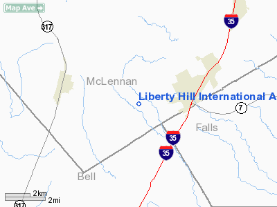
Liberty Hill Intl Airport |
Location & QuickFacts
| FAA Information Effective: | 2008-09-25 |
| Airport Identifier: | TS29 |
| Airport Status: | Operational |
| Longitude/Latitude: | 097-17-49.0210W/31-17-40.6210N
-97.296950/31.294617 (Estimated) |
| Elevation: | 790 ft / 240.79 m (Estimated) |
| Land: | 54 acres |
| From nearest city: | 3 nautical miles W of Eddy, TX |
| Location: | Mc Lennan County, TX |
| Magnetic Variation: | 07E (1985) |
Owner & Manager
| Ownership: | Privately owned |
| Owner: | William R Vinson |
| Address: | Rt 2/box 90
Moody, TX 76557 |
| Phone number: | 817-859-5801 |
| Manager: | William R Vinson |
| Address: | Rt 2/box 90
Moody, TX 76557 |
| Phone number: | 817-859-5801 |
Airport Operations and Facilities
| Airport Use: | Private |
| Segmented Circle: | No |
| Control Tower: | No |
| Sectional chart: | Houston |
| Region: | ASW - Southwest |
| Boundary ARTCC: | ZFW - Fort Worth |
| Tie-in FSS: | FTW - Fort Worth |
| FSS Phone: | 817-541-3474 |
| FSS Toll Free: | 1-800-WX-BRIEF |
Airport Services
Runway Information
Runway 18/36
| Dimension: | 2000 x 40 ft / 609.6 x 12.2 m |
| Surface: | TURF, Good Condition |
| |
Runway 18 |
Runway 36 |
| Traffic Pattern: | Left | Left |
| Obstruction: | 4 ft fence | 20 ft trees, 0.0 ft from runway |
|
Radio Navigation Aids
| ID |
Type |
Name |
Ch |
Freq |
Var |
Dist |
| ROB | NDB | Robinson | | 400.00 | 07E | 17.2 nm |
| HLR | NDB | Hood | | 347.00 | 07E | 23.5 nm |
| IL | NDB | Iresh | | 278.00 | 07E | 26.7 nm |
| GR | NDB | Starn | | 323.00 | 07E | 30.8 nm |
| GUO | NDB | Georgetown | | 332.00 | 06E | 41.7 nm |
| LXY | NDB | Mexia | | 329.00 | 07E | 45.3 nm |
| MNZ | NDB | Hamilton | | 251.00 | 07E | 47.8 nm |
| TPL | VOR/DME | Temple | 041X | 110.40 | 09E | 8.3 nm |
| GRK | VOR/DME | Gray | 055X | 111.80 | 07E | 30.9 nm |
| GNL | VOR/DME | Groesbeck | 025X | 108.80 | 05E | 42.1 nm |
| ACT | VORTAC | Waco | 100X | 115.30 | 09E | 22.1 nm |
| LZZ | VORTAC | Lampasas | 072X | 112.50 | 08E | 43.9 nm |
Remarks
- CTN: MULITPLE TWRS NORTH EAST & WEST OF ARPT.
Images and information placed above are from
http://www.airport-data.com/airport/TS29/
We thank them for the data!
| General Info
|
| Country |
United States
|
| State |
TEXAS
|
| FAA ID |
TS29
|
| Latitude |
31-17-40.621N
|
| Longitude |
097-17-49.021W
|
| Elevation |
790 feet
|
| Near City |
EDDY
|
We don't guarantee the information is fresh and accurate. The data may
be wrong or outdated.
For more up-to-date information please refer to other sources.
|
|


