 |
|
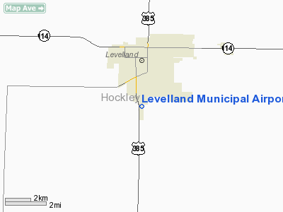
Location & QuickFacts
| FAA Information Effective: | 2008-09-25 |
| Airport Identifier: | LLN |
| Airport Status: | Operational |
| Longitude/Latitude: | 102-22-21.1000W/33-33-09.1000N
-102.372528/33.552528 (Estimated) |
| Elevation: | 3514 ft / 1071.07 m (Surveyed) |
| Land: | 329 acres |
| From nearest city: | 2 nautical miles S of Levelland, TX |
| Location: | Hockley County, TX |
| Magnetic Variation: | 09E (1995) |
Owner & Manager
| Ownership: | Publicly owned |
| Owner: | Levelland City & Hockley Co |
| Address: | Po Box 1010
Levelland, TX 79336 |
| Phone number: | 806-894-0113 |
| Manager: | Steven C. Bernstein |
| Address: | Rt 1 Box 50
Levelland, TX 79336 |
| Phone number: | 806-894-7328 |
Airport Operations and Facilities
| Airport Use: | Open to public |
| Wind indicator: | Yes |
| Segmented Circle: | Yes |
| Control Tower: | No |
| Lighting Schedule: | DUSK-DAWN
MIRL RY 17/35 PRESET LOW INTST; TO INCR INTST ACTVT - CTAF. |
| Beacon Color: | Clear-Green (lighted land airport) |
| Landing fee charge: | No |
| Sectional chart: | Albuquerque |
| Region: | ASW - Southwest |
| Boundary ARTCC: | ZFW - Fort Worth |
| Tie-in FSS: | FTW - Fort Worth |
| FSS on Airport: | No |
| FSS Phone: | 817-541-3474 |
| FSS Toll Free: | 1-800-WX-BRIEF |
| NOTAMs Facility: | FTW (NOTAM-d service avaliable) |
| Federal Agreements: | NGY |
Airport Communications
| CTAF: | 122.800 |
| Unicom: | 122.800 |
Airport Services
| Fuel available: | 100LLA
FOR FUEL AFT HRS CALL 806-894-7328. |
| Airframe Repair: | MAJOR |
| Power Plant Repair: | MAJOR |
Runway Information
Runway 08/26
| Dimension: | 2072 x 55 ft / 631.5 x 16.8 m |
| Surface: | ASPH, Good Condition |
| |
Runway 08 |
Runway 26 |
| Longitude: | 102-22-31.1705W | 102-22-06.7219W |
| Latitude: | 33-33-38.4327N | 33-33-37.8642N |
| Elevation: | 3510.00 ft | 3504.00 ft |
| Alignment: | 92 | 127 |
| Traffic Pattern: | Right | Left |
| Obstruction: | 15 ft road, 604.0 ft from runway, 26:1 slope to clear | 10 ft road, 201.0 ft from runway
+3 FT FENCE 185 FT FM THLD ACROSS APCH. |
|
Runway 17/35
| Dimension: | 6110 x 75 ft / 1862.3 x 22.9 m |
| Surface: | ASPH, Good Condition |
| Weight Limit: | Single wheel: 30000 lbs. |
| Edge Lights: | Medium |
| |
Runway 17 |
Runway 35 |
| Longitude: | 102-22-20.8632W | 102-22-22.8202W |
| Latitude: | 33-33-29.5152N | 33-32-29.1057N |
| Elevation: | 3505.00 ft | 3510.00 ft |
| Alignment: | 127 | 2 |
| Traffic Pattern: | Left | Right |
| Markings: | Non-precision instrument, Good Condition | Non-precision instrument, Good Condition |
| Crossing Height: | 47.00 ft | 39.00 ft |
| VASI: | 4-light PAPI on left side | 4-light PAPI on left side |
| Visual Glide Angle: | 3.00° | 3.00° |
| Runway End Identifier: | | Yes |
| Obstruction: | 36 ft tree, 1220.0 ft from runway, 270 ft left of centerline, 28:1 slope to clear | , 50:1 slope to clear |
|
Radio Navigation Aids
| ID |
Type |
Name |
Ch |
Freq |
Var |
Dist |
| LLN | NDB | Levelland | | 266.00 | 09E | 0.2 nm |
| LIU | NDB | Littlefield | | 212.00 | 10E | 22.1 nm |
| BFE | NDB | Brownfield | | 311.00 | 09E | 24.2 nm |
| PVW | VOR/DME | Plainview | 076X | 112.90 | 11E | 43.3 nm |
| LBB | VORTAC | Lubbock | 029X | 109.20 | 11E | 24.7 nm |
Images and information placed above are from
http://www.airport-data.com/airport/LLN/
We thank them for the data!
| General Info
|
| Country |
United States
|
| State |
TEXAS
|
| FAA ID |
LLN
|
| Latitude |
33.552508
33° 33' 09.03" N
|
| Longitude |
-102.372497
102° 22' 20.99" W
|
| Elevation |
3514 feet
1071 meters
|
| Type |
Civil
|
| Magnetic Variation |
007° E (01/06)
|
| Beacon |
Yes
|
| Operating Agency |
U.S.CIVIL AIRPORT WHEREIN PERMIT COVERS USE BY TRANSIT MILITARY AIRCRAFT
|
| Daylight Saving Time |
Second Sunday in March at 0200 to first Sunday in November at 0200 local time (Exception Arizona and that portion of Indiana in the Eastern Time Zone)
|
We don't guarantee the information is fresh and accurate. The data may
be wrong or outdated.
For more up-to-date information please refer to other sources.
|
|


