|
|
| Laredo International Airport |
 |
| Photo as of 9 February 2002 |
| IATA: LRD – ICAO: KLRD – FAA LID: LRD |
| Summary |
| Airport type |
Public |
| Owner |
City of Laredo |
| Serves |
Laredo, Texas |
| Elevation AMSL |
508 ft / 155 m |
| Coordinates |
27°32′38″N 099°27′42″W / 27.54389°N 99.46167°W / 27.54389; -99.46167 |
| Website |
CityOfLaredo.com/... |
| Runways |
| Direction |
Length |
Surface |
| ft |
m |
| 14/32 |
5,928 |
1,807 |
Concrete |
| 17L/35R |
8,236 |
2,510 |
Concrete |
| 17R/35L |
7,711 |
2,350 |
Asphalt |
| Statistics (2007) |
| Aircraft operations |
57,698 |
| Based aircraft |
41 |
| Sources: airport website and FAA |
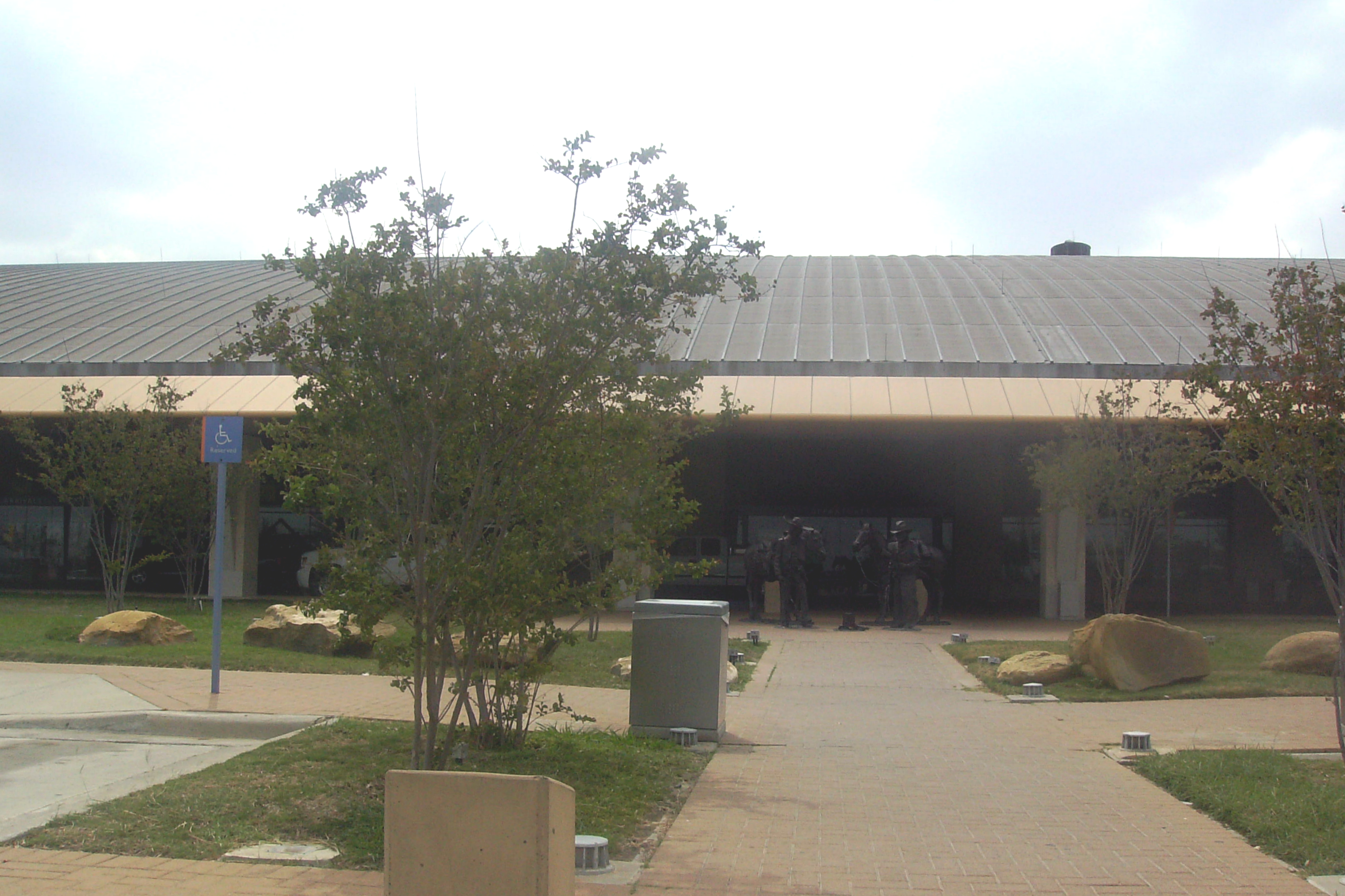
Sculpture of Mexican vaquero and Anglo rancher sharing a campfire at Laredo International Airport demonstrates solidarity between the two cultures in Laredo. 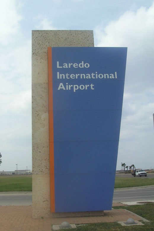 | |
KLRD entrance sign |
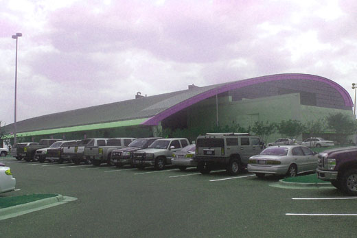 | |
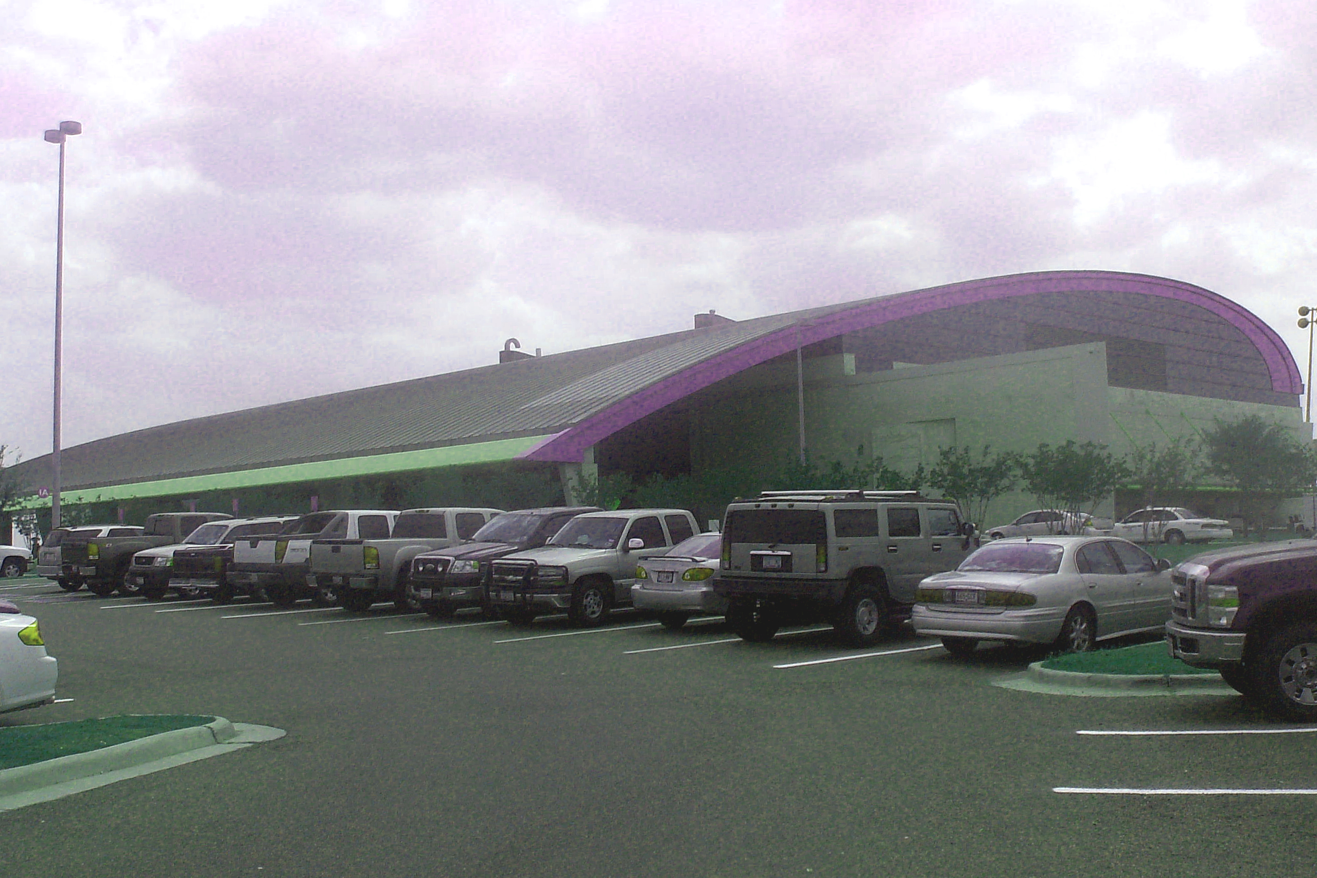
KLRD passenger terminal |
 | |
KLRD terminal entrance |
- For the Military use of this facility prior to 1973, see Laredo Air Force Base
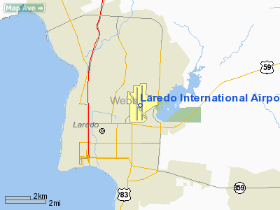
Laredo International Airport (IATA: LRD, ICAO: KLRD, FAA LID: LRD) is a city-owned public-use airport located three nautical miles (6 km) northeast of the central business district of Laredo, a city in Webb County, Texas, United States.
The airport is served by three commercial airlines. In the twelve months ending September 2007, LRD enplaned 109,000 passengers, a 22 percent increase from the same time period the year before. In 2006, LRD totaled 365 million pounds of cargo, a 3 percent decrease from 2005. History
The Laredo International Airport was used by the United States Army Air Force during World War II as Laredo Army Airfield, and by the United States Air Force as Laredo Air Force Base during the Cold War as a pilot training base with T-33 Shooting Star and later T-37 Tweet and T-38 Talon aircraft. The military presence ended in December 1973 as part of a nation-wide defense cutback following the end of the Vietnam War
Facilities and aircraft
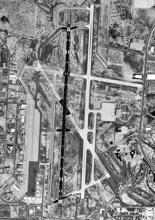
Laredo International Airport covers an area of 1,796 acres (727 ha) at an elevation of 508 feet (155 m) above mean sea level. It has three runways:
- Runway 14/32: 5,928 x 150 ft (1,807 x 46 m), Surface: Concrete
- Runway 17L/35R: 8,236 x 150 ft (2,510 x 46 m), Surface: Concrete
- Runway 17R/35L: 7,711 x 150 ft (2,350 x 46 m), Surface: Asphalt
For the 12-month period ending September 30, 2007, the airport had 57,698 aircraft operations, an average of 158 per day: 48% general aviation, 28% military, 18% air taxi and 7% scheduled commercial. At that time there were 41 aircraft based at this airport: 37% single-engine, 20% multi-engine, 32% jet and 12% helicopter.
There is one, two-floor terminal at the Laredo International Airport. The bottom floor contains the check-in counters, a gift shop, a restaurant, baggage claim, and US customs. The top floor contains two security lanes and four gates, all with jetways. Free Wi-Fi internet access is available throughout the terminal. Gates 3 and 4 allow direct access to US customs. KLRD sometimes receives a share of diverted flights when severe weather threatens Dallas or Houston.
Airlines and destinations
| Airlines |
Destinations |
| Allegiant Air |
Las Vegas |
| American Eagle |
Dallas/Fort Worth |
| Continental Express operated by ExpressJet Airlines |
Houston-Intercontinental |
Air cargo operators & destinations
- ABX Air (Wilmington, OH)
- BAX Global (Dallas/Fort Worth)
- FedEx Express (Memphis, TN)
- UPS Airlines (Louisville, KY)
Accidents and incidents
- On 31 October 1983, Douglas DC-3C N44896 of FBN Flying Service was destroyed by fire at Laredo International Airport while attempting to take-off on a cargo flight to McAllen-Miller International Airport, Texas. A fire had developed on board the aircraft during the take-off run, and the crew were unable to extinguish it with the equipment available to them.
- On 28 July 1987, Douglas C-53 N39DT of La Mesa Leasing Inc was damaged beyond economic repair when the port engine failed shortly after take-off on an international cargo flight to Ciudad Camargo Airport, Mexico. The aircraft was overloaded by 3,809 pounds (1,728 kg) and the power from the remaining good engine was insufficient to sustain flight. The aircraft stalled and crashed whilst attempting to make an emergency landing back at Laredo. Both crew survived. A post-accident investigation revealed no problems with the failed engine.
- On 18 January 1989, Douglas DC-3 XB-DYP crashed shortly after take-off. The aircraft was on an international cargo flight to Torreón International Airport, Mexico. The cause of the accident was that the cargo was improperly secured and shifted in flight, causing the centre of gravity to move aft.
- On 21 May 2002, Douglas DC-3A XB-JBR of Aero JBR ditched in Lake Casa Blanca, Texas after a double engine failure while performing a touch-and-go at Laredo International Airport. It is reported that one of the engines suffered a propellor overspeed condition. All three crew escaped from the submerged aircraft.
The above content comes from Wikipedia and is published under free licenses – click here to read more.
Location & QuickFacts
| FAA Information Effective: | 2008-09-25 |
| Airport Identifier: | LRD |
| Airport Status: | Operational |
| Longitude/Latitude: | 099-27-41.5174W/27-32-37.6779N
-99.461533/27.543799 (Estimated) |
| Elevation: | 508 ft / 154.84 m (Surveyed) |
| Land: | 1796 acres |
| From nearest city: | 3 nautical miles NE of Laredo, TX |
| Location: | Webb County, TX |
| Magnetic Variation: | 08E (1985) |
Owner & Manager
| Ownership: | Publicly owned |
| Owner: | City Of Laredo |
| Address: | Po Box 579
Laredo, TX 78041 |
| Phone number: | 956-791-7300 |
| Manager: | Jose Flores |
| Address: | 5210 Bob Bullock Loop
Laredo, TX 78041 |
| Phone number: | 956-795-2000 |
Airport Operations and Facilities
| Airport Use: | Open to public |
| Wind indicator: | Yes |
| Segmented Circle: | Yes |
| Control Tower: | Yes |
| Lighting Schedule: | DUSK-DAWN
WHEN ATCT CLSD ACTVT MALSR RY 17R - 120.1; MIRL RY 14/32; HIRL RYS 17L/35R & 17R/35L PRESET MED INTST. |
| Beacon Color: | Clear-Green (lighted land airport) |
| Landing fee charge: | No |
| Sectional chart: | Brownsville |
| Region: | ASW - Southwest |
| Boundary ARTCC: | ZHU - Houston |
| Tie-in FSS: | SJT - San Angelo |
| FSS on Airport: | No |
| FSS Toll Free: | 1-800-WX-BRIEF |
| NOTAMs Facility: | LRD (NOTAM-d service avaliable) |
| Certification type/date: | I B S 07/1975 |
| Federal Agreements: | NGPY |
Airport Communications
| CTAF: | 120.100 |
| Unicom: | 122.950 |
Airport Services
| Fuel available: | 100LLA
JP4 FUEL AVBL. |
| Power Plant Repair: | MAJOR |
| Bottled Oxygen: | LOW |
| Bulk Oxygen: | LOW |
Runway Information
Runway 14/32
| Dimension: | 5928 x 150 ft / 1806.9 x 45.7 m |
| Surface: | CONC, Poor Condition
BLOCK CRACKING ON PORTIONS OF THE RUNWAY.
FIRST 1,900 FT OF RY 17R EXCELLENT, CENTER 75 FT OF REMAINING GOOD. |
| Weight Limit: | Single wheel: 50000 lbs.
Dual wheel: 60000 lbs.
Dual tandem wheel: 125000 lbs. |
| Edge Lights: | Medium |
| |
Runway 14 |
Runway 32 |
| Longitude: | 099-28-00.2295W | 099-27-24.6628W |
| Latitude: | 27-32-58.0268N | 27-32-08.6293N |
| Elevation: | 505.00 ft | 467.00 ft |
| Alignment: | 127 | 127 |
| Traffic Pattern: | Left | Right |
| Markings: | Non-precision instrument, Good Condition | Non-precision instrument, Good Condition |
| Crossing Height: | 55.00 ft | 55.00 ft |
| VASI: | 4-box on left side | 4-box on left side |
| Visual Glide Angle: | 3.00° | 3.00° |
| Obstruction: | , 50:1 slope to clear | 12 ft road, 201.0 ft from runway, 250 ft right of centerline |
| Decleard distances: | Take off run available 5928.00 ft
Take off distance available 5928.00 ft
Actual stop distance available 5928.00 ft
Landing distance available 5928.00 ft
| Take off run available 5928.00 ft
Take off distance available 5928.00 ft
Actual stop distance available 5928.00 ft
Landing distance available 5928.00 ft
|
|
Runway 17L/35R
| Dimension: | 8236 x 150 ft / 2510.3 x 45.7 m |
| Surface: | CONC, Good Condition
BLOCK CRACKING ON PORTIONS OF THE RUNWAY.
FIRST 1,900 FT OF RY 17R EXCELLENT, CENTER 75 FT OF REMAINING GOOD. |
| Surface Treatment: | Saw-cut or plastic Grooved
RY GRVD CENTER 75 FT ONLY. |
| Weight Limit: | Single wheel: 90000 lbs.
Dual wheel: 190000 lbs.
Dual tandem wheel: 360000 lbs. |
| Edge Lights: | High |
| |
Runway 17L |
Runway 35R |
| Longitude: | 099-27-33.5975W | 099-27-37.6926W |
| Latitude: | 27-33-22.9271N | 27-32-01.4547N |
| Elevation: | 499.00 ft | 474.00 ft |
| Alignment: | 127 | 3 |
| Traffic Pattern: | Left | Right |
| Markings: | Non-precision instrument, Good Condition | Non-precision instrument, Good Condition |
| Crossing Height: | 51.00 ft | 0.00 ft |
| VASI: | 4-light PAPI on left side | |
| Visual Glide Angle: | 3.00° | 0.00° |
| Decleard distances: | Take off run available 8236.00 ft
Take off distance available 8236.00 ft
Actual stop distance available 8236.00 ft
Landing distance available 8236.00 ft
| Take off run available 8236.00 ft
Take off distance available 8236.00 ft
Actual stop distance available 8236.00 ft
Landing distance available 8236.00 ft
|
|
Runway 17R/35L
| Dimension: | 7711 x 150 ft / 2350.3 x 45.7 m |
| Surface: | ASPH, Fair Condition
BLOCK CRACKING ON PORTIONS OF THE RUNWAY.
FIRST 1,900 FT OF RY 17R EXCELLENT, CENTER 75 FT OF REMAINING GOOD. |
| Surface Treatment: | Saw-cut or plastic Grooved
RY GRVD CENTER 75 FT ONLY. |
| Weight Limit: | Single wheel: 70000 lbs.
Dual wheel: 110000 lbs.
Dual tandem wheel: 190000 lbs. |
| Edge Lights: | High |
| |
Runway 17R |
Runway 35L |
| Longitude: | 099-27-45.1639W | 099-27-48.9873W |
| Latitude: | 27-33-14.3413N | 27-31-58.0618N |
| Elevation: | 504.00 ft | 484.00 ft |
| Alignment: | 127 | 3 |
| ILS Type: | ILS/DME
| |
| Traffic Pattern: | Left | Right |
| Markings: | Precision instrument, Good Condition | Precision instrument, Good Condition |
| Crossing Height: | 53.00 ft | 63.00 ft |
| Displaced threshold: | 0.00 ft | 120.00 ft |
| VASI: | 4-box on left side | 4-box on left side |
| Visual Glide Angle: | 3.00° | 3.00° |
| Approach lights: | MALSR | |
| Runway End Identifier: | | No |
| Decleard distances: | Take off run available 7830.00 ft
Take off distance available 7830.00 ft
Actual stop distance available 7830.00 ft
Landing distance available 7830.00 ft
| Take off run available 7830.00 ft
Take off distance available 7830.00 ft
Actual stop distance available 7830.00 ft
Landing distance available 7830.00 ft
|
|
Radio Navigation Aids
| ID |
Type |
Name |
Ch |
Freq |
Var |
Dist |
| HBV | NDB | Hebbronville | | 266.00 | 06E | 39.9 nm |
| NLD | VOR/DME | Nuevo Laredo | 073X | 112.60 | 09E | 8.7 nm |
| LRD | VORTAC | Laredo | 121X | 117.40 | 09E | 4.6 nm |
Remarks
- 5' LINE OF SIGHT NOT AVBL BTN ENDS OF RY 14/32.
- ACFT WEIGHING MORE THAN 115,000 LBS ARE RSTRD FM USING TWY C BTN RY 17L/35R & RY 17R/35L.
- RY 14/32 RESTRICTED TO ACFT LESS THAN 60,000 LBS DTW.
- ARRESTING GEAR/SYSTEM: ENGINEERED MATERIALS ARRESTING SYSTEM (EMAS) 170 FT IN WIDTH BY 363 FT IN LENGTH LCTD AT THE DEPARTURE END OF RY 17R.
Images and information placed above are from
http://www.airport-data.com/airport/LRD/
We thank them for the data!
|
|