 |
|
| Lane Field Airport |
| IATA: none – ICAO: none – FAA LID: 58F |
| Summary |
| Airport type |
Public |
| Location |
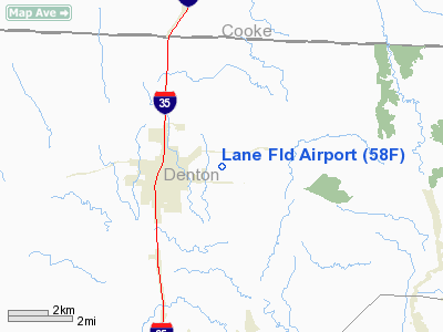
Sanger, Texas |
| Elevation AMSL |
700 ft / 213 m |
| Coordinates |
33°21′55″N 097°08′46″W / 33.36528°N 97.14611°W / 33.36528; -97.14611Coordinates: 33°21′55″N 097°08′46″W / 33.36528°N 97.14611°W / 33.36528; -97.14611 |
| Runways |
| Direction |
Length |
Surface |
| ft |
m |
| 17/35 |
3,400 |
1,036 |
Turf |
Lane Field Airport (FAA LID: 58F) is a public airport located two miles (3.2 km) east of the central business district (CBD) of Sanger, in Denton County, Texas, USA.
The airport is used solely for general aviation purposes.
Facilities
Lane Field Airport has one runway:
- Runway 17/35: 3,400 x 130 ft. (1,036 x 130 m), Surface: Turf
The above content comes from Wikipedia and is published under free licenses – click here to read more.
Location & QuickFacts
| FAA Information Effective: | 2008-09-25 |
| Airport Identifier: | 58F |
| Airport Status: | Operational |
| Longitude/Latitude: | 097-08-46.0460W/33-21-55.4140N
-97.146124/33.365393 (Estimated) |
| Elevation: | 700 ft / 213.36 m (Estimated) |
| Land: | 43 acres |
| From nearest city: | 2 nautical miles E of Sanger, TX |
| Location: | Denton County, TX |
| Magnetic Variation: | 07E (1985) |
Owner & Manager
| Ownership: | Privately owned |
| Owner: | Edward E Lane |
| Address: | 801 West Oak St
Denton, TX 76201 |
| Phone number: | 940-382-8577 |
| Manager: | Edward E. Lane |
| Address: | 801 West Oak St.
Denton, TX 76201 |
| Phone number: | 940-382-8577 |
Airport Operations and Facilities
| Airport Use: | Open to public |
| Segmented Circle: | No |
| Control Tower: | No |
| Landing fee charge: | No |
| Sectional chart: | Dallas-ft Worth |
| Region: | ASW - Southwest |
| Boundary ARTCC: | ZFW - Fort Worth |
| Tie-in FSS: | FTW - Fort Worth |
| FSS on Airport: | No |
| FSS Phone: | 817-541-3474 |
| FSS Toll Free: | 1-800-WX-BRIEF |
| NOTAMs Facility: | FTW (NOTAM-d service avaliable) |
Airport Communications
Airport Services
| Airframe Repair: | NONE |
| Power Plant Repair: | NONE |
Runway Information
Runway 17/35
| Dimension: | 3340 x 130 ft / 1018.0 x 39.6 m |
| Surface: | TURF, Fair Condition
NORTH END OF RWY RISES 20'. |
| |
Runway 17 |
Runway 35 |
| Traffic Pattern: | Left | Left |
| Obstruction: | 10 ft road, 65 ft right of centerline | 5 ft fence, 0.0 ft from runway |
|
Radio Navigation Aids
| ID |
Type |
Name |
Ch |
Freq |
Var |
Dist |
| GLE | NDB | Gainesville | | 330.00 | 06E | 21.4 nm |
| GMZ | NDB | Grindstone Mountain | | 356.00 | 07E | 34.6 nm |
| DNI | NDB | Denison | | 341.00 | 06E | 36.5 nm |
| RBD | NDB | Redbird | | 287.00 | 06E | 43.6 nm |
| PQF | NDB | Mesquite | | 248.00 | 06E | 45.6 nm |
| AUV | NDB | Arbuckle | | 284.00 | 07E | 47.2 nm |
| XQH | NDB | Cedar Hill | | 353.00 | 08E | 47.3 nm |
| MII | NDB | Caddo Mills | | 316.00 | 06E | 49.2 nm |
| NFW | TACAN | Nas Jrb Fort Worth | 024X | | 07E | 38.6 nm |
| TTT | VOR/DME | Maverick | 078X | 113.10 | 06E | 30.3 nm |
| CVE | VOR/DME | Cowboy | 109X | 116.20 | 06E | 31.0 nm |
| FUZ | VORTAC | Ranger | 104X | 115.70 | 06E | 28.7 nm |
| UKW | VORTAC | Bowie | 071X | 112.40 | 06E | 35.4 nm |
| BYP | VORTAC | Bonham | 093X | 114.60 | 06E | 46.9 nm |
| DAL | VOT | Dallas Love Field | | 113.30 | | 34.5 nm |
| FTW | VOT | Fort Worth Meacham | | 108.20 | | 34.6 nm |
Remarks
- LIVESTOCK ON & INVOF ARPT.
- SOUTH HALF OF RY SOFT AFT RAIN.
- RY 17/35 HAS NO THLD MARKINGS.
Images and information placed above are from
http://www.airport-data.com/airport/58F/
We thank them for the data!
| General Info
|
| Country |
United States
|
| State |
TEXAS
|
| FAA ID |
58F
|
| Latitude |
33-21-55.414N
|
| Longitude |
097-08-46.046W
|
| Elevation |
700 feet
|
| Near City |
SANGER
|
We don't guarantee the information is fresh and accurate. The data may
be wrong or outdated.
For more up-to-date information please refer to other sources.
|
|


