 |
|
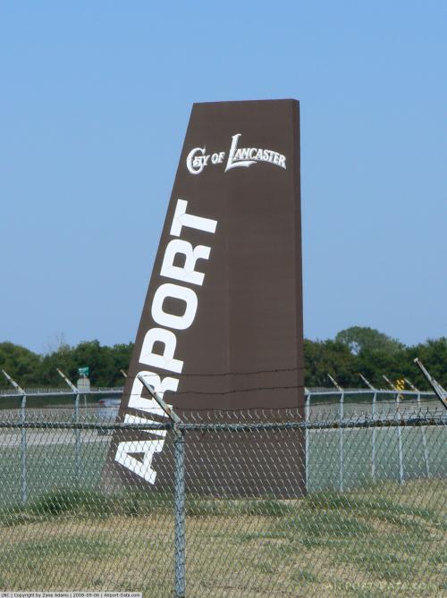
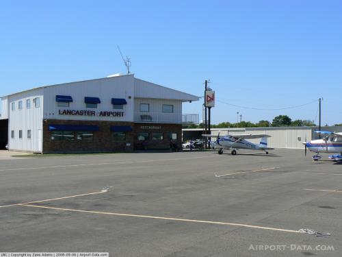
| Lancaster Airport |
| IATA: none – ICAO: KLNC – FAA LID: LNC |
| Summary |
| Airport type |
Public |
| Owner |
City of Lancaster |
| Serves |
Lancaster, Texas |
| Elevation AMSL |
501 ft / 153 m |
| Coordinates |
32°34′45″N 096°43′09″W / 32.57917°N 96.71917°W / 32.57917; -96.71917 |
| Runways |
| Direction |
Length |
Surface |
| ft |
m |
| 13/31 |
5,000 |
1,524 |
Asphalt |
| Statistics (2007) |
| Aircraft operations |
67,100 |
| Based aircraft |
128 |
| Source: Federal Aviation Administration |
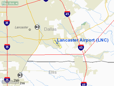
Lancaster Airport (ICAO: KLNC, FAA LID: LNC), also known as Lancaster Regional Airport, is a city-owned public-use airport located two nautical miles (4 km) south of the central business district of Lancaster, a city in Dallas County, Texas, United States.
Although most U.S. airports use the same three-letter location identifier for the FAA and IATA, this airport is assigned LNC by the FAA but has no designation from the IATA (which assigned LNC to Lengbati, Papua New Guinea).
Facilities and aircraft
Lancaster Airport covers an area of 300 acres (121 ha) at an elevation of 501 feet (153 m) above mean sea level. It has one asphalt paved runway designated 13/31 which measures is 5,000 by 100 feet (1,524 x 30 m).
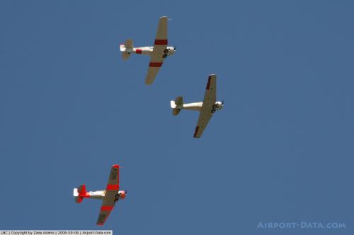
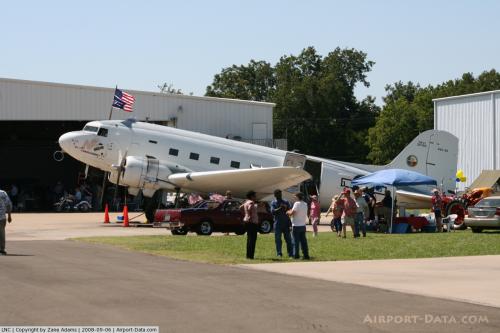
For the 12-month period ending May 18, 2007, the airport had 67,100 aircraft operations, an average of 183 per day: 99% general aviation and <1% military. At that time there were 128 aircraft based at this airport: 70% single-engine, 16% multi-engine, 8% jet, 5% helicopter and 2% glider.
The above content comes from Wikipedia and is published under free licenses – click here to read more.
 |
(Click on the photo to enlarge) |
 |
(Click on the photo to enlarge) |
 |
(Click on the photo to enlarge) |
 |
(Click on the photo to enlarge) |
Location & QuickFacts
| FAA Information Effective: | 2008-09-25 |
| Airport Identifier: | LNC |
| Airport Status: | Operational |
| Longitude/Latitude: | 096-43-08.5840W/32-34-45.0880N
-96.719051/32.579191 (Estimated) |
| Elevation: | 501 ft / 152.70 m (Surveyed) |
| Land: | 300 acres |
| From nearest city: | 2 nautical miles S of Lancaster, TX |
| Location: | Dallas County, TX |
| Magnetic Variation: | 06E (1990) |
Owner & Manager
| Ownership: | Publicly owned |
| Owner: | City Of Lancaster |
| Address: | Po Box 940
Lancaster, TX 75146 |
| Phone number: | 972-218-1305 |
| Manager: | Arb Rylant
CITY MANAGER. |
| Address: | 730 Ferris Road Ste 102
Lancaster, TX 75146 |
| Phone number: | 972-227-5721
EMERGENCY PHONE: 469-245-6412. |
Airport Operations and Facilities
| Airport Use: | Open to public |
| Wind indicator: | Yes |
| Segmented Circle: | Yes |
| Control Tower: | No |
| Lighting Schedule: | DUSK-DAWN |
| Beacon Color: | Clear-Green (lighted land airport) |
| Landing fee charge: | No |
| Sectional chart: | Dallas-ft Worth |
| Region: | ASW - Southwest |
| Boundary ARTCC: | ZFW - Fort Worth |
| Tie-in FSS: | FTW - Fort Worth |
| FSS on Airport: | No |
| FSS Phone: | 817-541-3474 |
| FSS Toll Free: | 1-800-WX-BRIEF |
| NOTAMs Facility: | LNC (NOTAM-d service avaliable) |
| Federal Agreements: | NGY |
Airport Communications
| CTAF: | 122.700 |
| Unicom: | 122.700 |
Airport Services
| Fuel available: | 100LLA |
| Airframe Repair: | MAJOR |
| Power Plant Repair: | MAJOR |
| Bottled Oxygen: | NONE |
| Bulk Oxygen: | NONE |
Runway Information
Runway 13/31
| Dimension: | 5000 x 100 ft / 1524.0 x 30.5 m |
| Surface: | ASPH, Good Condition |
| Weight Limit: | Single wheel: 20000 lbs.
Dual wheel: 40000 lbs. |
| Edge Lights: | Medium |
| |
Runway 13 |
Runway 31 |
| Longitude: | 096-43-27.2720W | 096-42-49.9550W |
| Latitude: | 32-35-04.1250N | 32-34-26.0560N |
| Elevation: | 501.00 ft | 480.00 ft |
| Alignment: | 127 | 127 |
| Traffic Pattern: | Left | Right |
| Markings: | Non-precision instrument, Good Condition | Non-precision instrument, Good Condition |
| Crossing Height: | 25.00 ft | 0.00 ft |
| VASI: | 2-light PAPI on left side | 2-light PAPI on left side |
| Visual Glide Angle: | 3.50° | 3.50° |
| Runway End Identifier: | | Yes |
| Obstruction: | 35 ft pole, 1350.0 ft from runway, 370 ft right of centerline, 32:1 slope to clear | , 50:1 slope to clear |
|
Radio Navigation Aids
| ID |
Type |
Name |
Ch |
Freq |
Var |
Dist |
| LNC | NDB | Lancaster | | 239.00 | 06E | 0.2 nm |
| RBD | NDB | Redbird | | 287.00 | 06E | 9.7 nm |
| JUG | NDB | Jecca | | 388.00 | 06E | 10.9 nm |
| XQH | NDB | Cedar Hill | | 353.00 | 08E | 13.1 nm |
| PQF | NDB | Mesquite | | 248.00 | 06E | 16.8 nm |
| AVZ | NDB | Travis | | 260.00 | 06E | 26.1 nm |
| CGQ | NDB | Powell | | 344.00 | 06E | 34.3 nm |
| MII | NDB | Caddo Mills | | 316.00 | 06E | 36.5 nm |
| CRS | NDB | Corsicana | | 396.00 | 06E | 37.0 nm |
| SYW | NDB | Cash | | 428.00 | 05E | 40.9 nm |
| CSZ | NDB | Crossroads | | 215.00 | 08E | 49.6 nm |
| NFW | TACAN | Nas Jrb Fort Worth | 024X | | 07E | 38.2 nm |
| MJF | TACAN | Arvilla | 033X | | 05E | 44.3 nm |
| CVE | VOR/DME | Cowboy | 109X | 116.20 | 06E | 20.9 nm |
| TTT | VOR/DME | Maverick | 078X | 113.10 | 06E | 23.8 nm |
| FUZ | VORTAC | Ranger | 104X | 115.70 | 06E | 29.8 nm |
| CQY | VORTAC | Cedar Creek | 095X | 114.80 | 06E | 34.7 nm |
| DAL | VOT | Dallas Love Field | | 113.30 | | 17.4 nm |
| FTW | VOT | Fort Worth Meacham | | 108.20 | | 35.4 nm |
Images and information placed above are from
http://www.airport-data.com/airport/LNC/
We thank them for the data!
| General Info
|
| Country |
United States
|
| State |
TEXAS
|
| FAA ID |
LNC
|
| Latitude |
32-34-45.088N
|
| Longitude |
096-43-08.584W
|
| Elevation |
501 feet
|
| Near City |
LANCASTER
|
We don't guarantee the information is fresh and accurate. The data may
be wrong or outdated.
For more up-to-date information please refer to other sources.
|
|


