 |
|
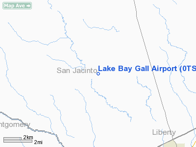
Location & QuickFacts
| FAA Information Effective: | 2008-09-25 |
| Airport Identifier: | 0TS5 |
| Airport Status: | Operational |
| Longitude/Latitude: | 095-11-10.7730W/30-26-30.7380N
-95.186326/30.441872 (Estimated) |
| Elevation: | 230 ft / 70.10 m (Estimated) |
| Land: | 0 acres |
| From nearest city: | 8 nautical miles NW of Cleveland, TX |
| Location: | San Jacinto County, TX |
| Magnetic Variation: | 06E (1985) |
Owner & Manager
| Ownership: | Privately owned |
| Owner: | Allen G Williams Md |
| Address: | Route 3 Box 414g
Cleveland, TX 77327 |
| Phone number: | 713-592-3724 |
| Manager: | Allen G Williams Md |
| Address: | Route 3 Box 414g
Cleveland, TX 77327 |
| Phone number: | 713-592-3724 |
Airport Operations and Facilities
| Airport Use: | Private |
| Wind indicator: | No |
| Segmented Circle: | No |
| Control Tower: | No |
| Landing fee charge: | No |
| Sectional chart: | Houston |
| Region: | ASW - Southwest |
| Boundary ARTCC: | ZHU - Houston |
| Tie-in FSS: | CXO - Montgomery County |
| FSS on Airport: | No |
| FSS Toll Free: | 1-800-WX-BRIEF
FOR FP FILING CALL CXO FSS 1-800-833-5602. |
Airport Services
| Airframe Repair: | NONE |
| Power Plant Repair: | NONE |
Runway Information
Runway 05/23
| Dimension: | 3200 x 180 ft / 975.4 x 54.9 m |
| Surface: | TURF, |
| |
Runway 05 |
Runway 23 |
| Traffic Pattern: | Left | Left |
|
Radio Navigation Aids
| ID |
Type |
Name |
Ch |
Freq |
Var |
Dist |
| BVP | NDB | Nixin | | 326.00 | 05E | 27.0 nm |
| DWH | NDB | David Hooks | | 521.00 | 05E | 27.4 nm |
| UTS | NDB | Huntsville | | 308.00 | 06E | 27.6 nm |
| EYQ | NDB | Weiser | | 286.00 | 06E | 38.6 nm |
| LYD | NDB | Lakeside | | 249.00 | 05E | 45.5 nm |
| JPA | NDB | Sanjac | | 347.00 | 05E | 46.9 nm |
| HRD | NDB | Hardin County | | 524.00 | 04E | 48.4 nm |
| CBC | NDB | Anahuac | | 413.00 | 05E | 48.6 nm |
| HUB | VOR/DME | Hobby | 118X | 117.10 | 05E | 47.5 nm |
| IAH | VORTAC | Humble | 113X | 116.60 | 05E | 30.3 nm |
| DAS | VORTAC | Daisetta | 116X | 116.90 | 05E | 31.9 nm |
| TNV | VORTAC | Navasota | 106X | 115.90 | 08E | 46.1 nm |
| LFK | VORTAC | Lufkin | 058X | 112.10 | 05E | 49.6 nm |
| HOU | VOT | Houston Wm P Hobby | | 108.40 | | 48.1 nm |
Remarks
- TWR WEST OF FLD INTERFERES WITH TFC PATTERN.
Images and information placed above are from
http://www.airport-data.com/airport/0TS5/
We thank them for the data!
| General Info
|
| Country |
United States
|
| State |
TEXAS
|
| FAA ID |
0TS5
|
| Latitude |
30-26-30.738N
|
| Longitude |
095-11-10.773W
|
| Elevation |
230 feet
|
| Near City |
CLEVELAND
|
We don't guarantee the information is fresh and accurate. The data may
be wrong or outdated.
For more up-to-date information please refer to other sources.
|
|


