 |
|
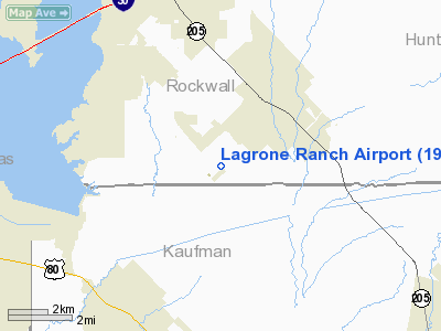
Location & QuickFacts
| FAA Information Effective: | 2008-09-25 |
| Airport Identifier: | 19TA |
| Airport Status: | Operational |
| Longitude/Latitude: | 096-25-00.9450W/32-49-20.4540N
-96.416929/32.822348 (Estimated) |
| Elevation: | 567 ft / 172.82 m (Estimated) |
| Land: | 0 acres |
| From nearest city: | 0 nautical miles N of Mc Clendon-chisholm, TX |
| Location: | Rockwall County, TX |
| Magnetic Variation: | 06E (1985) |
Owner & Manager
| Ownership: | Privately owned |
| Owner: | Ron Lagrone |
| Address: | 549 Stevens Road
Forney, TX 75126 |
| Phone number: | 214-771-0881 |
| Manager: | Ron Lagrone |
| Address: | 2631 Stevens Rd
Rockwall, TX 75087 |
| Phone number: | 214-771-0881 |
Airport Operations and Facilities
| Airport Use: | Private |
| Wind indicator: | No |
| Segmented Circle: | No |
| Control Tower: | No |
| Landing fee charge: | No |
| Sectional chart: | Dallas-ft Worth |
| Region: | ASW - Southwest |
| Boundary ARTCC: | ZFW - Fort Worth |
| Tie-in FSS: | FTW - Fort Worth |
| FSS on Airport: | No |
| FSS Phone: | 817-541-3474 |
| FSS Toll Free: | 1-800-WX-BRIEF |
Runway Information
Runway 15/33
| Dimension: | 3100 x 50 ft / 944.9 x 15.2 m |
| Surface: | TURF, |
| |
Runway 15 |
Runway 33 |
| Traffic Pattern: | Left | Left |
|
Radio Navigation Aids
| ID |
Type |
Name |
Ch |
Freq |
Var |
Dist |
| PQF | NDB | Mesquite | | 248.00 | 06E | 5.7 nm |
| AVZ | NDB | Travis | | 260.00 | 06E | 9.3 nm |
| JUG | NDB | Jecca | | 388.00 | 06E | 11.0 nm |
| MII | NDB | Caddo Mills | | 316.00 | 06E | 15.6 nm |
| SYW | NDB | Cash | | 428.00 | 05E | 20.1 nm |
| LNC | NDB | Lancaster | | 239.00 | 06E | 21.3 nm |
| RBD | NDB | Redbird | | 287.00 | 06E | 24.6 nm |
| XQH | NDB | Cedar Hill | | 353.00 | 08E | 31.5 nm |
| CGQ | NDB | Powell | | 344.00 | 06E | 45.6 nm |
| CRS | NDB | Corsicana | | 396.00 | 06E | 47.8 nm |
| HJM | NDB | Rayburn | | 415.00 | 06E | 49.1 nm |
| AHX | NDB | Athens | | 269.00 | 06E | 49.7 nm |
| MJF | TACAN | Arvilla | 033X | | 05E | 23.2 nm |
| CVE | VOR/DME | Cowboy | 109X | 116.20 | 06E | 24.9 nm |
| TTT | VOR/DME | Maverick | 078X | 113.10 | 06E | 31.6 nm |
| SLR | VOR/DME | Sulphur Springs | 027X | 109.00 | 08E | 49.5 nm |
| FUZ | VORTAC | Ranger | 104X | 115.70 | 06E | 38.7 nm |
| CQY | VORTAC | Cedar Creek | 095X | 114.80 | 06E | 39.6 nm |
| BYP | VORTAC | Bonham | 093X | 114.60 | 06E | 44.0 nm |
| DAL | VOT | Dallas Love Field | | 113.30 | | 22.0 nm |
| FTW | VOT | Fort Worth Meacham | | 108.20 | | 47.6 nm |
Remarks
- CTN: WATCH FOR LIVESTOCK ON RWY.
- NO LANDING WITHOUT PRIOR APPROVAL.
- CONDL--PROVIDED LANDING THRESHOLDS ARE DSPLCD TO PROVIDE CLEAR APPROACHES OF 20:1 OR BETTER.
Images and information placed above are from
http://www.airport-data.com/airport/19TA/
We thank them for the data!
| General Info
|
| Country |
United States
|
| State |
TEXAS
|
| FAA ID |
19TA
|
| Latitude |
32-49-20.454N
|
| Longitude |
096-25-00.945W
|
| Elevation |
567 feet
|
| Near City |
MC CLENDON-CHISHOLM
|
We don't guarantee the information is fresh and accurate. The data may
be wrong or outdated.
For more up-to-date information please refer to other sources.
|
|


