 |
|
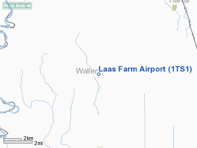
Location & QuickFacts
| FAA Information Effective: | 2008-09-25 |
| Airport Identifier: | 1TS1 |
| Airport Status: | Operational |
| Longitude/Latitude: | 095-59-38.8430W/29-54-45.8130N
-95.994123/29.912726 (Estimated) |
| Elevation: | 165 ft / 50.29 m (Estimated) |
| Land: | 10 acres |
| From nearest city: | 6 nautical miles S of Pattison, TX |
| Location: | Waller County, TX |
| Magnetic Variation: | 06E (1985) |
Owner & Manager
| Ownership: | Privately owned |
| Owner: | Weldon Laas |
| Address: | Rt 1/box 70
Brookshire, TX 77423 |
| Phone number: | 409-826-2029 |
| Manager: | Weldon Laas |
| Address: | Rt 1/box 70
Brookshire |
| Phone number: | 409-826-2029 |
Airport Operations and Facilities
| Airport Use: | Private |
| Segmented Circle: | No |
| Control Tower: | No |
| Sectional chart: | Houston |
| Region: | ASW - Southwest |
| Boundary ARTCC: | ZHU - Houston |
| Tie-in FSS: | CXO - Montgomery County |
| FSS Toll Free: | 1-800-WX-BRIEF
FOR FP FILING CALL CXO FSS 1-800-833-5602. |
Runway Information
Runway 17/35
| Dimension: | 2000 x 40 ft / 609.6 x 12.2 m |
| Surface: | TURF, |
| |
Runway 17 |
Runway 35 |
| Traffic Pattern: | Right | Left |
| Obstruction: | 30 ft pline, 100.0 ft from runway | |
|
Radio Navigation Aids
| ID |
Type |
Name |
Ch |
Freq |
Var |
Dist |
| LYD | NDB | Lakeside | | 249.00 | 05E | 17.5 nm |
| EYQ | NDB | Weiser | | 286.00 | 06E | 18.4 nm |
| SGR | NDB | Hull | | 388.00 | 05E | 24.4 nm |
| DWH | NDB | David Hooks | | 521.00 | 05E | 25.7 nm |
| BNH | NDB | Brenham | | 362.00 | 06E | 27.1 nm |
| SYG | NDB | Sandy Point | | 402.00 | 05E | 36.9 nm |
| ARM | NDB | Wharton | | 245.00 | 06E | 40.4 nm |
| BVP | NDB | Nixin | | 326.00 | 05E | 40.9 nm |
| EFD | TACAN | Ellington | 031X | | 05E | 47.3 nm |
| ELA | VOR/DME | Eagle Lake | 111X | 116.40 | 08E | 22.6 nm |
| HUB | VOR/DME | Hobby | 118X | 117.10 | 05E | 40.5 nm |
| TNV | VORTAC | Navasota | 106X | 115.90 | 08E | 22.8 nm |
| IDU | VORTAC | Industry | 039X | 110.20 | 08E | 29.7 nm |
| IAH | VORTAC | Humble | 113X | 116.60 | 05E | 33.9 nm |
| CLL | VORTAC | College Station | 080X | 113.30 | 08E | 47.1 nm |
| HOU | VOT | Houston Wm P Hobby | | 108.40 | | 40.6 nm |
Remarks
- PRVDD ALL OPNS ARE CONDUCTED ON THE WEST SIDE OF RWY.
Images and information placed above are from
http://www.airport-data.com/airport/1TS1/
We thank them for the data!
| General Info
|
| Country |
United States
|
| State |
TEXAS
|
| FAA ID |
1TS1
|
| Latitude |
29-54-45.813N
|
| Longitude |
095-59-38.843W
|
| Elevation |
165 feet
|
| Near City |
PATTISON
|
We don't guarantee the information is fresh and accurate. The data may
be wrong or outdated.
For more up-to-date information please refer to other sources.
|
|


