 |
|
Coordinates: 29°40′09″N 095°03′51″W / 29.66917°N 95.06417°W / 29.66917; -95.06417
| La Porte Municipal Airport |
| IATA: none – ICAO: none – FAA LID: T41 |
| Summary |
| Airport type |
Public |
| Owner |
City of La Porte |
| Serves |
La Porte, Texas |
| Elevation AMSL |
25 ft / 8 m |
| Runways |
| Direction |
Length |
Surface |
| ft |
m |
| 12/30 |
4,165 |
1,269 |
Asphalt |
| 5/23 |
2,998 |
914 |
Asphalt |
| Statistics (2007) |
| Aircraft operations |
79,433 |
| Based aircraft |
95 |
| Source: Federal Aviation Administration |
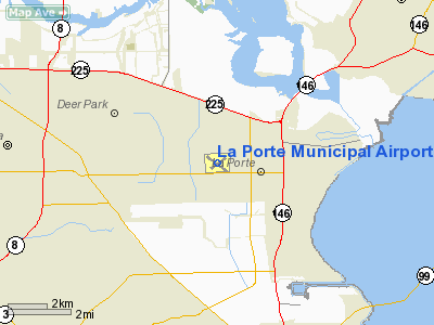
La Porte Municipal Airport (FAA LID: T41) is a city-owned public-use airport located three miles (5 km) northwest of the central business district of La Porte, a city in Harris County, Texas, United States.
Facilities and aircraft
La Porte Municipal Airport covers an area of 300 acres (121 ha) which contains two asphalt paved runways: 12/30 measuring 4,165 x 75 ft (1,269 x 23 m) and 5/23 measuring 2,998 x 75 ft (914 x 23 m).
For the 12-month period ending June 5, 2007, the airport had 79,433 general aviation aircraft operations, an average of 217 per day. At that time there were 95 aircraft based at the airport: 87% single-engine, 9% multi-engine, 1% jet and 2% helicopter.
The above content comes from Wikipedia and is published under free licenses – click here to read more.
Location & QuickFacts
| FAA Information Effective: | 2008-09-25 |
| Airport Identifier: | T41 |
| Airport Status: | Operational |
| Longitude/Latitude: | 095-03-51.1000W/29-40-09.3000N
-95.064194/29.669250 (Estimated) |
| Elevation: | 25 ft / 7.62 m (Surveyed) |
| Land: | 300 acres |
| From nearest city: | 3 nautical miles NW of La Porte, TX |
| Location: | Harris County, TX |
| Magnetic Variation: | 05E (1990) |
Owner & Manager
| Ownership: | Publicly owned |
| Owner: | City Of La Porte |
| Address: | 604 W Fairmont Pkwy
La Porte, TX 77571 |
| Phone number: | 281-471-9650 |
| Manager: | Steve Gillett
DIR OF PUBLIC WORKS. |
| Address: | 2963 N 23rd Street
La Porte, TX 77571 |
| Phone number: | 281-471-9650 |
Airport Operations and Facilities
| Airport Use: | Open to public |
| Wind indicator: | Yes |
| Segmented Circle: | Yes |
| Control Tower: | No |
| Lighting Schedule: | DUSK-DAWN
MIRL RYS 05/23 & 12/30 PRESET LOW INTST; TO INCR INTST ACTVT - CTAF. |
| Beacon Color: | Clear-Green (lighted land airport) |
| Landing fee charge: | No |
| Sectional chart: | Houston |
| Region: | ASW - Southwest |
| Boundary ARTCC: | ZHU - Houston |
| Tie-in FSS: | CXO - Montgomery County |
| FSS on Airport: | No |
| FSS Toll Free: | 1-800-WX-BRIEF
FOR FP FILING CALL CXO FSS 1-800-992-7433. |
| NOTAMs Facility: | CXO (NOTAM-d service avaliable) |
| Federal Agreements: | NGPY |
Airport Communications
| CTAF: | 122.700 |
| Unicom: | 122.700 |
Airport Services
| Fuel available: | 100LLA |
| Airframe Repair: | MAJOR |
| Power Plant Repair: | MAJOR |
Runway Information
Runway 05/23
| Dimension: | 2998 x 75 ft / 913.8 x 22.9 m |
| Surface: | ASPH, Good Condition |
| Weight Limit: | Single wheel: 25000 lbs. |
| Edge Lights: | Medium |
| |
Runway 05 |
Runway 23 |
| Longitude: | 095-04-03.9006W | 095-03-37.3643W |
| Latitude: | 29-40-00.3601N | 29-40-18.8997N |
| Elevation: | 23.00 ft | 24.00 ft |
| Alignment: | 51 | 127 |
| Traffic Pattern: | Left | Left |
| Markings: | Basic, Fair Condition | Basic, Fair Condition |
| Obstruction: | 30 ft pline, 920.0 ft from runway, 205 ft right of centerline, 24:1 slope to clear | 25 ft trees, 800.0 ft from runway, 150 ft right of centerline, 24:1 slope to clear |
|
Runway 12/30
| Dimension: | 4165 x 75 ft / 1269.5 x 22.9 m |
| Surface: | ASPH, Good Condition |
| Weight Limit: | Single wheel: 23000 lbs. |
| Edge Lights: | Medium |
| |
Runway 12 |
Runway 30 |
| Longitude: | 095-04-10.5537W | 095-03-32.4468W |
| Latitude: | 29-40-21.1776N | 29-39-56.8454N |
| Elevation: | 24.00 ft | 24.00 ft |
| Alignment: | 126 | 127 |
| Traffic Pattern: | Left | Left |
| Markings: | Non-precision instrument, Good Condition | Non-precision instrument, Good Condition |
| Crossing Height: | 45.00 ft | 0.00 ft |
| Displaced threshold: | 190.00 ft | 402.00 ft |
| VASI: | 4-light PAPI on left side | |
| Visual Glide Angle: | 3.00° | 0.00° |
| Runway End Identifier: | Yes | |
| Obstruction: | 49 ft trees, 1100.0 ft from runway, 18:1 slope to clear
APCH RATIO 28:1 FM DSPLCD THLD TO 49 FT TREES AT 1290 FT FM DSPLCD THLD ACROSS APCH.
6 FT FENCE 199 FT FM THLD 246 FT LEFT OF CNTRLN. | 8 ft fence, 200.0 ft from runway, 236 ft left of centerline
APCH RATIO 18:1 FM DSPLCD THLD TO 28 FT PLINE AT 516 FT FM DSPLCD THLD 314 FT L OF CNTRLN. |
|
Radio Navigation Aids
| ID |
Type |
Name |
Ch |
Freq |
Var |
Dist |
| JPA | NDB | Sanjac | | 347.00 | 05E | 0.3 nm |
| BVP | NDB | Nixin | | 326.00 | 05E | 21.0 nm |
| CBC | NDB | Anahuac | | 413.00 | 05E | 21.9 nm |
| SYG | NDB | Sandy Point | | 402.00 | 05E | 23.4 nm |
| GLS | NDB | Galveston | | 206.00 | 08E | 25.8 nm |
| SGR | NDB | Hull | | 388.00 | 05E | 31.0 nm |
| LYD | NDB | Lakeside | | 249.00 | 05E | 33.2 nm |
| EYQ | NDB | Weiser | | 286.00 | 06E | 34.0 nm |
| DWH | NDB | David Hooks | | 521.00 | 05E | 37.9 nm |
| EFD | TACAN | Ellington | 031X | | 05E | 6.3 nm |
| HUB | VOR/DME | Hobby | 118X | 117.10 | 05E | 11.1 nm |
| MHF | VOR/DME | Trinity | 083X | 113.60 | 07E | 18.1 nm |
| IAH | VORTAC | Humble | 113X | 116.60 | 05E | 22.7 nm |
| VUH | VORTAC | Scholes | 077X | 113.00 | 06E | 26.1 nm |
| DAS | VORTAC | Daisetta | 116X | 116.90 | 05E | 38.2 nm |
| HOU | VOT | Houston Wm P Hobby | | 108.40 | | 11.3 nm |
Remarks
- PAEW ADJ ALL RYS & TWYS.
- TWY B CLSD INDEFLY.
- TWY A LGTS OTS INDEFLY.
- PRE DATES THE ACT.
Images and information placed above are from
http://www.airport-data.com/airport/T41/
We thank them for the data!
| General Info
|
| Country |
United States
|
| State |
TEXAS
|
| FAA ID |
T41
|
| Latitude |
29-40-09.300N
|
| Longitude |
095-03-51.100W
|
| Elevation |
25 feet
|
| Near City |
LA PORTE
|
We don't guarantee the information is fresh and accurate. The data may
be wrong or outdated.
For more up-to-date information please refer to other sources.
|
|


