 |
|
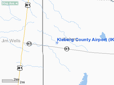
Location & QuickFacts
| FAA Information Effective: | 2008-09-25 |
| Airport Identifier: | IKG |
| Airport Status: | Operational |
| Longitude/Latitude: | 098-01-51.3000W/27-33-03.1000N
-98.030917/27.550861 (Estimated) |
| Elevation: | 130 ft / 39.62 m (Surveyed) |
| Land: | 295 acres |
| From nearest city: | 9 nautical miles W of Kingsville, TX |
| Location: | Kleberg County, TX |
| Magnetic Variation: | 06E (2000) |
Owner & Manager
| Ownership: | Publicly owned |
| Owner: | Kleberg County |
| Address: | Po Box 752
Kingsville, TX 78363
PETE DE LA GARZA COUNTY JUDGE, KELBERG COUNTY - PO BOX 752. |
| Phone number: | 361-595-8585 |
| Manager: | Mike Muzyczyn, Fbo |
| Address: | Po Box 53
Kingsville, TX 78364 |
| Phone number: | 361-592-1225
OR 361-595-8540 |
Airport Operations and Facilities
| Airport Use: | Open to public |
| Wind indicator: | Yes |
| Segmented Circle: | Yes |
| Control Tower: | No |
| Lighting Schedule: | DUSK-DAWN
MIRL RY 13/31 PRESET LOW INTST; TO INCR INTST & ACTVT REIL RYS 13 & 31 - CTAF. |
| Beacon Color: | Clear-Green (lighted land airport) |
| Landing fee charge: | Yes
LANDING FEE FOR TURBINE & JET AIRCRAFT. |
| Sectional chart: | Brownsville |
| Region: | ASW - Southwest |
| Boundary ARTCC: | ZHU - Houston |
| Tie-in FSS: | SJT - San Angelo |
| FSS on Airport: | No |
| FSS Toll Free: | 1-800-WX-BRIEF |
| NOTAMs Facility: | SJT (NOTAM-d service avaliable) |
| Federal Agreements: | NGY |
Airport Communications
| CTAF: | 122.700 |
| Unicom: | 122.700 |
Airport Services
| Fuel available: | 100LLA+ |
| Airframe Repair: | MAJOR |
| Power Plant Repair: | MAJOR |
| Bottled Oxygen: | HIGH |
| Bulk Oxygen: | NONE |
Runway Information
Runway 13/31
| Dimension: | 6000 x 75 ft / 1828.8 x 22.9 m |
| Surface: | ASPH, Fair Condition |
| Weight Limit: | Single wheel: 35000 lbs.
Dual wheel: 47000 lbs.
Dual tandem wheel: 70000 lbs. |
| Edge Lights: | Medium |
| |
Runway 13 |
Runway 31 |
| Longitude: | 098-02-12.7469W | 098-01-29.9172W |
| Latitude: | 27-33-25.8421N | 27-32-40.3206N |
| Elevation: | 130.00 ft | 124.00 ft |
| Alignment: | 127 | 127 |
| Traffic Pattern: | Left | Left |
| Markings: | Non-precision instrument, Fair Condition | Non-precision instrument, Fair Condition |
| Crossing Height: | 40.00 ft | 41.00 ft |
| VASI: | 4-light PAPI on left side | 4-light PAPI on left side |
| Visual Glide Angle: | 3.00° | 3.00° |
| Runway End Identifier: | Yes
& 31 REIL 200' FM THR. | Yes
REIL RYS 13 & 31 OTS INDEFLY. |
| Obstruction: | 15 ft tree, 700.0 ft from runway, 325 ft left of centerline, 33:1 slope to clear | , 50:1 slope to clear |
|
Radio Navigation Aids
| ID |
Type |
Name |
Ch |
Freq |
Var |
Dist |
| TKB | NDB | Kleberg County | | 347.00 | 06E | 4.4 nm |
| BKS | NDB | Brooks County | | 353.00 | 06E | 21.2 nm |
| HBV | NDB | Hebbronville | | 266.00 | 06E | 39.8 nm |
| NQI | TACAN | Kingsville | 125X | | 09E | 12.4 nm |
| NOG | TACAN | Orange Grove | 063X | | 09E | 20.7 nm |
| ALI | VOR | Alice | | 114.50 | 06E | 11.4 nm |
| CRP | VORTAC | Corpus Christi | 102X | 115.50 | 09E | 37.7 nm |
| NGP | VORTAC | Truax | 087X | 114.00 | 06E | 40.0 nm |
Remarks
- BIRDS ON & INVOF ARPT (SEASONAL).
- PARALLEL TWY CLSD TO ACFT OVER 15,000 LBS.
- NORTH TWY TO RY 13 CLSD INDEFLY.
Images and information placed above are from
http://www.airport-data.com/airport/IKG/
We thank them for the data!
| General Info
|
| Country |
United States
|
| State |
TEXAS
|
| FAA ID |
IKG
|
| Time |
UTC-6(-5DT)
|
| Latitude |
27.550861
27° 33' 03.10" N
|
| Longitude |
-98.030919
098° 01' 51.31" W
|
| Elevation |
131 feet
40 meters
|
| Type |
Civil
|
| Magnetic Variation |
005° E (01/06)
|
| Beacon |
Yes
|
| Operating Agency |
U.S.CIVIL AIRPORT WHEREIN PERMIT COVERS USE BY TRANSIT MILITARY AIRCRAFT
|
| Near City |
Kingsville
|
| Operating Hours |
SEE REMARKS FOR OPERATING HOURS OR COMMUNICATIONS FOR POSSIBLE HOURS
|
| Daylight Saving Time |
Second Sunday in March at 0200 to first Sunday in November at 0200 local time (Exception Arizona and that portion of Indiana in the Eastern Time Zone)
|
We don't guarantee the information is fresh and accurate. The data may
be wrong or outdated.
For more up-to-date information please refer to other sources.
|
|


