 |
|
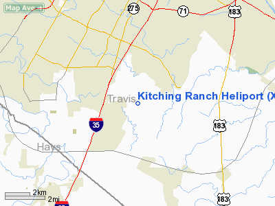
Location & QuickFacts
| FAA Information Effective: | 2008-09-25 |
| Airport Identifier: | XS65 |
| Airport Status: | Operational |
| Longitude/Latitude: | 097-45-53.0150W/30-08-50.7640N
-97.764726/30.147434 (Estimated) |
| Elevation: | 620 ft / 188.98 m (Estimated) |
| Land: | 0 acres |
| From nearest city: | 15 nautical miles S of Austin, TX |
| Location: | Travis County, TX |
| Magnetic Variation: | 07E (1990) |
Owner & Manager
| Ownership: | Privately owned |
| Owner: | Paul Kitching |
| Address: | 9704 Cheryl Lynn Rd
Austin, TX 78747 |
| Phone number: | 512-282-1645 |
| Manager: | Paul Kitching |
| Address: | 9704 Cheryl Lynn Rd
Austin, TX 78747 |
| Phone number: | 512-282-1645 |
Airport Operations and Facilities
| Airport Use: | Private |
| Wind indicator: | Yes |
| Segmented Circle: | No |
| Control Tower: | No |
| Sectional chart: | San Antonio |
| Region: | ASW - Southwest |
| Boundary ARTCC: | ZHU - Houston |
| Tie-in FSS: | SJT - San Angelo |
| FSS on Airport: | No |
| FSS Toll Free: | 1-800-WX-BRIEF |
Runway Information
Helipad H1
| Dimension: | 50 x 50 ft / 15.2 x 15.2 m |
| Surface: | TURF, |
| |
Runway H1 |
Runway |
| Traffic Pattern: | Left | Left |
|
Radio Navigation Aids
| ID |
Type |
Name |
Ch |
Freq |
Var |
Dist |
| GUO | NDB | Georgetown | | 332.00 | 06E | 32.6 nm |
| MFS | NDB | Horseshoe Bay Resort | | 403.00 | 07E | 38.2 nm |
| GYB | NDB | Lee County | | 385.00 | 07E | 40.9 nm |
| BMQ | NDB | Burnet | | 341.00 | 07E | 43.2 nm |
| DHK | TACAN | Randolph | 036X | | 09E | 45.1 nm |
| CWK | VORTAC | Centex | 075X | 112.80 | 06E | 18.5 nm |
| RND | VORTAC | Randolph | 70X | 112.30 | 09E | 46.5 nm |
| SAT | VORTAC | San Antonio | 115X | 116.80 | 08E | 47.3 nm |
| STV | VORTAC | Stonewall | 085X | 113.80 | 08E | 49.0 nm |
Remarks
- PRVDD VFR; A LGTD WINDCONE PLACED NEAR HELI; A WARNING SIGN IS PLACED NEAR ENTRANCE ABOUT HEL OPNL AREA; & INGRESS/EGRESS ROUTES ESTABLISHED TO NOT OVERFLY RESIDENTIAL AREA.
Images and information placed above are from
http://www.airport-data.com/airport/XS65/
We thank them for the data!
| General Info
|
| Country |
United States
|
| State |
TEXAS
|
| FAA ID |
XS65
|
| Latitude |
30-08-50.764N
|
| Longitude |
097-45-53.015W
|
| Elevation |
620 feet
|
| Near City |
AUSTIN
|
We don't guarantee the information is fresh and accurate. The data may
be wrong or outdated.
For more up-to-date information please refer to other sources.
|
|


