|
|
| Naval Air Station Kingsville |
 |
| IATA: NQI – ICAO: KNQI - FAA: NQI |
| Summary |
| Airport type |
Naval Air Station |
| Operator |
United States Navy |
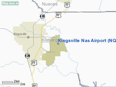
| Location |
Kleberg County, near Kingsville, Texas |
| Built |
July 4, 1942 |
| In use |
Active |
| Commander |
CAPT Philip L Waddingham |
| Elevation AMSL |
50 ft / 15 m |
| Coordinates |
27°30′26″N 97°48′35″W / 27.50722°N 97.80972°W / 27.50722; -97.80972 |
| Runways |
| Direction |
Length |
Surface |
| ft |
m |
| 13L/31R |
8,000 |
2,438 |
PEM |
| 13R/31L |
8,000 |
2,438 |
PEM |
| 17L/35R |
8,000 |
2,438 |
PEM |
| 17R/35L |
8,000 |
2,438 |
PEM |
Naval Air Station Kingsville or NAS Kingsville (IATA: NQI, ICAO: KNQI, FAA LID: NQI) is a military airport located 3 miles east of Kingsville, Texas.
Under the current US Navy organization known as Commander, Naval Installations (CNI), NAS Corpus Christi and NAS Kingsville are part of Navy Region Southeast headquartered at NAS Jacksonville, Florida. Both facilities were previously under the since-disestablished Navy Region South, where the rear admiral serving as Region Commander and as Chief of Naval Air Training (CNATRA) were the same individual.
NAS Kingsville’s operation is the natural complement of NAS Corpus Christi. NAS Kingsville operates higher performance single engine aircraft, generally over land. Distance, rather than safety or capacity concerns, limits NAS Kingsville use of overwater areas.
NAS Kingsville also organizes and hosts the annual Wings Over South Texas Air Show. Current operations
Naval Air Station Kingsville is one of the U.S. Navy’s premier locations for jet aviation training. The naval air station’s primary mission is to train Student Naval Aviators for the United States Navy and United States Marine Corps and tactical jet pilots for other select NATO and Allied countries. To accomplish its mission, NAS Kingsville is home to Training Air Wing TWO and several tenant commands, military as well as civilian, with a total complement of approximately 300 officers, 200 enlisted, 350 civilian personnel, and 625 contract maintenance personnel. The wing was the first in the Navy to operate the Boeing T-45 Goshawk aircraft, providing a single carrier-capable aircraft to replace the North American Rockwell T-2 Buckeye and the McDonnell Douglas TA-4 Skyhawk II in the Navy's strike pilot training pipeline. Originally equipped with the T-45A model of the Goshawk, the wing began accepting new production T-45C model aircraft in 2005, which replaces the earlier T-45A aircraft's analog cockpit with a digital or "glass" cockpit similar to what students will find when they transition to operational fleet combat aircraft. All T-45A aircraft at NAS Kingsville are slated to be retrofitted and upgraded to a T-45C configuration under the T-45 Required Avionics Modernization Program (T-45 RAMP), with a select number of RAMP modified aircraft slated for transfer to Training Air Wing SIX at NAS Pensacola, Florida in support of Student Naval Flight Officer training under the Undergraduate Military Flight Officer (UMFO) program.
The NAS Kingsville Operations Department operates the airfield and provides services to support operations of activity, tenant, and transiting aircraft; provides firefighting functions, both structural and fire and rescue; provides air traffic control; operates air terminal; schedules administrative and proficiency flights; repairs and maintains station ground electronics equipment; stores, maintains, and issues assigned ordnance and munitions; operates firing ranges; operates aerial targets, bombing ranges, and auxiliary landing fields. NAS Kingsville also has both Military and Civilian security which man the entry control points and conduct vehicle inspections and patrols.
Tenant Units
- Training Squadron Twenty-One (VT-21) "Redhawks"
- Training Squadron Twenty-Two (VT-22) "Golden Eagles"
- Naval Branch Clinic Kingsville
- NAVAIR Orlando Training Systems Division In-Service Engineering Office (ISEO) Detachment
- Training Air Wing Two
The above content comes from Wikipedia and is published under free licenses – click here to read more.
Location & QuickFacts
| FAA Information Effective: | 2008-09-25 |
| Airport Identifier: | NQI |
| Airport Status: | Operational |
| Longitude/Latitude: | 097-48-29.8400W/27-30-16.2530N
-97.808289/27.504515 (Estimated) |
| Elevation: | 50 ft / 15.24 m (Estimated) |
| Land: | 0 acres |
| From nearest city: | 3 nautical miles E of Kingsville, TX |
| Location: | Kleberg County, TX |
| Magnetic Variation: | 07E (1980) |
Owner & Manager
| Ownership: | Navy owned |
| Owner: | U S Navy |
| Address: | Oceanographic Ofc-code 3142
Washington, DC 20373 |
| Manager: | Commanding Officer |
| Address: | Naval Air Station
Kingsville, TX 78419 |
Airport Operations and Facilities
| Airport Use: | Private |
| Segmented Circle: | No |
| Control Tower: | Yes |
| Lighting Schedule: | DUSK-DAWN |
| Beacon Color: | Split-Clear-Green (lighted military airport) |
| Sectional chart: | Brownsville |
| Region: | ASW - Southwest |
| Boundary ARTCC: | ZHU - Houston |
| Tie-in FSS: | SJT - San Angelo |
| FSS on Airport: | No |
| FSS Toll Free: | 1-800-WX-BRIEF |
| NOTAMs Facility: | SJT (NOTAM-d service avaliable) |
Airport Services
| Bottled Oxygen: | NONE |
| Bulk Oxygen: | LOW |
Runway Information
Runway 13L/31R
| Dimension: | 8001 x 200 ft / 2438.7 x 61.0 m |
| Surface: | PEM, |
| Pavement Class: | 61 /F/B/W/T |
| Weight Limit: | Dual tandem wheel: 345000 lbs.
Dual dual tandem wheel: 840000 lbs. |
| Edge Lights: | High |
| |
Runway 13L |
Runway 31R |
| Longitude: | 097-48-54.8620W | 097-47-51.3550W |
| Latitude: | 27-30-50.2530N | 27-29-54.8480N |
| Elevation: | 48.00 ft | 37.00 ft |
| Alignment: | 127 | 127 |
| Traffic Pattern: | Left | Left |
| Arresting: | E28B | E28B |
|
Runway 13R/31L
| Dimension: | 8000 x 200 ft / 2438.4 x 61.0 m |
| Surface: | PEM, |
| Pavement Class: | 82 /F/C/W/T |
| Weight Limit: | Dual tandem wheel: 345000 lbs.
Dual dual tandem wheel: 840000 lbs. |
| Edge Lights: | High |
| |
Runway 13R |
Runway 31L |
| Longitude: | 097-49-00.2950W | 097-47-56.7930W |
| Latitude: | 27-30-45.2910N | 27-29-49.8920N |
| Elevation: | 50.00 ft | 41.00 ft |
| Alignment: | 127 | 127 |
| ILS Type: | LOC/GS
| |
| Traffic Pattern: | Left | Left |
| Arresting: | E28B | E28B |
|
Runway 17L/35R
| Dimension: | 8000 x 200 ft / 2438.4 x 61.0 m |
| Surface: | PEM, |
| Pavement Class: | 69 /F/B/W/T |
| Weight Limit: | Dual tandem wheel: 345000 lbs.
Dual dual tandem wheel: 840000 lbs. |
| Edge Lights: | High |
| |
Runway 17L |
Runway 35R |
| Longitude: | 097-48-30.4560W | 097-48-29.4770W |
| Latitude: | 27-30-52.0790N | 27-29-32.8620N |
| Elevation: | 48.00 ft | 46.00 ft |
| Alignment: | 127 | 127 |
| Traffic Pattern: | Left | Left |
| Arresting: | E28B | E28B |
| Approach lights: | | ALSF1 |
| Centerline Lights: | Yes | Yes |
| Touchdown Lights: | Yes | |
|
Runway 17R/35L
| Dimension: | 8000 x 200 ft / 2438.4 x 61.0 m |
| Surface: | PEM, |
| Pavement Class: | 61 /F/B/W/T |
| Weight Limit: | Dual tandem wheel: 345000 lbs.
Dual dual tandem wheel: 840000 lbs. |
| Edge Lights: | High |
| |
Runway 17R |
Runway 35L |
| Longitude: | 097-48-38.2230W | 097-48-37.2600W |
| Latitude: | 27-30-52.0050N | 27-29-32.7900N |
| Elevation: | 48.00 ft | 48.00 ft |
| Alignment: | 127 | 127 |
| Traffic Pattern: | Left | Left |
| Arresting: | E28B | E28B |
|
Radio Navigation Aids
| ID |
Type |
Name |
Ch |
Freq |
Var |
Dist |
| TKB | NDB | Kleberg County | | 347.00 | 06E | 16.0 nm |
| BKS | NDB | Brooks County | | 353.00 | 06E | 24.5 nm |
| NQI | TACAN | Kingsville | 125X | | 09E | 0.3 nm |
| NOG | TACAN | Orange Grove | 063X | | 09E | 26.6 nm |
| ALI | VOR | Alice | | 114.50 | 06E | 18.1 nm |
| NGP | VORTAC | Truax | 087X | 114.00 | 06E | 29.5 nm |
| CRP | VORTAC | Corpus Christi | 102X | 115.50 | 09E | 30.8 nm |
Remarks
- CAUTION: HVY JET INST TRNG DUR FLD OPR HR.
- BEARING STRENGTH RWY 13R/31L: ST175 SBTT593 TRT585.
- BEARING STRENGTH RWY 17R/35L: ST175 SBTT593 TRT585.
- BEARING STRENGTH RWY 17L/35R: ST175 SBTT593 TRT585.
- RWY-LGTS: RWY 13L - OLS & WAVE-OFF. RWY 13R - OLS & WAVE-OFF.
- RWY-LGTS: RWY 13R - OLS & WAVE-OFF. RWY 31L - OLS & WAVE-OFF.
- RWY-LGTS: RWY 17L - OLS & WAVE-OFF. RWY 35R - OLS & WAVE-OFF.
- RWY-LGTS: RWY 17R - OLS & WAVE-OFF. RWY 35L - OLS & WAVE-OFF.
- SERVICE - LGT: OLS GS 3.25‘.
- JASU: 1(NC-8A) 1(GTC-85) 1(NCPP-105).
- FUEL: J8.
- FLUID: SP PRESAIR LOX.
- OIL: O-148-156.
- TRAN ALERT: EXP SVCG DELAYS WKEND. SVC NOT AVBL SUN TIL 2300Z. TRAN MUST SUPERVISE SVCG. DRAG CHUTE REPACK UNAVBL.
- MISC: EXP 15 MIN DELAY DUR PEAK TRNG PERIODS.
- CAUTION: AVOID OVFT OF CHEMICAL PLANT 5 NM N.
- CAT C AFLD.
- TFC PAT: ARR TRANSIENT ACFT EXPC ENROUTE DESCENT.
- TFC PAT: USE LDG/TAXI LGT FOR FINAL PORTION OF INST APCH DUR VFR.
- RSTD: PPR FOR NON-CNATRA ACFT DSN876-6108/6283, C361-516-6108/6283.
- MISC: DUR SINGLE RWY OPR, ALL NON-TRNG WG 2 ACFT SHOULD EXP DELAYS AND WAVE-OFFS DUR PEAK TFC.
- BEARING STRENGTH RWY 13L/31R: ST 175 SBTT593 TRT585.
Images and information placed above are from
http://www.airport-data.com/airport/NQI/
We thank them for the data!
| General Info
|
| Country |
United States
|
| State |
TEXAS
|
| FAA ID |
NQI
|
| Latitude |
27-30-26.129N
|
| Longitude |
097-48-34.988W
|
| Elevation |
50 feet
|
| Near City |
KINGSVILLE
|
We don't guarantee the information is fresh and accurate. The data may
be wrong or outdated.
For more up-to-date information please refer to other sources.
|
|