 |
|
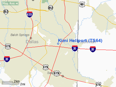
Location & QuickFacts
| FAA Information Effective: | 2008-09-25 |
| Airport Identifier: | TS64 |
| Airport Status: | Operational |
| Longitude/Latitude: | 096-33-36.9660W/32-42-30.4700N
-96.560268/32.708464 (Estimated) |
| Elevation: | 440 ft / 134.11 m (Estimated) |
| Land: | 0 acres |
| From nearest city: | 4 nautical miles SE of Mesquite, TX |
| Location: | Dallas County, TX |
| Magnetic Variation: | 06E (1985) |
Owner & Manager
| Ownership: | Privately owned |
| Owner: | Ronald L. La Fleur |
| Address: | Po Box 360458
Dallas, TX 75236 |
| Phone number: | 214-222-2957 |
| Manager: | Ronald L. La Fleur |
| Address: | Po Box 360458
Dallas, TX 75253 |
| Phone number: | 214-222-2957 |
Airport Operations and Facilities
| Airport Use: | Private |
| Wind indicator: | Yes |
| Segmented Circle: | No |
| Control Tower: | No |
| Sectional chart: | Dallas-ft Worth |
| Region: | ASW - Southwest |
| Boundary ARTCC: | ZFW - Fort Worth |
| Tie-in FSS: | FTW - Fort Worth |
| FSS Phone: | 817-541-3474 |
| FSS Toll Free: | 1-800-WX-BRIEF |
Runway Information
Helipad H1
| Dimension: | 100 x 100 ft / 30.5 x 30.5 m |
| Surface: | TURF, |
| |
Runway H1 |
Runway |
| Traffic Pattern: | Left | Left |
|
Radio Navigation Aids
| ID |
Type |
Name |
Ch |
Freq |
Var |
Dist |
| JUG | NDB | Jecca | | 388.00 | 06E | 2.8 nm |
| PQF | NDB | Mesquite | | 248.00 | 06E | 6.3 nm |
| LNC | NDB | Lancaster | | 239.00 | 06E | 11.3 nm |
| RBD | NDB | Redbird | | 287.00 | 06E | 15.8 nm |
| AVZ | NDB | Travis | | 260.00 | 06E | 16.0 nm |
| XQH | NDB | Cedar Hill | | 353.00 | 08E | 22.2 nm |
| MII | NDB | Caddo Mills | | 316.00 | 06E | 25.4 nm |
| SYW | NDB | Cash | | 428.00 | 05E | 29.8 nm |
| CGQ | NDB | Powell | | 344.00 | 06E | 39.3 nm |
| CRS | NDB | Corsicana | | 396.00 | 06E | 41.8 nm |
| CSZ | NDB | Crossroads | | 215.00 | 08E | 49.4 nm |
| AHX | NDB | Athens | | 269.00 | 06E | 49.6 nm |
| MJF | TACAN | Arvilla | 033X | | 05E | 33.1 nm |
| NFW | TACAN | Nas Jrb Fort Worth | 024X | | 07E | 44.6 nm |
| CVE | VOR/DME | Cowboy | 109X | 116.20 | 06E | 20.5 nm |
| TTT | VOR/DME | Maverick | 078X | 113.10 | 06E | 26.1 nm |
| FUZ | VORTAC | Ranger | 104X | 115.70 | 06E | 33.1 nm |
| CQY | VORTAC | Cedar Creek | 095X | 114.80 | 06E | 35.9 nm |
| DAL | VOT | Dallas Love Field | | 113.30 | | 16.9 nm |
| FTW | VOT | Fort Worth Meacham | | 108.20 | | 40.9 nm |
Images and information placed above are from
http://www.airport-data.com/airport/TS64/
We thank them for the data!
| General Info
|
| Country |
United States
|
| State |
TEXAS
|
| FAA ID |
TS64
|
| Latitude |
32-42-30.470N
|
| Longitude |
096-33-36.966W
|
| Elevation |
440 feet
|
| Near City |
MESQUITE
|
We don't guarantee the information is fresh and accurate. The data may
be wrong or outdated.
For more up-to-date information please refer to other sources.
|
|


