 |
|
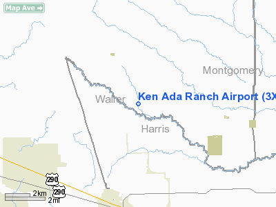
Location & QuickFacts
| FAA Information Effective: | 2008-09-25 |
| Airport Identifier: | 3XS8 |
| Airport Status: | Operational |
| Longitude/Latitude: | 095-54-00.8310W/30-07-50.7780N
-95.900231/30.130772 (Estimated) |
| Elevation: | 250 ft / 76.20 m (Estimated) |
| Land: | 0 acres |
| From nearest city: | 6 nautical miles N of Waller, TX |
| Location: | Waller County, TX |
| Magnetic Variation: | 06E (1985) |
Owner & Manager
| Ownership: | Privately owned |
| Owner: | Bud Adams Ranches, Inc |
| Address: | Po Box 844
Houston, TX 77001 |
| Phone number: | 713-797-1500 |
| Manager: | W. R. Scofield |
| Address: | P.o. Box 844
Houston, TX 77001 |
| Phone number: | 713-797-1500 |
Airport Operations and Facilities
| Airport Use: | Private |
| Wind indicator: | Yes |
| Segmented Circle: | No |
| Control Tower: | No |
| Lighting Schedule: | PHONE REQ
FOR RWY LIGHTS CALL 713-797-1500. |
| Landing fee charge: | No |
| Sectional chart: | Houston |
| Region: | ASW - Southwest |
| Boundary ARTCC: | ZHU - Houston |
| Tie-in FSS: | CXO - Montgomery County |
| FSS on Airport: | No |
| FSS Toll Free: | 1-800-WX-BRIEF
FOR FP FILING CALL CXO FSS 1-800-833-5602. |
Airport Services
| Airframe Repair: | NONE |
| Power Plant Repair: | NONE |
Runway Information
Runway NW/SE
| Dimension: | 4200 x 100 ft / 1280.2 x 30.5 m |
| Surface: | ASPH, |
| Edge Lights: | Medium |
| |
Runway NW |
Runway SE |
| Traffic Pattern: | Left | Left |
|
Radio Navigation Aids
| ID |
Type |
Name |
Ch |
Freq |
Var |
Dist |
| DWH | NDB | David Hooks | | 521.00 | 05E | 17.4 nm |
| EYQ | NDB | Weiser | | 286.00 | 06E | 17.9 nm |
| LYD | NDB | Lakeside | | 249.00 | 05E | 22.2 nm |
| BNH | NDB | Brenham | | 362.00 | 06E | 25.2 nm |
| SGR | NDB | Hull | | 388.00 | 05E | 32.6 nm |
| BVP | NDB | Nixin | | 326.00 | 05E | 36.6 nm |
| UTS | NDB | Huntsville | | 308.00 | 06E | 40.0 nm |
| SYG | NDB | Sandy Point | | 402.00 | 05E | 44.0 nm |
| EFD | TACAN | Ellington | 031X | | 05E | 49.9 nm |
| ELA | VOR/DME | Eagle Lake | 111X | 116.40 | 08E | 35.6 nm |
| HUB | VOR/DME | Hobby | 118X | 117.10 | 05E | 43.3 nm |
| TNV | VORTAC | Navasota | 106X | 115.90 | 08E | 12.5 nm |
| IAH | VORTAC | Humble | 113X | 116.60 | 05E | 30.7 nm |
| IDU | VORTAC | Industry | 039X | 110.20 | 08E | 36.0 nm |
| CLL | VORTAC | College Station | 080X | 113.30 | 08E | 39.3 nm |
| HOU | VOT | Houston Wm P Hobby | | 108.40 | | 43.6 nm |
Remarks
- OWNER DOES NOT DESIRE CHARTING.
Images and information placed above are from
http://www.airport-data.com/airport/3XS8/
We thank them for the data!
| General Info
|
| Country |
United States
|
| State |
TEXAS
|
| FAA ID |
3XS8
|
| Latitude |
30-07-50.778N
|
| Longitude |
095-54-00.831W
|
| Elevation |
250 feet
|
| Near City |
WALLER
|
We don't guarantee the information is fresh and accurate. The data may
be wrong or outdated.
For more up-to-date information please refer to other sources.
|
|


