 |
|
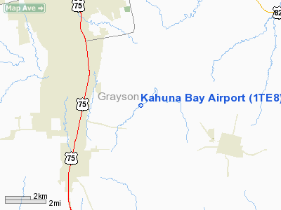
Location & QuickFacts
| FAA Information Effective: | 2008-09-25 |
| Airport Identifier: | 1TE8 |
| Airport Status: | Operational |
| Longitude/Latitude: | 096-33-29.9500W/33-32-56.3800N
-96.558319/33.548994 (Estimated) |
| Elevation: | 702 ft / 213.97 m (Estimated) |
| Land: | 30 acres |
| From nearest city: | 3 nautical miles NE of Howe, TX |
| Location: | Grayson County, TX |
| Magnetic Variation: | 05E (2000) |
Owner & Manager
| Ownership: | Privately owned |
| Owner: | Jeffrey D. Hansen |
| Address: | Po Box 970, 296 Bent Creek Lane
Sherman, TX 75090 |
| Phone number: | 903-532-6690 |
| Manager: | Jeffrey D. Hansen |
| Address: | Po Box 970, 296 Bent Creek Lane
Sherman, TX 75090 |
| Phone number: | 903-532-6690 |
Airport Operations and Facilities
| Airport Use: | Private |
| Wind indicator: | Yes |
| Segmented Circle: | No |
| Control Tower: | No |
| Sectional chart: | Dallas-ft Worth |
| Region: | ASW - Southwest |
| Boundary ARTCC: | ZFW - Fort Worth |
| Tie-in FSS: | FTW - Fort Worth |
| FSS Phone: | 817-541-3474 |
| FSS Toll Free: | 1-800-WX-BRIEF |
Airport Services
Runway Information
Runway 04/22
| Dimension: | 1100 x 200 ft / 335.3 x 61.0 m |
| Surface: | TURF, |
| |
Runway 04 |
Runway 22 |
| Traffic Pattern: | Left | Left |
| Obstruction: | 45 ft trees | 45 ft trees |
|
Runway 17W/35W
| Dimension: | 2500 x 300 ft / 762.0 x 91.4 m |
| Surface: | WATER, |
| |
Runway 17W |
Runway 35W |
| Traffic Pattern: | Left | Left |
| Obstruction: | 70 ft wire | 70 ft wire, 300.0 ft from runway |
|
Radio Navigation Aids
| ID |
Type |
Name |
Ch |
Freq |
Var |
Dist |
| DNI | NDB | Denison | | 341.00 | 06E | 17.4 nm |
| HJM | NDB | Rayburn | | 415.00 | 06E | 19.5 nm |
| DUA | NDB | Durant | | 359.00 | 05E | 24.9 nm |
| GLE | NDB | Gainesville | | 330.00 | 06E | 33.6 nm |
| MII | NDB | Caddo Mills | | 316.00 | 06E | 34.3 nm |
| SYW | NDB | Cash | | 428.00 | 05E | 42.1 nm |
| PQF | NDB | Mesquite | | 248.00 | 06E | 44.5 nm |
| AUV | NDB | Arbuckle | | 284.00 | 07E | 45.9 nm |
| AVZ | NDB | Travis | | 260.00 | 06E | 49.9 nm |
| MJF | TACAN | Arvilla | 033X | | 05E | 38.3 nm |
| URH | VOR/DME | Texoma | 090X | 114.30 | 05E | 25.2 nm |
| CVE | VOR/DME | Cowboy | 109X | 116.20 | 06E | 43.2 nm |
| TTT | VOR/DME | Maverick | 078X | 113.10 | 06E | 47.5 nm |
| BYP | VORTAC | Bonham | 093X | 114.60 | 06E | 16.3 nm |
| DAL | VOT | Dallas Love Field | | 113.30 | | 44.7 nm |
Images and information placed above are from
http://www.airport-data.com/airport/1TE8/
We thank them for the data!
| General Info
|
| Country |
United States
|
| State |
TEXAS
|
| FAA ID |
1TE8
|
| Latitude |
33-32-56.380N
|
| Longitude |
096-33-29.950W
|
| Elevation |
702 feet
|
| Near City |
HOWE
|
We don't guarantee the information is fresh and accurate. The data may
be wrong or outdated.
For more up-to-date information please refer to other sources.
|
|


