 |
|
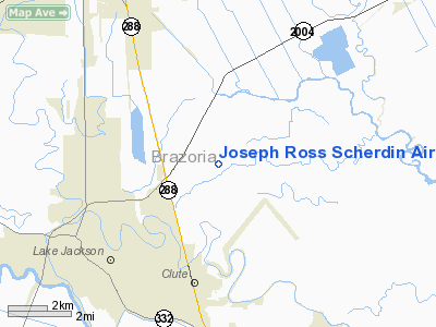
Joseph Ross Scherdin Airport |
Location & QuickFacts
| FAA Information Effective: | 2008-09-25 |
| Airport Identifier: | 93XS |
| Airport Status: | Operational |
| Longitude/Latitude: | 095-22-57.7800W/29-04-51.8810N
-95.382717/29.081078 (Estimated) |
| Elevation: | 10 ft / 3.05 m (Estimated) |
| Land: | 0 acres |
| From nearest city: | 3 nautical miles NE of Richwood, TX |
| Location: | Brazoria County, TX |
| Magnetic Variation: | 06E (1985) |
Owner & Manager
| Ownership: | Privately owned |
| Owner: | Jimmie Scherdin |
| Address: | 120 Wisteria
Lake Jackson, TX 77566 |
| Phone number: | 713-297-7260 |
| Manager: | Jimmie Scherdin |
| Address: | 120 Wisteria
Lake Jackson, TX 77566 |
| Phone number: | 713-297-7260 |
Airport Operations and Facilities
| Airport Use: | Private |
| Wind indicator: | Yes |
| Segmented Circle: | No |
| Control Tower: | No |
| Landing fee charge: | No |
| Sectional chart: | Houston |
| Region: | ASW - Southwest |
| Boundary ARTCC: | ZHU - Houston |
| Tie-in FSS: | CXO - Montgomery County |
| FSS on Airport: | No |
| FSS Toll Free: | 1-800-WX-BRIEF
FOR FP FILING CALL CXO FSS 1-800-833-5602. |
Airport Services
Runway Information
Runway 17/35
| Dimension: | 2600 x 50 ft / 792.5 x 15.2 m |
| Surface: | TURF, |
| |
Runway 17 |
Runway 35 |
| Traffic Pattern: | Right | Left |
|
Radio Navigation Aids
| ID |
Type |
Name |
Ch |
Freq |
Var |
Dist |
| SYG | NDB | Sandy Point | | 402.00 | 05E | 25.7 nm |
| BYY | NDB | Bay City | | 344.00 | 06E | 25.9 nm |
| SGR | NDB | Hull | | 388.00 | 05E | 36.1 nm |
| GLS | NDB | Galveston | | 206.00 | 08E | 36.2 nm |
| JPA | NDB | Sanjac | | 347.00 | 05E | 38.9 nm |
| ARM | NDB | Wharton | | 245.00 | 06E | 41.7 nm |
| LYD | NDB | Lakeside | | 249.00 | 05E | 46.8 nm |
| EFD | TACAN | Ellington | 031X | | 05E | 33.6 nm |
| HUB | VOR/DME | Hobby | 118X | 117.10 | 05E | 35.0 nm |
| MHF | VOR/DME | Trinity | 083X | 113.60 | 07E | 43.5 nm |
| VUH | VORTAC | Scholes | 077X | 113.00 | 06E | 29.3 nm |
| HOU | VOT | Houston Wm P Hobby | | 108.40 | | 34.3 nm |
Remarks
- VFR ONLY PRVDD 20:1 APCH SLOPE OVER ALL OBSTNS ESTABD & MAINTD.
Images and information placed above are from
http://www.airport-data.com/airport/93XS/
We thank them for the data!
| General Info
|
| Country |
United States
|
| State |
TEXAS
|
| FAA ID |
93XS
|
| Latitude |
29-04-51.881N
|
| Longitude |
095-22-57.780W
|
| Elevation |
10 feet
|
| Near City |
RICHWOOD
|
We don't guarantee the information is fresh and accurate. The data may
be wrong or outdated.
For more up-to-date information please refer to other sources.
|
|


