 |
|
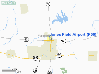
Location & QuickFacts
| FAA Information Effective: | 2008-09-25 |
| Airport Identifier: | F00 |
| Airport Status: | Operational |
| Longitude/Latitude: | 096-10-45.5700W/33-36-47.1300N
-96.179325/33.613092 (Estimated) |
| Elevation: | 618 ft / 188.37 m (Surveyed) |
| Land: | 300 acres |
| From nearest city: | 2 nautical miles N of Bonham, TX |
| Location: | Fannin County, TX |
| Magnetic Variation: | 06E (1990) |
Owner & Manager
| Ownership: | Publicly owned |
| Owner: | City Of Bonham |
| Address: | 301 E. 5th St.
Bonham, TX 75418 |
| Phone number: | 903-583-7555 |
| Manager: | Ronnie Ford
DIRECTOR OF PUBLIC WORKS. |
| Address: | 301 E. 5th St.
Bonham, TX 75418 |
| Phone number: | 903-583-7555 |
Airport Operations and Facilities
| Airport Use: | Open to public |
| Wind indicator: | Yes |
| Segmented Circle: | Yes |
| Control Tower: | No |
| Lighting Schedule: | DUSK-DAWN
ACTVT MIRL RY 17/35; PAPI RYS 17 & 35 - CTAF. |
| Beacon Color: | Clear-Green (lighted land airport) |
| Landing fee charge: | No |
| Sectional chart: | Dallas-ft Worth |
| Region: | ASW - Southwest |
| Boundary ARTCC: | ZFW - Fort Worth |
| Tie-in FSS: | FTW - Fort Worth |
| FSS on Airport: | No |
| FSS Phone: | 817-541-3474 |
| FSS Toll Free: | 1-800-WX-BRIEF |
| NOTAMs Facility: | FTW (NOTAM-d service avaliable) |
| Federal Agreements: | NGRY |
Airport Communications
| CTAF: | 122.800 |
| Unicom: | 122.800
UNICOM OTS INDEFLY. |
Airport Services
| Fuel available: | 100LL
FUEL AVBL WITH CREDIT CARD. |
| Airframe Repair: | MINOR |
| Power Plant Repair: | MINOR |
| Bottled Oxygen: | NONE |
| Bulk Oxygen: | NONE |
Runway Information
Runway 17/35
| Dimension: | 4000 x 75 ft / 1219.2 x 22.9 m |
| Surface: | ASPH, Good Condition |
| Weight Limit: | Single wheel: 12500 lbs. |
| Edge Lights: | Medium |
| |
Runway 17 |
Runway 35 |
| Longitude: | 096-10-44.8800W | 096-10-46.2500W |
| Latitude: | 33-37-06.9000N | 33-36-27.3450N |
| Elevation: | 618.00 ft | 612.00 ft |
| Alignment: | 127 | 2 |
| Traffic Pattern: | Left | Left |
| Markings: | Non-precision instrument, Good Condition | Non-precision instrument, Good Condition |
| Crossing Height: | 35.00 ft | 35.00 ft |
| VASI: | 2-light PAPI on left side | 2-light PAPI on left side |
| Visual Glide Angle: | 3.00° | 3.00° |
| Obstruction: | , 50:1 slope to clear | 5 ft fence, 200.0 ft from runway, 225 ft left of centerline
24 FT TREE 258 FT LEFT OF CNTRLN 35 FT FROM END OF RY. |
|
Radio Navigation Aids
| ID |
Type |
Name |
Ch |
Freq |
Var |
Dist |
| HJM | NDB | Rayburn | | 415.00 | 06E | 0.2 nm |
| DUA | NDB | Durant | | 359.00 | 05E | 22.7 nm |
| DNI | NDB | Denison | | 341.00 | 06E | 27.6 nm |
| MII | NDB | Caddo Mills | | 316.00 | 06E | 34.6 nm |
| SYW | NDB | Cash | | 428.00 | 05E | 38.4 nm |
| HHW | NDB | Hugo | | 323.00 | 05E | 41.0 nm |
| AEE | NDB | Antlers | | 391.00 | 05E | 43.6 nm |
| MJF | TACAN | Arvilla | 033X | | 05E | 33.4 nm |
| URH | VOR/DME | Texoma | 090X | 114.30 | 05E | 22.6 nm |
| PRX | VOR/DME | Paris | 083X | 113.60 | 07E | 36.9 nm |
| SLR | VOR/DME | Sulphur Springs | 027X | 109.00 | 08E | 40.5 nm |
| BYP | VORTAC | Bonham | 093X | 114.60 | 06E | 5.3 nm |
Images and information placed above are from
http://www.airport-data.com/airport/F00/
We thank them for the data!
| General Info
|
| Country |
United States
|
| State |
TEXAS
|
| FAA ID |
F00
|
| Latitude |
33-36-42.200N
|
| Longitude |
096-10-45.800W
|
| Elevation |
618 feet
|
| Near City |
BONHAM
|
We don't guarantee the information is fresh and accurate. The data may
be wrong or outdated.
For more up-to-date information please refer to other sources.
|
|


