 |
|
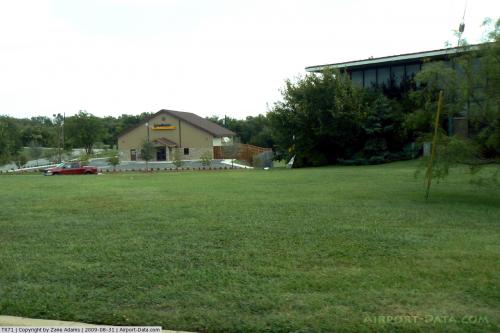 |
(Click on the photo to enlarge) |
Location & QuickFacts
| FAA Information Effective: | 2008-09-25 |
| Airport Identifier: | TX71 |
| Airport Status: | Operational |
| Longitude/Latitude: | 097-24-49.0680W/32-42-55.4710N
-97.413630/32.715409 (Estimated) |
| Elevation: | 680 ft / 207.26 m (Estimated) |
| Land: | 0 acres |
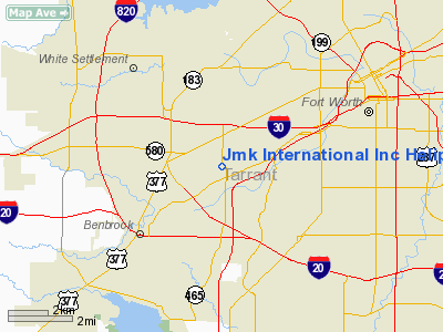
| From nearest city: | 3 nautical miles NE of Fort Worth, TX |
| Location: | Tarrant County, TX |
| Magnetic Variation: | 07E (1990) |
Owner & Manager
| Ownership: | Privately owned |
| Owner: | Jmk International Inc. |
| Address: | 4800 Bryant Irvin Ct.
Fort Worth, TX 76107 |
| Phone number: | 817-737-3703
EXT 22. |
| Manager: | Michael B. Evans |
| Address: | 4800 Bryant Irvin Ct.
Fort Worth, TX 76107 |
| Phone number: | 817-737-3703 |
Airport Operations and Facilities
| Airport Use: | Private |
| Segmented Circle: | No |
| Control Tower: | No |
| Sectional chart: | Dallas-ft Worth |
| Region: | ASW - Southwest |
| Boundary ARTCC: | ZFW - Fort Worth |
| Tie-in FSS: | FTW - Fort Worth |
| FSS on Airport: | No |
| FSS Phone: | 817-541-3474 |
| FSS Toll Free: | 1-800-WX-BRIEF |
Runway Information
Helipad H1
| Dimension: | 40 x 40 ft / 12.2 x 12.2 m |
| Surface: | ASPH, |
| |
Runway H1 |
Runway |
| Traffic Pattern: | Left | Left |
|
Radio Navigation Aids
| ID |
Type |
Name |
Ch |
Freq |
Var |
Dist |
| XQH | NDB | Cedar Hill | | 353.00 | 08E | 23.4 nm |
| RBD | NDB | Redbird | | 287.00 | 06E | 27.5 nm |
| MWL | NDB | Mineral Wells | | 266.00 | 06E | 32.8 nm |
| LNC | NDB | Lancaster | | 239.00 | 06E | 36.0 nm |
| JUG | NDB | Jecca | | 388.00 | 06E | 44.7 nm |
| PQF | NDB | Mesquite | | 248.00 | 06E | 45.1 nm |
| NFW | TACAN | Nas Jrb Fort Worth | 024X | | 07E | 3.6 nm |
| TTT | VOR/DME | Maverick | 078X | 113.10 | 06E | 21.0 nm |
| CVE | VOR/DME | Cowboy | 109X | 116.20 | 06E | 27.8 nm |
| FUZ | VORTAC | Ranger | 104X | 115.70 | 06E | 15.8 nm |
| MQP | VORTAC | Millsap | 124X | 117.70 | 09E | 29.5 nm |
| JEN | VORTAC | Glen Rose | 097X | 115.00 | 06E | 40.9 nm |
| FTW | VOT | Fort Worth Meacham | | 108.20 | | 6.7 nm |
| DAL | VOT | Dallas Love Field | | 113.30 | | 29.5 nm |
Remarks
- PRVDD VFR; SAFETY BARRIER IS ERECTED AROUND HELI; WARNING SIGNS PLACED AT ENTRANCE TO HELI; INGRESS/EGRESS RTES SHALL BE N & S ALONG BRYANT IRVING RD; & THE WIRES ALONG BRYANT IRVING RD ARE MKD.
Images and information placed above are from
http://www.airport-data.com/airport/TX71/
We thank them for the data!
| General Info
|
| Country |
United States
|
| State |
TEXAS
|
| FAA ID |
TX71
|
| Latitude |
32-42-55.471N
|
| Longitude |
097-24-49.068W
|
| Elevation |
680 feet
|
| Near City |
FORT WORTH
|
We don't guarantee the information is fresh and accurate. The data may
be wrong or outdated.
For more up-to-date information please refer to other sources.
|
|


