 |
|
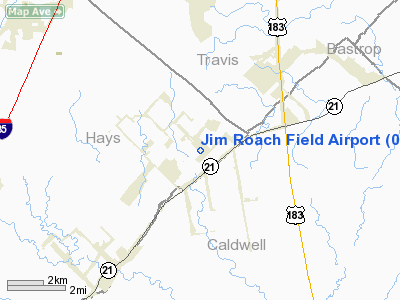
Location & QuickFacts
| FAA Information Effective: | 2008-09-25 |
| Airport Identifier: | 0TS9 |
| Airport Status: | Operational |
| Longitude/Latitude: | 097-44-14.0070W/30-00-55.7810N
-97.737224/30.015495 (Estimated) |
| Elevation: | 600 ft / 182.88 m (Estimated) |
| Land: | 0 acres |
| From nearest city: | 0 nautical miles NW of Niederwald, TX |
| Location: | Hays County, TX |
| Magnetic Variation: | 07E (1985) |
Owner & Manager
| Ownership: | Privately owned |
| Owner: | Jim Roach |
| Address: | 11 N Old Spanish Trail
Uhland, TX 78640 |
| Phone number: | 512-398-3035
BUSINESS PHONE. |
| Manager: | Jim Roach |
| Address: | 11 N Old Spanish Trail
Uhland, TX 78640 |
| Phone number: | 512-398-3036
HOME PHONE. |
Airport Operations and Facilities
| Airport Use: | Private |
| Wind indicator: | Yes |
| Segmented Circle: | No |
| Control Tower: | No |
| Sectional chart: | San Antonio |
| Region: | ASW - Southwest |
| Boundary ARTCC: | ZHU - Houston |
| Tie-in FSS: | SJT - San Angelo |
| FSS Toll Free: | 1-800-WX-BRIEF |
Runway Information
Runway 04/22
| Dimension: | 1260 x 70 ft / 384.0 x 21.3 m
WIDTH MKD WITH WHITE PAINTED TIRES. |
| Surface: | TURF, |
| |
Runway 04 |
Runway 22 |
| Traffic Pattern: | Left | Left |
| Displaced threshold: | 0.00 ft | 420.00 ft |
| Obstruction: | | 25 ft pline, 500.0 ft from runway |
|
Radio Navigation Aids
| ID |
Type |
Name |
Ch |
Freq |
Var |
Dist |
| GUO | NDB | Georgetown | | 332.00 | 06E | 40.3 nm |
| GYB | NDB | Lee County | | 385.00 | 07E | 40.5 nm |
| MFS | NDB | Horseshoe Bay Resort | | 403.00 | 07E | 44.4 nm |
| DHK | TACAN | Randolph | 036X | | 09E | 39.9 nm |
| CWK | VORTAC | Centex | 075X | 112.80 | 06E | 24.3 nm |
| RND | VORTAC | Randolph | 70X | 112.30 | 09E | 41.3 nm |
| SAT | VORTAC | San Antonio | 115X | 116.80 | 08E | 43.9 nm |
| SAT | VOT | San Antonio Intl | | 110.40 | | 48.0 nm |
Remarks
- CAUTION: CATTLE ON & INVOF ARPT.
- PRVDD NE END OF RWY IS DSPLCD TO ASSURE A CLEAR APCH SLOPE.
Images and information placed above are from
http://www.airport-data.com/airport/0TS9/
We thank them for the data!
| General Info
|
| Country |
United States
|
| State |
TEXAS
|
| FAA ID |
0TS9
|
| Latitude |
30-00-55.781N
|
| Longitude |
097-44-14.007W
|
| Elevation |
600 feet
|
| Near City |
NIEDERWALD
|
We don't guarantee the information is fresh and accurate. The data may
be wrong or outdated.
For more up-to-date information please refer to other sources.
|
|


