 |
|
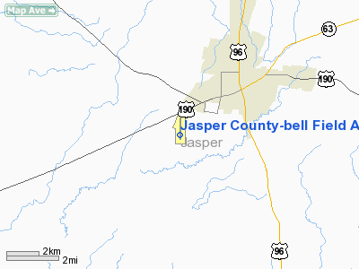
Jasper County-bell Field Airport |
Location & QuickFacts
| FAA Information Effective: | 2008-09-25 |
| Airport Identifier: | JAS |
| Airport Status: | Operational |
| Longitude/Latitude: | 094-02-05.8000W/30-53-08.5000N
-94.034944/30.885694 (Estimated) |
| Elevation: | 213 ft / 64.92 m (Surveyed) |
| Land: | 413 acres |
| From nearest city: | 4 nautical miles SW of Jasper, TX |
| Location: | Jasper County, TX |
| Magnetic Variation: | 04E (1995) |
Owner & Manager
| Ownership: | Publicly owned |
| Owner: | Jasper County |
| Address: | 121 N. Austin Street
Jasper, TX 75951 |
| Phone number: | 409-384-2612 |
| Manager: | Mark Allen
COUNTY JUDGE. |
| Address: | 121 N. Austin Street
Jasper, TX 75951 |
| Phone number: | 409-384-2612
AIRPORT PHONE 409-381-8151. |
Airport Operations and Facilities
| Airport Use: | Open to public |
| Wind indicator: | Yes |
| Segmented Circle: | Yes |
| Control Tower: | No |
| Lighting Schedule: | DUSK-DAWN
ACTVT MIRL RY 18/36 - CTAF. |
| Beacon Color: | Clear-Green (lighted land airport) |
| Landing fee charge: | No |
| Sectional chart: | Houston |
| Region: | ASW - Southwest |
| Boundary ARTCC: | ZHU - Houston |
| Tie-in FSS: | CXO - Montgomery County |
| FSS on Airport: | No |
| FSS Toll Free: | 1-800-WX-BRIEF |
| NOTAMs Facility: | JAS (NOTAM-d service avaliable) |
| Federal Agreements: | NGY |
Airport Communications
| CTAF: | 122.800 |
| Unicom: | 122.800 |
Airport Services
| Fuel available: | 100LLA |
| Airframe Repair: | MAJOR |
| Power Plant Repair: | MAJOR |
| Bottled Oxygen: | NONE |
| Bulk Oxygen: | NONE |
Runway Information
Runway 18/36
| Dimension: | 5500 x 70 ft / 1676.4 x 21.3 m |
| Surface: | ASPH, Good Condition |
| Weight Limit: | Single wheel: 21000 lbs. |
| Edge Lights: | Medium |
| |
Runway 18 |
Runway 36 |
| Longitude: | 094-02-05.2516W | 094-02-06.2934W |
| Latitude: | 30-53-35.7603N | 30-52-41.3330N |
| Elevation: | 212.00 ft | 178.00 ft |
| Alignment: | 127 | 1 |
| Traffic Pattern: | Left | Left |
| Markings: | Non-precision instrument, Good Condition | Non-precision instrument, Good Condition |
| Crossing Height: | 41.00 ft | 41.00 ft |
| VASI: | 2-light PAPI on left side | 2-light PAPI on left side |
| Visual Glide Angle: | 3.00° | 3.00° |
| Obstruction: | 80 ft trees, 2540.0 ft from runway, 200 ft right of centerline, 29:1 slope to clear | 63 ft trees, 1920.0 ft from runway, 27:1 slope to clear |
|
Radio Navigation Aids
| ID |
Type |
Name |
Ch |
Freq |
Var |
Dist |
| POE1 | FAN MARKER | North | | | 07E | 44.1 nm |
| POE | FAN MARKER | South | | | 07E | 45.3 nm |
| JAS | NDB | Jasper | | 344.00 | 04E | 4.1 nm |
| HRD | NDB | Hardin County | | 524.00 | 04E | 35.0 nm |
| DR | NDB | Idder | | 385.00 | 04E | 37.0 nm |
| VED | NDB | Leesville | | 247.00 | 04E | 38.0 nm |
| DQU | NDB | De Quincy | | 410.00 | 05E | 39.9 nm |
| GUV | NDB | Gator | | 359.00 | 05E | 44.6 nm |
| MMY | NDB | Many | | 272.00 | 04E | 48.4 nm |
| GDE | NDB | Goodhue | | 368.00 | 07E | 49.8 nm |
| LFK | VORTAC | Lufkin | 058X | 112.10 | 05E | 38.9 nm |
| FXU | VORTAC | Polk | 021X | 108.40 | 05E | 44.2 nm |
Images and information placed above are from
http://www.airport-data.com/airport/JAS/
We thank them for the data!
| General Info
|
| Country |
United States
|
| State |
TEXAS
|
| FAA ID |
JAS
|
| Latitude |
30-53-08.550N
|
| Longitude |
094-02-05.770W
|
| Elevation |
213 feet
|
| Near City |
JASPER
|
We don't guarantee the information is fresh and accurate. The data may
be wrong or outdated.
For more up-to-date information please refer to other sources.
|
|


