 |
|
Location & QuickFacts
| FAA Information Effective: | 2008-09-25 |
| Airport Identifier: | 26R |
| Airport Status: | Operational |
| Longitude/Latitude: | 096-34-55.0637W/29-00-03.5963N
-96.581962/29.000999 (Estimated) |
| Elevation: | 61 ft / 18.59 m (Estimated) |
| Land: | 108 acres |
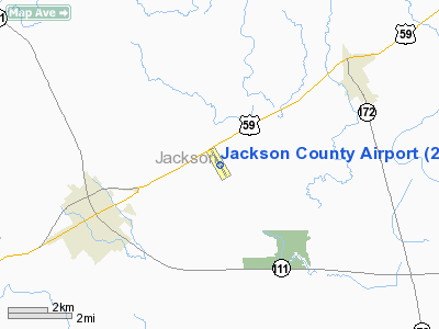
| From nearest city: | 3 nautical miles NE of Edna, TX |
| Location: | Jackson County, TX |
| Magnetic Variation: | 08E (1980) |
Owner & Manager
| Ownership: | Publicly owned |
| Owner: | Jackson County
HARRISON STAFFORD, COUNTY JUDGE. |
| Address: | Court House
Edna, TX 77957 |
| Phone number: | 361-782-2352 |
| Manager: | Bobby Fielder |
| Address: | Po Box 244
Edna, TX 77957 |
| Phone number: | 361-782-6391 |
Airport Operations and Facilities
| Airport Use: | Open to public |
| Wind indicator: | Yes |
| Segmented Circle: | Yes |
| Control Tower: | No |
| Lighting Schedule: | DUSK-DAWN |
| Beacon Color: | Clear-Green (lighted land airport)
ROTG BCN OTS INDEFLY. |
| Landing fee charge: | No |
| Sectional chart: | Houston |
| Region: | ASW - Southwest |
| Boundary ARTCC: | ZHU - Houston |
| Tie-in FSS: | CXO - Montgomery County |
| FSS on Airport: | No |
| FSS Toll Free: | 1-800-WX-BRIEF
FOR FP FILING CALL CXO FSS 1-800-833-5602 |
| NOTAMs Facility: | CXO (NOTAM-d service avaliable) |
| Federal Agreements: | NGY |
Airport Communications
| CTAF: | 122.800 |
| Unicom: | 122.800 |
Airport Services
| Airframe Repair: | MAJOR |
| Power Plant Repair: | MAJOR |
Runway Information
Runway 14/32
| Dimension: | 3393 x 70 ft / 1034.2 x 21.3 m |
| Surface: | ASPH, Good Condition |
| Weight Limit: | Single wheel: 12500 lbs. |
| Edge Lights: | Medium |
| |
Runway 14 |
Runway 32 |
| Longitude: | 096-35-04.7210W | 096-34-45.4071W |
| Latitude: | 29-00-18.0863N | 28-59-49.1106N |
| Elevation: | 61.00 ft | 61.00 ft |
| Alignment: | 127 | 127 |
| Traffic Pattern: | Left | Left |
| Markings: | Non-precision instrument, Good Condition | Non-precision instrument, Good Condition |
| Obstruction: | 30 ft pline, 1560.0 ft from runway, 45:1 slope to clear | 16 ft tree, 770.0 ft from runway, 76 ft right of centerline, 36:1 slope to clear |
|
Radio Navigation Aids
| ID |
Type |
Name |
Ch |
Freq |
Var |
Dist |
| PKV | NDB | Port Lavaca | | 515.00 | 05E | 21.7 nm |
| ARM | NDB | Wharton | | 245.00 | 06E | 27.2 nm |
| OKT | NDB | Yoakum | | 350.00 | 06E | 34.7 nm |
| BYY | NDB | Bay City | | 344.00 | 06E | 38.0 nm |
| VCT | VOR/DME | Victoria | 027X | 109.00 | 06E | 21.7 nm |
| ELA | VOR/DME | Eagle Lake | 111X | 116.40 | 08E | 42.1 nm |
| PSX | VORTAC | Palacios | 120X | 117.30 | 08E | 20.3 nm |
Remarks
- TO MONITOR AEROBATIC BOX - 123.3.
Images and information placed above are from
http://www.airport-data.com/airport/26R/
We thank them for the data!
| General Info
|
| Country |
United States
|
| State |
TEXAS
|
| FAA ID |
26R
|
| Latitude |
29-00-03.636N
|
| Longitude |
096-34-55.008W
|
| Elevation |
61 feet
|
| Near City |
EDNA
|
We don't guarantee the information is fresh and accurate. The data may
be wrong or outdated.
For more up-to-date information please refer to other sources.
|
|


