 |
|
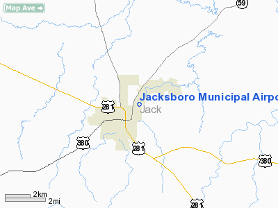
Location & QuickFacts
| FAA Information Effective: | 2008-09-25 |
| Airport Identifier: | 21F |
| Airport Status: | Operational |
| Longitude/Latitude: | 098-08-48.1590W/33-13-43.4100N
-98.146711/33.228725 (Estimated) |
| Elevation: | 1055 ft / 321.56 m (Estimated) |
| Land: | 65 acres |
| From nearest city: | 1 nautical miles NE of Jacksboro, TX |
| Location: | Jack County, TX |
| Magnetic Variation: | 07E (1985) |
Owner & Manager
| Ownership: | Publicly owned |
| Owner: | City Of Jacksboro |
| Address: | 112 West Belknap
Jacksboro, TX 76458 |
| Phone number: | 940-567-6321 |
| Manager: | Dennie Pippin
SHALONA DOWELL, CITY ADMINISTRATOR, CITY OF JACKSBORO. |
| Address: | 112 West Belknap
Jacksboro, TX 76458 |
| Phone number: | 940-567-6321 |
Airport Operations and Facilities
| Airport Use: | Open to public |
| Wind indicator: | Yes |
| Segmented Circle: | Yes |
| Control Tower: | No |
| Lighting Schedule: | DUSK-DAWN
ACTVT MIRL RY 17/35 - CTAF. |
| Beacon Color: | Clear-Green (lighted land airport) |
| Landing fee charge: | No |
| Sectional chart: | Dallas-ft Worth |
| Region: | ASW - Southwest |
| Boundary ARTCC: | ZFW - Fort Worth |
| Tie-in FSS: | FTW - Fort Worth |
| FSS on Airport: | No |
| FSS Phone: | 817-541-3474 |
| FSS Toll Free: | 1-800-WX-BRIEF |
| NOTAMs Facility: | FTW (NOTAM-d service avaliable) |
| Federal Agreements: | NY1 |
Airport Communications
Airport Services
| Bottled Oxygen: | NONE |
| Bulk Oxygen: | NONE |
Runway Information
Runway 17/35
| Dimension: | 3220 x 75 ft / 981.5 x 22.9 m |
| Surface: | ASPH, Poor Condition
PAVEMENT CRACKED WITH WEEDS & GRASS GROWING THRU CRACKS. |
| Weight Limit: | Single wheel: 4000 lbs. |
| Edge Lights: | Medium |
| |
Runway 17 |
Runway 35 |
| Traffic Pattern: | Left | Left |
| Markings: | Basic, Fair Condition | Basic, Fair Condition |
| Obstruction: | 41 ft pole, 1350.0 ft from runway, 28:1 slope to clear
5 FT BRUSH 60 FT FM THLD 36 FT LEFT. GROUND DROPS TO LAKE AT 140 FT. | 8 ft trees, 217.0 ft from runway, 15 ft left of centerline, 2:1 slope to clear
15 FT BRUSH 127 FT FM THLD 15 FT LEFT. |
|
Radio Navigation Aids
| ID |
Type |
Name |
Ch |
Freq |
Var |
Dist |
| GHX | NDB | Graham | | 371.00 | 07E | 18.0 nm |
| GZV | NDB | Brazos River | | 280.00 | 07E | 21.4 nm |
| MWL | NDB | Mineral Wells | | 266.00 | 06E | 27.0 nm |
| GMZ | NDB | Grindstone Mountain | | 356.00 | 07E | 29.4 nm |
| ONY | NDB | Olney | | 272.00 | 07E | 34.4 nm |
| SKB | NDB | Scotland | | 344.00 | 08E | 37.8 nm |
| BKD | NDB | Breckenridge | | 245.00 | 07E | 47.4 nm |
| NFW | TACAN | Nas Jrb Fort Worth | 024X | | 07E | 45.0 nm |
| SHP | TACAN | Sheppard | 045X | | 10E | 48.4 nm |
| UKW | VORTAC | Bowie | 071X | 112.40 | 06E | 24.7 nm |
| MQP | VORTAC | Millsap | 124X | 117.70 | 09E | 31.1 nm |
| FTW | VOT | Fort Worth Meacham | | 108.20 | | 46.8 nm |
Remarks
- AIRPORT ACCESS GATE LOCKED.
Images and information placed above are from
http://www.airport-data.com/airport/21F/
We thank them for the data!
| General Info
|
| Country |
United States
|
| State |
TEXAS
|
| FAA ID |
21F
|
| Latitude |
33-13-43.410N
|
| Longitude |
098-08-48.159W
|
| Elevation |
1055 feet
|
| Near City |
JACKSBORO
|
We don't guarantee the information is fresh and accurate. The data may
be wrong or outdated.
For more up-to-date information please refer to other sources.
|
|


