 |
|
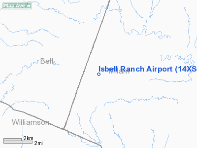
Location & QuickFacts
| FAA Information Effective: | 2008-09-25 |
| Airport Identifier: | 14XS |
| Airport Status: | Operational |
| Longitude/Latitude: | 097-16-25.9890W/30-48-30.6830N
-97.273886/30.808523 (Estimated) |
| Elevation: | 430 ft / 131.06 m (Estimated) |
| Land: | 13 acres |
| From nearest city: | 1 nautical miles N of Davilla, TX |
| Location: | Milam County, TX |
| Magnetic Variation: | 07E (1985) |
Owner & Manager
| Ownership: | Privately owned |
| Owner: | James A Isbell |
| Address: | 2404 Pebble Beach Dr
Austin, TX 78747 |
| Phone number: | 512-280-4457 |
| Manager: | James A Isbell |
| Address: | 2404 Pebble Beach Dr.
Austin, TX 78747 |
| Phone number: | 512-280-4457 |
Airport Operations and Facilities
| Airport Use: | Private |
| Wind indicator: | No |
| Segmented Circle: | No |
| Control Tower: | No |
| Landing fee charge: | No |
| Sectional chart: | San Antonio |
| Region: | ASW - Southwest |
| Boundary ARTCC: | ZHU - Houston |
| Tie-in FSS: | SJT - San Angelo |
| FSS on Airport: | No |
| FSS Toll Free: | 1-800-WX-BRIEF |
Runway Information
Runway 01/19
| Dimension: | 1800 x 100 ft / 548.6 x 30.5 m |
| Surface: | TURF,
RWY NOT REGULARLY MOWED. |
| |
Runway 01 |
Runway 19 |
| Traffic Pattern: | Left | Left |
| Obstruction: | 4 ft fence, 10.0 ft from runway | 4 ft fence, 10.0 ft from runway |
|
Radio Navigation Aids
| ID |
Type |
Name |
Ch |
Freq |
Var |
Dist |
| GUO | NDB | Georgetown | | 332.00 | 06E | 22.3 nm |
| IL | NDB | Iresh | | 278.00 | 07E | 25.9 nm |
| HLR | NDB | Hood | | 347.00 | 07E | 29.7 nm |
| GR | NDB | Starn | | 323.00 | 07E | 37.9 nm |
| GYB | NDB | Lee County | | 385.00 | 07E | 41.3 nm |
| ROB | NDB | Robinson | | 400.00 | 07E | 43.1 nm |
| BMQ | NDB | Burnet | | 341.00 | 07E | 49.9 nm |
| TPL | VOR/DME | Temple | 041X | 110.40 | 09E | 25.3 nm |
| GRK | VOR/DME | Gray | 055X | 111.80 | 07E | 30.9 nm |
| CWK | VORTAC | Centex | 075X | 112.80 | 06E | 29.0 nm |
| CLL | VORTAC | College Station | 080X | 113.30 | 08E | 45.8 nm |
Remarks
- PVT USE; EACH RWY MAINTAINED FOR A 20:1 APCH SLOPE BY REMOVAL OR TOPPING OF TREES OR BY DISPLACEMENT OF RWY THR.
Images and information placed above are from
http://www.airport-data.com/airport/14XS/
We thank them for the data!
| General Info
|
| Country |
United States
|
| State |
TEXAS
|
| FAA ID |
14XS
|
| Latitude |
30-48-30.683N
|
| Longitude |
097-16-25.989W
|
| Elevation |
430 feet
|
| Near City |
DAVILLA
|
We don't guarantee the information is fresh and accurate. The data may
be wrong or outdated.
For more up-to-date information please refer to other sources.
|
|


