 |
|
| Ironhead Airport |
| IATA: none – ICAO: none – FAA LID: T58 |
| Summary |
| Airport type |
Public |
| Location |
Sanger, Texas |
| Elevation AMSL |
715 ft / 218 m |
| Coordinates |
33°19′54″N 097°13′49″W / 33.33167°N 97.23028°W / 33.33167; -97.23028Coordinates: 33°19′54″N 097°13′49″W / 33.33167°N 97.23028°W / 33.33167; -97.23028 |
| Runways |
| Direction |
Length |
Surface |
| ft |
m |
| 18/36 |
2,500 |
762 |
Turf |
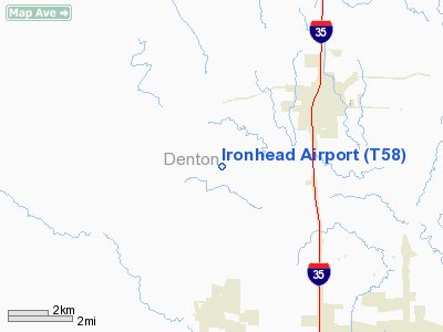
Ironhead Airport (FAA LID: T58) is a public airport located three miles (4.8 km) southwest of the central business district (CBD) of Sanger, in Denton County, Texas, USA.
The airport is used solely for general aviation purposes.
Facilities
Ironhead Airport has one runway:
- Runway 18/36: 2,500 x 200 ft. (762 x 61 m), Surface: Turf
The above content comes from Wikipedia and is published under free licenses – click here to read more.
Location & QuickFacts
| FAA Information Effective: | 2008-09-25 |
| Airport Identifier: | T58 |
| Airport Status: | Operational |
| Longitude/Latitude: | 097-13-49.0580W/33-19-54.4170N
-97.230294/33.331783 (Estimated) |
| Elevation: | 715 ft / 217.93 m (Estimated) |
| Land: | 52 acres |
| From nearest city: | 3 nautical miles SW of Sanger, TX |
| Location: | Denton County, TX |
| Magnetic Variation: | 07E (1985) |
Owner & Manager
| Ownership: | Privately owned |
| Owner: | Ben E. Huston And Thomas W. Huston |
| Address: | 5808 Michael Rd
Sanger, TX 76266 |
| Phone number: | 940-458-7348 |
| Manager: | Ben E. Huston And Thomas W. Huston |
| Address: | 5808 Michael Road
Sanger, TX 76266 |
| Phone number: | 940-458-7348
OR 940-458-7988. |
Airport Operations and Facilities
| Airport Use: | Open to public |
| Wind indicator: | Yes |
| Segmented Circle: | No |
| Control Tower: | No |
| Landing fee charge: | No |
| Sectional chart: | Dallas-ft Worth |
| Region: | ASW - Southwest |
| Boundary ARTCC: | ZFW - Fort Worth |
| Tie-in FSS: | FTW - Fort Worth |
| FSS on Airport: | No |
| FSS Phone: | 817-541-3474 |
| FSS Toll Free: | 1-800-WX-BRIEF |
| NOTAMs Facility: | FTW (NOTAM-d service avaliable) |
Airport Communications
Airport Services
Runway Information
Runway 18/36
| Dimension: | 2500 x 200 ft / 762.0 x 61.0 m |
| Surface: | TURF, Good Condition |
| |
Runway 18 |
Runway 36 |
| Traffic Pattern: | Left | Left |
| Obstruction: | 5 ft fence, 64.0 ft from runway, 64 ft left of centerline, 12:1 slope to clear | 15 ft road, 300.0 ft from runway, 20:1 slope to clear |
|
Radio Navigation Aids
| ID |
Type |
Name |
Ch |
Freq |
Var |
Dist |
| GLE | NDB | Gainesville | | 330.00 | 06E | 23.3 nm |
| GMZ | NDB | Grindstone Mountain | | 356.00 | 07E | 31.8 nm |
| DNI | NDB | Denison | | 341.00 | 06E | 40.8 nm |
| RBD | NDB | Redbird | | 287.00 | 06E | 43.3 nm |
| XQH | NDB | Cedar Hill | | 353.00 | 08E | 46.3 nm |
| PQF | NDB | Mesquite | | 248.00 | 06E | 47.3 nm |
| AUV | NDB | Arbuckle | | 284.00 | 07E | 49.5 nm |
| NFW | TACAN | Nas Jrb Fort Worth | 024X | | 07E | 35.3 nm |
| TTT | VOR/DME | Maverick | 078X | 113.10 | 06E | 29.4 nm |
| CVE | VOR/DME | Cowboy | 109X | 116.20 | 06E | 31.2 nm |
| FUZ | VORTAC | Ranger | 104X | 115.70 | 06E | 26.7 nm |
| UKW | VORTAC | Bowie | 071X | 112.40 | 06E | 32.1 nm |
| FTW | VOT | Fort Worth Meacham | | 108.20 | | 31.6 nm |
| DAL | VOT | Dallas Love Field | | 113.30 | | 34.8 nm |
Remarks
- NORTH 700 FT RY 18/36 SLOPES DOWNWARD 25 FT IN ELEV.
- 6 FT METAL POLE 60 FT FM AER 18.
- WILDLIFE ON AND IN VICINITY OF AIRPORT.
- PRVDD THRS ARE DSPLCD TO PROVIDE 20:1 APCH SLOPES OVER ANY OBSTRUCTIONS IN APCH AREA.
Images and information placed above are from
http://www.airport-data.com/airport/T58/
We thank them for the data!
| General Info
|
| Country |
United States
|
| State |
TEXAS
|
| FAA ID |
T58
|
| Latitude |
33-19-54.417N
|
| Longitude |
097-13-49.058W
|
| Elevation |
715 feet
|
| Near City |
SANGER
|
We don't guarantee the information is fresh and accurate. The data may
be wrong or outdated.
For more up-to-date information please refer to other sources.
|
|


