 |
|
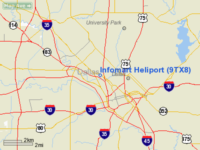
Location & QuickFacts
| FAA Information Effective: | 2008-09-25 |
| Airport Identifier: | 9TX8 |
| Airport Status: | Operational |
| Longitude/Latitude: | 096-49-16.0060W/32-48-10.4620N
-96.821113/32.802906 (Estimated) |
| Elevation: | 420 ft / 128.02 m (Estimated) |
| Land: | 0 acres |
| From nearest city: | 2 nautical miles NE of Dallas, TX |
| Location: | Dallas County, TX |
| Magnetic Variation: | 06E (1990) |
Owner & Manager
| Ownership: | Privately owned |
| Owner: | Im Joint Venture-dbainfomart |
| Address: | 1950 Stemmons, Suite 6038
Dallas, TX 75207 |
| Phone number: | 214-746-3500 |
| Address: |
|
Airport Operations and Facilities
| Airport Use: | Private |
| Segmented Circle: | No |
| Control Tower: | No |
| Lighting Schedule: | PHONE REQ
FOR FLOOD LGTS CALL 214-746-3500. |
| Sectional chart: | Houston |
| Region: | ASW - Southwest |
| Boundary ARTCC: | ZFW - Fort Worth |
| Tie-in FSS: | FTW - Fort Worth |
| FSS on Airport: | No |
| FSS Phone: | 817-541-3474 |
| FSS Toll Free: | 1-800-WX-BRIEF |
Runway Information
Helipad H1
| Dimension: | 50 x 50 ft / 15.2 x 15.2 m |
| Surface: | CONC, |
| |
Runway H1 |
Runway |
| Traffic Pattern: | Left | Left |
|
Radio Navigation Aids
| ID |
Type |
Name |
Ch |
Freq |
Var |
Dist |
| RBD | NDB | Redbird | | 287.00 | 06E | 8.0 nm |
| LNC | NDB | Lancaster | | 239.00 | 06E | 14.4 nm |
| PQF | NDB | Mesquite | | 248.00 | 06E | 14.8 nm |
| XQH | NDB | Cedar Hill | | 353.00 | 08E | 15.0 nm |
| JUG | NDB | Jecca | | 388.00 | 06E | 16.7 nm |
| AVZ | NDB | Travis | | 260.00 | 06E | 29.0 nm |
| MII | NDB | Caddo Mills | | 316.00 | 06E | 32.2 nm |
| SYW | NDB | Cash | | 428.00 | 05E | 39.5 nm |
| CGQ | NDB | Powell | | 344.00 | 06E | 48.7 nm |
| NFW | TACAN | Nas Jrb Fort Worth | 024X | | 07E | 31.3 nm |
| MJF | TACAN | Arvilla | 033X | | 05E | 41.5 nm |
| CVE | VOR/DME | Cowboy | 109X | 116.20 | 06E | 6.7 nm |
| TTT | VOR/DME | Maverick | 078X | 113.10 | 06E | 11.8 nm |
| FUZ | VORTAC | Ranger | 104X | 115.70 | 06E | 18.8 nm |
| CQY | VORTAC | Cedar Creek | 095X | 114.80 | 06E | 48.1 nm |
| DAL | VOT | Dallas Love Field | | 113.30 | | 3.1 nm |
| FTW | VOT | Fort Worth Meacham | | 108.20 | | 27.2 nm |
Remarks
- PRVDD VFR; A WIND INDICATOR IS MAINTINED; A SAFETY BARRIER IS INSTALLED AROUND HELIPORT; A SIGN PLACED NEAR ENTRANCE WARNING OF HELICOPTER OPNS; POLES N & S OF HELIPORT ARE REMOVED; AND INGRESS/EGRESS IS FM THE N & S AND IS MKD WITH DIRECTIONAL ARROWS.
Images and information placed above are from
http://www.airport-data.com/airport/9TX8/
We thank them for the data!
| General Info
|
| Country |
United States
|
| State |
TEXAS
|
| FAA ID |
9TX8
|
| Latitude |
32-48-10.462N
|
| Longitude |
096-49-16.006W
|
| Elevation |
420 feet
|
| Near City |
DALLAS
|
We don't guarantee the information is fresh and accurate. The data may
be wrong or outdated.
For more up-to-date information please refer to other sources.
|
|


