 |
|
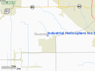
Industrial Helicopters Inc Heliport |
Location & QuickFacts
| FAA Information Effective: | 2008-09-25 |
| Airport Identifier: | TX10 |
| Airport Status: | Operational |
| Longitude/Latitude: | 097-34-24.0000W/27-43-24.0000N
-97.573333/27.723333 (Estimated) |
| Elevation: | 10 ft / 3.05 m (Estimated) |
| Land: | 0 acres |
| From nearest city: | 0 nautical miles SW of Corpus Christi, TX |
| Location: | Nueces County, TX |
| Magnetic Variation: | 06E (2000) |
Owner & Manager
| Ownership: | Privately owned |
| Owner: | Industrial Helicopters, Inc |
| Address: | Po Box 90210
Lafayette, LA 70509 |
| Phone number: | 318-233-3356 |
| Manager: | J. Oran Richard |
| Address: | Po Box 90210
Lafayette, LA 70509 |
| Phone number: | 318-233-3356 |
Airport Operations and Facilities
| Airport Use: | Private |
| Wind indicator: | Yes |
| Segmented Circle: | No |
| Control Tower: | No |
| Sectional chart: | Brownsville |
| Region: | ASW - Southwest |
| Boundary ARTCC: | ZHU - Houston |
| Tie-in FSS: | SJT - San Angelo |
| FSS Toll Free: | 1-800-WX-BRIEF |
Airport Services
Runway Information
Helipad H1
| Dimension: | 200 x 200 ft / 61.0 x 61.0 m |
| Surface: | TURF, |
| |
Runway H1 |
Runway |
| Traffic Pattern: | Left | Left |
|
Radio Navigation Aids
| ID |
Type |
Name |
Ch |
Freq |
Var |
Dist |
| TKB | NDB | Kleberg County | | 347.00 | 06E | 28.2 nm |
| RKP | NDB | Rockport | | 391.00 | 06E | 35.6 nm |
| MNO | NDB | Mellon Ranch | | 375.00 | 06E | 38.7 nm |
| BEA | NDB | Beeville | | 284.00 | 07E | 40.5 nm |
| BKS | NDB | Brooks County | | 353.00 | 06E | 42.6 nm |
| NQI | TACAN | Kingsville | 125X | | 09E | 18.3 nm |
| NOG | TACAN | Orange Grove | 063X | | 09E | 27.0 nm |
| ALI | VOR | Alice | | 114.50 | 06E | 23.9 nm |
| CRP | VORTAC | Corpus Christi | 102X | 115.50 | 09E | 12.8 nm |
| NGP | VORTAC | Truax | 087X | 114.00 | 06E | 15.0 nm |
Remarks
- PRVDD ORANGE BALLS ARE PLACED ON ADJACENT PLINES.
Images and information placed above are from
http://www.airport-data.com/airport/TX10/
We thank them for the data!
| General Info
|
| Country |
United States
|
| State |
TEXAS
|
| FAA ID |
XS87
|
| Latitude |
28-26-42.000N
|
| Longitude |
096-26-54.000W
|
| Elevation |
10 feet
|
| Near City |
PORT O'CONNOR
|
We don't guarantee the information is fresh and accurate. The data may
be wrong or outdated.
For more up-to-date information please refer to other sources.
|
|


