 |
|
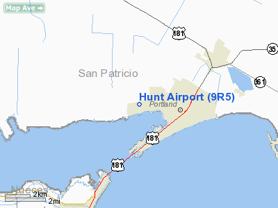
Location & QuickFacts
| FAA Information Effective: | 2008-09-25 |
| Airport Identifier: | 9R5 |
| Airport Status: | Operational |
| Longitude/Latitude: | 097-21-15.9710W/27-53-16.0840N
-97.354436/27.887801 (Estimated) |
| Elevation: | 40 ft / 12.19 m (Surveyed) |
| Land: | 168 acres |
| From nearest city: | 2 nautical miles NW of Portland, TX |
| Location: | San Patricio County, TX |
| Magnetic Variation: | 07E (1985) |
Owner & Manager
| Ownership: | Privately owned |
| Owner: | W. E. Hunt Estate |
| Address: | Box 60
Portland, TX 78374 |
| Phone number: | 361-643-3950 |
| Manager: | Janie Mitchell |
| Address: | Box 60
Portland, TX 78374 |
| Phone number: | 361-643-3950 |
Airport Operations and Facilities
| Airport Use: | Open to public |
| Wind indicator: | Yes |
| Segmented Circle: | No |
| Control Tower: | No |
| Landing fee charge: | No |
| Sectional chart: | Brownsville |
| Region: | ASW - Southwest |
| Boundary ARTCC: | ZHU - Houston |
| Tie-in FSS: | SJT - San Angelo |
| FSS on Airport: | No |
| FSS Toll Free: | 1-800-WX-BRIEF |
| NOTAMs Facility: | SJT (NOTAM-d service avaliable) |
Airport Communications
Airport Services
| Bottled Oxygen: | NONE |
| Bulk Oxygen: | NONE |
Runway Information
Runway 14L/32R
| Dimension: | 2650 x 20 ft / 807.7 x 6.1 m |
| Surface: | ASPH, Poor Condition
HAS SEVERE GRASS ENCROACHMENT ON RY & POT HOLES ALONG CNTRLN.
HEAVY RUTTING ALONG ENTIRE RUNWAY LENGTH |
| Weight Limit: | Single wheel: 9000 lbs. |
| |
Runway 14L |
Runway 32R |
| Traffic Pattern: | Right | Left |
| Obstruction: | 60 ft pline, 2200.0 ft from runway, 33:1 slope to clear
+19 FT ROAD FM THLD ACROSS APCH. | , 50:1 slope to clear
GROUND DROPS OFF APPROXLY 10 FT AT THLD. |
|
Runway 14R/32L
| Dimension: | 1400 x 60 ft / 426.7 x 18.3 m |
| Surface: | TURF-GRVL, Poor Condition
HAS SEVERE GRASS ENCROACHMENT ON RY & POT HOLES ALONG CNTRLN.
HEAVY RUTTING ALONG ENTIRE RUNWAY LENGTH |
| |
Runway 14R |
Runway 32L |
| Traffic Pattern: | Right | Left |
| Obstruction: | , 50:1 slope to clear | 12 ft bldg, 0.0 ft from runway, 105 ft right of centerline |
|
Radio Navigation Aids
| ID |
Type |
Name |
Ch |
Freq |
Var |
Dist |
| RKP | NDB | Rockport | | 391.00 | 06E | 20.4 nm |
| MNO | NDB | Mellon Ranch | | 375.00 | 06E | 24.9 nm |
| BEA | NDB | Beeville | | 284.00 | 07E | 37.2 nm |
| TKB | NDB | Kleberg County | | 347.00 | 06E | 42.4 nm |
| NQI | TACAN | Kingsville | 125X | | 09E | 33.5 nm |
| NOG | TACAN | Orange Grove | 063X | | 09E | 36.6 nm |
| ALI | VOR | Alice | | 114.50 | 06E | 36.6 nm |
| CRP | VORTAC | Corpus Christi | 102X | 115.50 | 09E | 4.9 nm |
| NGP | VORTAC | Truax | 087X | 114.00 | 06E | 12.5 nm |
Remarks
- NOISE ABATEMENT PROCEDURES IN EFFECT - CALL ARPT MGR AT 361-643-3950.
- OWNER RESIDES ON ARPT.
- ESTAB PRIOR TO 1959.
Images and information placed above are from
http://www.airport-data.com/airport/9R5/
We thank them for the data!
| General Info
|
| Country |
United States
|
| State |
TEXAS
|
| FAA ID |
9R5
|
| Latitude |
27-53-16.084N
|
| Longitude |
097-21-15.971W
|
| Elevation |
40 feet
|
| Near City |
PORTLAND
|
We don't guarantee the information is fresh and accurate. The data may
be wrong or outdated.
For more up-to-date information please refer to other sources.
|
|


