 |
|
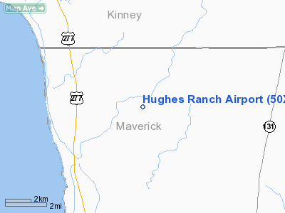
Location & QuickFacts
| FAA Information Effective: | 2008-09-25 |
| Airport Identifier: | 50XS |
| Airport Status: | Operational |
| Longitude/Latitude: | 100-35-04.2950W/29-02-35.8720N
-100.584526/29.043298 (Estimated) |
| Elevation: | 905 ft / 275.84 m (Estimated) |
| Land: | 0 acres |
| From nearest city: | 5 nautical miles NE of Quemado, TX |
| Location: | Maverick County, TX |
| Magnetic Variation: | 08E (1985) |
Owner & Manager
| Ownership: | Privately owned |
| Owner: | Dan A. Hughes |
| Address: | P O Drawer 669
Beeville, TX 78104-0669 |
| Phone number: | 512-358-3752 |
| Manager: | S. R. May Or Richard Myers |
| Address: | P O Drawer 669
Beeville, TX 78104-0669 |
| Phone number: | 512-358-3752
EXT 44. |
Airport Operations and Facilities
| Airport Use: | Private |
| Wind indicator: | Yes |
| Segmented Circle: | No |
| Control Tower: | No |
| Landing fee charge: | No |
| Sectional chart: | San Antonio |
| Region: | ASW - Southwest |
| Boundary ARTCC: | ZHU - Houston |
| Tie-in FSS: | SJT - San Angelo |
| FSS on Airport: | No |
| FSS Toll Free: | 1-800-WX-BRIEF |
Runway Information
Runway 13/31
| Dimension: | 4608 x 75 ft / 1404.5 x 22.9 m |
| Surface: | ASPH, |
| |
Runway 13 |
Runway 31 |
| Traffic Pattern: | Left | Left |
| Markings: | Nonstandard,
13/31 CNTRLN STRIPE ONLY. | Nonstandard, |
|
Radio Navigation Aids
| ID |
Type |
Name |
Ch |
Freq |
Var |
Dist |
| BRX | NDB | La Fonda Ranch | | 269.00 | 09E | 10.1 nm |
| PFO | NDB | Spofford | | 356.00 | 08E | 10.3 nm |
| CPZ | NDB | Chaparrosa Ranch | | 385.00 | 10E | 31.5 nm |
| LKX | NDB | La Pryor | | 223.00 | 09E | 39.0 nm |
| UVA | NDB | Uvalde | | 281.00 | 07E | 45.8 nm |
| DLF | VORTAC | Laughlin | 091X | 114.40 | 07E | 21.5 nm |
Remarks
- CTN DEER & TURKEY ON RWY.
Images and information placed above are from
http://www.airport-data.com/airport/50XS/
We thank them for the data!
|
|


