 |
|
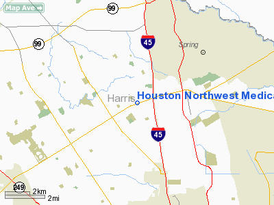
Houston Northwest Medical Center Heliport |
Location & QuickFacts
| FAA Information Effective: | 2008-09-25 |
| Airport Identifier: | TA95 |
| Airport Status: | Operational |
| Longitude/Latitude: | 095-26-32.7780W/30-01-03.7930N
-95.442438/30.017720 (Estimated) |
| Elevation: | 116 ft / 35.36 m (Estimated) |
| Land: | 0 acres |
| From nearest city: | 9 nautical miles S of Spring, TX |
| Location: | Harris County, TX |
| Magnetic Variation: | 06E (1985) |
Owner & Manager
| Ownership: | Privately owned |
| Owner: | Houston Nw Medical Center
HNMC, D/B/A. |
| Address: | 710 Fm 1960 West
Houston, TX 77090 |
| Phone number: | 713-440-1000 |
| Manager: | J. Barry Shevehuk, Ced |
| Address: | 710 Fm 1960 West
Houston, TX 77090 |
| Phone number: | 713-440-1000 |
Airport Operations and Facilities
| Airport Use: | Private
MEDICAL. |
| Wind indicator: | No |
| Segmented Circle: | Yes |
| Control Tower: | No |
| Lighting Schedule: | PHONE REQ
FOR PERIMETER LGTS CALL 713-440-1000. |
| Landing fee charge: | No |
| Sectional chart: | Houston |
| Region: | ASW - Southwest |
| Boundary ARTCC: | ZHU - Houston |
| Tie-in FSS: | CXO - Montgomery County |
| FSS on Airport: | No |
| FSS Toll Free: | 1-800-WX-BRIEF
FOR FP FILING CALL CXO FSS 1-800-833-5602. |
Runway Information
Helipad H1
| Dimension: | 80 x 80 ft / 24.4 x 24.4 m |
| Surface: | ASPH, |
| |
Runway H1 |
Runway |
| Traffic Pattern: | Left | Left |
|
Radio Navigation Aids
| ID |
Type |
Name |
Ch |
Freq |
Var |
Dist |
| DWH | NDB | David Hooks | | 521.00 | 05E | 9.1 nm |
| EYQ | NDB | Weiser | | 286.00 | 06E | 11.5 nm |
| BVP | NDB | Nixin | | 326.00 | 05E | 11.9 nm |
| LYD | NDB | Lakeside | | 249.00 | 05E | 17.2 nm |
| SGR | NDB | Hull | | 388.00 | 05E | 25.7 nm |
| JPA | NDB | Sanjac | | 347.00 | 05E | 28.6 nm |
| SYG | NDB | Sandy Point | | 402.00 | 05E | 31.0 nm |
| CBC | NDB | Anahuac | | 413.00 | 05E | 43.2 nm |
| UTS | NDB | Huntsville | | 308.00 | 06E | 44.1 nm |
| BNH | NDB | Brenham | | 362.00 | 06E | 49.9 nm |
| EFD | TACAN | Ellington | 031X | | 05E | 28.8 nm |
| HUB | VOR/DME | Hobby | 118X | 117.10 | 05E | 23.4 nm |
| MHF | VOR/DME | Trinity | 083X | 113.60 | 07E | 46.0 nm |
| IAH | VORTAC | Humble | 113X | 116.60 | 05E | 6.2 nm |
| TNV | VORTAC | Navasota | 106X | 115.90 | 08E | 35.9 nm |
| DAS | VORTAC | Daisetta | 116X | 116.90 | 05E | 42.7 nm |
| HOU | VOT | Houston Wm P Hobby | | 108.40 | | 24.0 nm |
Images and information placed above are from
http://www.airport-data.com/airport/TA95/
We thank them for the data!
| General Info
|
| Country |
United States
|
| State |
TEXAS
|
| FAA ID |
TA95
|
| Latitude |
30-01-03.793N
|
| Longitude |
095-26-32.778W
|
| Elevation |
116 feet
|
| Near City |
SPRING
|
We don't guarantee the information is fresh and accurate. The data may
be wrong or outdated.
For more up-to-date information please refer to other sources.
|
|


