 |
|
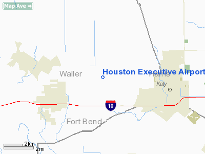
Houston Executive Airport |
| Houston Executive Airport |
| IATA: none – ICAO: KTME – FAA LID: TME |
| Summary |
| Airport type |
Public |
| Owner |
WCF, LLC |
| Serves |
Houston, Texas |
| Location |
Waller County, Texas |
| Elevation AMSL |
166 ft / 51 m |
| Coordinates |
29°48′18″N 095°53′52″W / 29.805°N 95.89778°W / 29.805; -95.89778 |
| Website |
HoustonExecutiveAirport.com |
| Runways |
| Direction |
Length |
Surface |
| ft |
m |
| 18/36 |
6,610 |
2,015 |
Asphalt |
| Sources: FAA and airport website |
Houston Executive Airport (ICAO: KTME, FAA LID: TME, formerly 78T) is a public-use airport in unincorporated Waller County, Texas, United States. The airport is located 28 nautical miles (52 km) west of the central business district of Houston. in Brookshire, Texas. The airport is privately owned by WCF, LLC, which is based in Waller County.
Although most U.S. airports use the same three-letter location identifier for the FAA and IATA, this airport is assigned TME by the FAA but has no designation from the IATA (which assigned TME to Tame, Colombia). History
The airport, which opened in January 2007, was funded by Ron Henriksen, an area businessman and pilot. Henriksen said that the airport's business plan caters to businesses based in the Energy Corridor area of Houston. Andrew Perry, the airport's executive director, said in February 2007 that the airport could compete with Sugar Land Regional Airport in Sugar Land, Texas and that the airport's proximity to Interstate 10 and Energy Corridor businesses were the airport's greatest advantages. Lance LaCour, the council president and chief executive officer of the Katy Area Economic Development Council, said that the group intended to promote and help increase business at the airport since the group believed that the airport could help the council attract new industries to its area and retain existing industries in its area. By June 2007 the airport has around 50 flight operations per working week and up to 80 flight operations per weekend block. Alan Clark, the transportation planning director for regional planning group Houston-Galveston Area Council, said that the data suggests that leisure travelers use the airport more often than corporate travel.
By June 2007 the airport started construction on a 48,000-square-foot (4,500 m) service center. The center, scheduled to open in 2008, has a business center, a crew lounge, a 26,000-square-foot (2,400 m) hangar, a weather briefing room, and other facilities.
Facilities
Houston Executive Airport covers an area of 1,280 acres (518 ha) at an elevation of 166 feet (51 m) above mean sea level. It has one asphalt paved runway designated 18/36 which measures 6,610 by 100 ft. (2,015 x 30 m). Facilities include hangar space, Wi-Fi internet, crew lounge, rental cars, luxury crew cars, and 24 hour service.
The above content comes from Wikipedia and is published under free licenses – click here to read more.
Location & QuickFacts
| FAA Information Effective: | 2008-09-25 |
| Airport Identifier: | TME |
| Airport Status: | Operational |
| Longitude/Latitude: | 095-53-52.4000W/29-48-18.1000N
-95.897889/29.805028 (Estimated) |
| Elevation: | 166 ft / 50.60 m (Surveyed) |
| Land: | 1280 acres |
| From nearest city: | 28 nautical miles W of Houston, TX |
| Location: | Waller County, TX |
| Magnetic Variation: | 04E (2010) |
Owner & Manager
| Ownership: | Privately owned |
| Owner: | Wcf, Llc |
| Address: | 2914 Cardiff Road
Brookshire, TX 77423 |
| Phone number: | 281-945-5000 |
| Manager: | Andrew Perry |
| Address: | 2914 Cardiff Road
Brookshire, TX 77423 |
| Phone number: | 281-945-5415 |
Airport Operations and Facilities
| Airport Use: | Open to public |
| Wind indicator: | Yes |
| Segmented Circle: | Yes |
| Control Tower: | No |
| Lighting Schedule: | DUSK-DAWN
ACTVT MIRL RY 18/36, REIL RYS 18 & 36 - CTAF. |
| Beacon Color: | Clear-Green (lighted land airport) |
| Landing fee charge: | No |
| Sectional chart: | Houston |
| Region: | ASW - Southwest |
| Boundary ARTCC: | ZHU - Houston |
| Tie-in FSS: | CXO - Montgomery County |
| FSS on Airport: | No |
| FSS Toll Free: | 1-800-WX-BRIEF |
| NOTAMs Facility: | CXO (NOTAM-d service avaliable) |
Airport Communications
| CTAF: | 122.975 |
| Unicom: | 122.975
AUTOMATED UNICOM. |
Airport Services
| Fuel available: | 100LLA
FOR SVC AFT HRS CALL 281-945-5000. 100LL AVBL 24 HRS SELF SERVE. |
Runway Information
Runway 18/36
| Dimension: | 6610 x 100 ft / 2014.7 x 30.5 m |
| Surface: | ASPH, |
| Weight Limit: | Dual wheel: 50000 lbs. |
| Edge Lights: | Medium |
| |
Runway 18 |
Runway 36 |
| Longitude: | 095-53-52.8600W | 095-53-51.8800W |
| Latitude: | 29-48-50.8500N | 29-47-45.4000N |
| Elevation: | 166.00 ft | 163.00 ft |
| Alignment: | 127 | 127 |
| Traffic Pattern: | Left | Right |
| Markings: | Non-precision instrument, | Non-precision instrument, |
| Crossing Height: | 40.00 ft | 40.00 ft |
| Displaced threshold: | 0.00 ft | 1560.00 ft |
| VASI: | 4-light PAPI on left side | 4-light PAPI on left side |
| Visual Glide Angle: | 3.00° | 3.00° |
| Runway End Identifier: | Yes | Yes |
| Obstruction: | 30 ft pline, 500.0 ft from runway | |
|
Radio Navigation Aids
| ID |
Type |
Name |
Ch |
Freq |
Var |
Dist |
| LYD | NDB | Lakeside | | 249.00 | 05E | 11.5 nm |
| EYQ | NDB | Weiser | | 286.00 | 06E | 15.5 nm |
| SGR | NDB | Hull | | 388.00 | 05E | 16.3 nm |
| DWH | NDB | David Hooks | | 521.00 | 05E | 25.9 nm |
| SYG | NDB | Sandy Point | | 402.00 | 05E | 28.9 nm |
| BNH | NDB | Brenham | | 362.00 | 06E | 35.2 nm |
| ARM | NDB | Wharton | | 245.00 | 06E | 35.7 nm |
| BVP | NDB | Nixin | | 326.00 | 05E | 37.3 nm |
| JPA | NDB | Sanjac | | 347.00 | 05E | 44.0 nm |
| EFD | TACAN | Ellington | 031X | | 05E | 40.4 nm |
| ELA | VOR/DME | Eagle Lake | 111X | 116.40 | 08E | 23.5 nm |
| HUB | VOR/DME | Hobby | 118X | 117.10 | 05E | 33.6 nm |
| IAH | VORTAC | Humble | 113X | 116.60 | 05E | 30.2 nm |
| TNV | VORTAC | Navasota | 106X | 115.90 | 08E | 30.2 nm |
| IDU | VORTAC | Industry | 039X | 110.20 | 08E | 35.8 nm |
| HOU | VOT | Houston Wm P Hobby | | 108.40 | | 33.7 nm |
Remarks
- NOISE SENSITIVE AREA EAST OF ARPT IN EFFECT: AVOID HOUSING AREA AND NO TOUCH & GO NIGHTTIME LNDGS.
- BIRDS ON & INVOF ARPT.
- GCO AVBL ON FREQ 121.725 THRU IAH CD & FLT SVCS.
- PRVDD TFC PATTERN RESTRICTED TO EAST SIDE OF ARPT; TFC PATTERN ALTITUDE AT LEAST 800 FT AGL; AND A WILDLIFE HAZARD MGMT PLAN IS DEVELOPED AND IMPLEMENTED.
Images and information placed above are from
http://www.airport-data.com/airport/TME/
We thank them for the data!
|
|


