 |
|
| Houston County Airport |
| IATA: none – ICAO: KDKR – FAA LID: DKR |
| Summary |
| Airport type |
Public |
| Owner |
Houston County |
| Location |
Crockett, Texas |
| Elevation AMSL |
348 ft / 106 m |
| Coordinates |
31°18′25″N 095°24′14″W / 31.30694°N 95.40389°W / 31.30694; -95.40389 |
| Runways |
| Direction |
Length |
Surface |
| ft |
m |
| 2/20 |
4,000 |
1,219 |
Asphalt |
| Statistics (2005) |
| Aircraft operations |
6,600 |
| Source: Federal Aviation Administration |
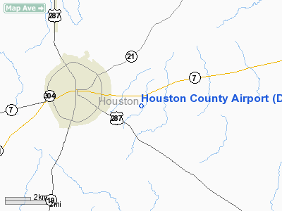
Houston County Airport (ICAO: KDKR, FAA LID: DKR) is a public airport located three miles (5 km) southeast of the central business district of Crockett, in Houston County, Texas, United States. It is owned by Houston County.
Although most U.S. airports use the same three-letter location identifier for the FAA and IATA, Houston County Airport is assigned DKR by the FAA but has no designation from the IATA (which assigned DKR to Dakar-Yoff-Léopold Sédar Senghor International Airport in Dakar, Senegal).
Facilities and aircraft
Houston County Airport covers an area of 55 acres (22 ha) which contains one Asphalt paved runway, 2/20, measuring 4,000 x 75 ft (1,219 x 23 m). For the 12-month period ending July 25, 2005, the airport had 6,600 aircraft operations, 100% of which were general aviation.
The above content comes from Wikipedia and is published under free licenses – click here to read more.
Location & QuickFacts
| FAA Information Effective: | 2008-09-25 |
| Airport Identifier: | DKR |
| Airport Status: | Operational |
| Longitude/Latitude: | 095-24-13.7900W/31-18-25.0600N
-95.403831/31.306961 (Estimated) |
| Elevation: | 348 ft / 106.07 m (Surveyed) |
| Land: | 55 acres |
| From nearest city: | 3 nautical miles SE of Crockett, TX |
| Location: | Houston County, TX |
| Magnetic Variation: | 05E (2000) |
Owner & Manager
| Ownership: | Publicly owned |
| Owner: | Houston County |
| Address: | Houston County Courthouse
Crockett, TX 75835 |
| Phone number: | 936-544-3255 |
| Manager: | R. C. Von Doenhoff (judge) |
| Address: | Houston County Courthouse
Crockett, TX 75835 |
| Phone number: | 936-544-3255
EXTENSION 224. |
Airport Operations and Facilities
| Airport Use: | Open to public |
| Wind indicator: | Yes |
| Segmented Circle: | Yes |
| Control Tower: | No |
| Lighting Schedule: | DUSK-DAWN
ACTVT MIRL RY 02/20 - 123.5. |
| Beacon Color: | Clear-Green (lighted land airport)
ROTG BCN OTS INDEFLY. |
| Landing fee charge: | No |
| Sectional chart: | Houston |
| Region: | ASW - Southwest |
| Boundary ARTCC: | ZHU - Houston |
| Tie-in FSS: | CXO - Montgomery County |
| FSS on Airport: | No |
| FSS Toll Free: | 1-800-WX-BRIEF
FOR FP FILING CALL CXO FSS 1-800-833-5602 |
| NOTAMs Facility: | DKR (NOTAM-d service avaliable) |
| Federal Agreements: | NGY |
Airport Communications
Airport Services
| Bottled Oxygen: | NONE |
| Bulk Oxygen: | NONE |
Runway Information
Runway 02/20
| Dimension: | 4000 x 75 ft / 1219.2 x 22.9 m |
| Surface: | ASPH, Good Condition |
| Weight Limit: | Single wheel: 12000 lbs. |
| Edge Lights: | Medium |
| |
Runway 02 |
Runway 20 |
| Longitude: | 095-24-22.2430W | 095-24-05.3380W |
| Latitude: | 31-18-06.6420N | 31-18-43.4730N |
| Elevation: | 326.00 ft | 348.00 ft |
| Alignment: | 22 | 127 |
| Traffic Pattern: | Left | Left |
| Markings: | Non-precision instrument, Fair Condition | Non-precision instrument, Good Condition |
| Crossing Height: | 0.00 ft | 29.00 ft |
| VASI: | | 2-box SAVASI on right side |
| Visual Glide Angle: | 0.00° | 4.00° |
| Obstruction: | 15 ft trees, 280.0 ft from runway, 210 ft right of centerline, 5:1 slope to clear | 50 ft trees, 1200.0 ft from runway, 20:1 slope to clear |
|
Radio Navigation Aids
| ID |
Type |
Name |
Ch |
Freq |
Var |
Dist |
| PSN | NDB | Palestine | | 375.00 | 04E | 32.3 nm |
| JSO | NDB | Cherokee County | | 263.00 | 05E | 35.2 nm |
| UTS | NDB | Huntsville | | 308.00 | 06E | 35.4 nm |
| OC | NDB | Nados | | 253.00 | 05E | 36.7 nm |
| GXD | NDB | Nacogdoches | | 391.00 | 05E | 41.3 nm |
| FZT | VOR/DME | Frankston | 051X | 111.40 | 06E | 46.6 nm |
| LOA | VORTAC | Leona | 045X | 110.80 | 08E | 31.0 nm |
| LFK | VORTAC | Lufkin | 058X | 112.10 | 05E | 36.4 nm |
Remarks
- PAEW ON RY 02/20.
- TWYS A, B AND RAMP CLSD INDEFLY.
Images and information placed above are from
http://www.airport-data.com/airport/DKR/
We thank them for the data!
| General Info
|
| Country |
United States
|
| State |
TEXAS
|
| FAA ID |
DKR
|
| Latitude |
31.306961
31° 18' 25.06" N
|
| Longitude |
-95.403831
095° 24' 13.79" W
|
| Elevation |
348 feet
106 meters
|
| Magnetic Variation |
004° E (01/06)
|
| Beacon |
Yes
|
| Operating Agency |
U.S.CIVIL AIRPORT WHEREIN PERMIT COVERS USE BY TRANSIT MILITARY AIRCRAFT
|
| Daylight Saving Time |
Second Sunday in March at 0200 to first Sunday in November at 0200 local time (Exception Arizona and that portion of Indiana in the Eastern Time Zone)
|
We don't guarantee the information is fresh and accurate. The data may
be wrong or outdated.
For more up-to-date information please refer to other sources.
|
|


